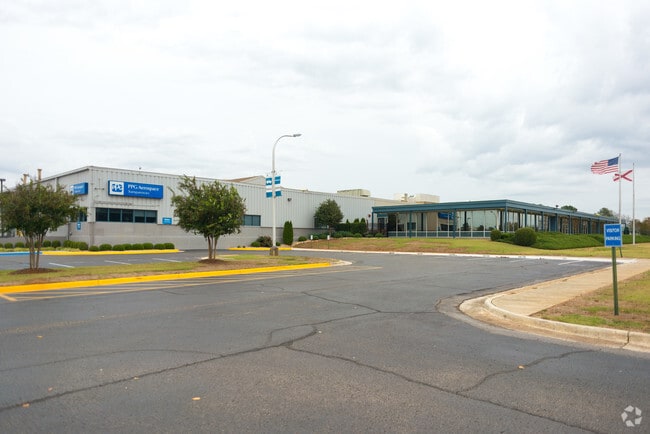
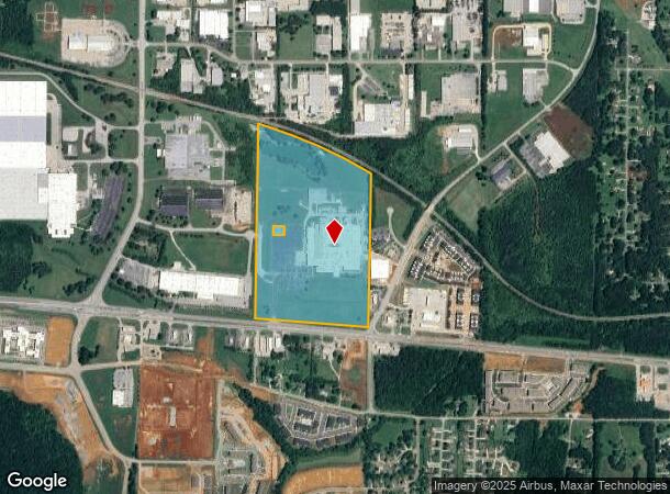
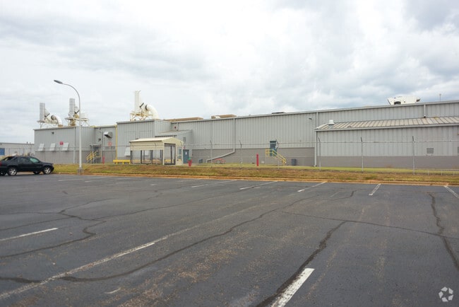
Property Record
1719 Highway 72 E, Huntsville, AL 35811
NEARBY LISTINGS FOR SALE OR LEASE
Property Detail
1719 Highway 72 E
13-05-16-0-000-059.000
PART OF W 1/2 OF SEC 16 BEG AT CEN OF SEC 16 TH S 1618.30 FT TO N MAR HWY 72 TH ALG N MAR OF R/O/W N 85 DEG W 1338.72 FT TH N
Officebuilding
Madison
X
Alabama
01089C0194F
63 AC
2025
North Huntsville
2025
Huntsville
000203
Huntsville, AL
7,950 SF
DEMOGRAPHICS near 1719 Highway 72 E
1 Mile
3 Mile
5 Mile
2024 Total Population
1,582
23,079
73,800
2029 Population
1,788
25,254
81,611
Pop Growth 2024-2029
+ 13.02%
+ 9.42%
+ 10.58%
Average Age
42
39
41
2024 Total Households
667
8,423
29,629
HH Growth 2024-2029
+ 13.64%
+ 11.27%
+ 11.54%
Median Household Inc
$95,898
$80,800
$72,728
Avg Household Size
2.40
2.30
2.30
2024 Avg HH Vehicles
2.00
2.00
2.00
Median Home Value
$241,666
$231,510
$237,764
Median Year Built
2003
1988
1978
Nearby Places
Map Layers
Map Styles
 Street
 Aerial
- Restaurants
- Banks
- Shops
- Fitness
- Groceries
PUBLIC TRANSPORTATION
AIRPORT
Huntsville International-Carl T Jones Field
DRIVE
WALK
Distance
Huntsville International-Carl T Jones Field
29 min
19.1 mi
Nearby Properties
Address
Land Use
TOTAL SIZE
Lot Size
Zoning
Address
Land Use
TOTAL SIZE
Lot Size
Zoning
672 SF
105 AC
Address
Land Use
TOTAL SIZE
Lot Size
Zoning
13,388 SF
18 AC
Address
Land Use
TOTAL SIZE
Lot Size
Zoning
14,652 SF
16.62 AC
Address
Land Use
TOTAL SIZE
Lot Size
Zoning
1,440 SF
22 AC
Address
Land Use
TOTAL SIZE
Lot Size
Zoning
20,160 SF
157 AC
Address
Land Use
TOTAL SIZE
Lot Size
Zoning
6,600 SF
12 AC
Address
Land Use
TOTAL SIZE
Lot Size
Zoning
2,532 SF
22.76 AC
Address
Land Use
TOTAL SIZE
Lot Size
Zoning
71,695 SF
7.80 AC
Address
Land Use
TOTAL SIZE
Lot Size
Zoning
201,250 SF
15 AC
Address
Land Use
TOTAL SIZE
Lot Size
Zoning
1,740 SF
24 AC
Address
Land Use
TOTAL SIZE
Lot Size
Zoning
254,514 SF
20 AC
Address
Land Use
TOTAL SIZE
Lot Size
Zoning
90,690 SF
9.29 AC
Address
Land Use
TOTAL SIZE
Lot Size
Zoning
6,120 SF
10 AC
Address
Land Use
TOTAL SIZE
Lot Size
Zoning
57,106 SF
47 AC
Address
Land Use
TOTAL SIZE
Lot Size
Zoning
141,120 SF
15 AC
Address
Land Use
TOTAL SIZE
Lot Size
Zoning
17,946 SF
5 AC
Address
Land Use
TOTAL SIZE
Lot Size
Zoning
20.80 AC
Address
Land Use
TOTAL SIZE
Lot Size
Zoning
207,500 SF
25 AC
Address
Land Use
TOTAL SIZE
Lot Size
Zoning
223,500 SF
6.60 AC
Address
Land Use
TOTAL SIZE
Lot Size
Zoning
5,051 SF
5.20 AC
Address
Land Use
TOTAL SIZE
Lot Size
Zoning
Address
Land Use
TOTAL SIZE
Lot Size
Zoning
3,293 SF
3 AC
Address
Land Use
TOTAL SIZE
Lot Size
Zoning
23,944 SF
13 AC
Address
Land Use
TOTAL SIZE
Lot Size
Zoning
5,905 SF
16 AC
Address
Land Use
TOTAL SIZE
Lot Size
Zoning
8,862 SF
6.40 AC
Address
Land Use
TOTAL SIZE
Lot Size
Zoning
3,450 SF
4.48 AC
Address
Land Use
TOTAL SIZE
Lot Size
Zoning
Address
Land Use
TOTAL SIZE
Lot Size
Zoning
55,319 SF
6.16 AC
Address
Land Use
TOTAL SIZE
Lot Size
Zoning
100,000 SF
11 AC
The World's #1 Commercial Real Estate Marketplace
Connect with us
© 2026 CoStar Group
The information above has been obtained from sources believed reliable. While we do not doubt its accuracy we have not verified it and make no guarantee, warranty or representation about it. It is your responsibility to independently confirm its accuracy and completeness. Any projections, opinions, assumptions, or estimates used are for example only and do not represent the current or future performance of the property. The value of this transaction to you depends on tax and other factors which should be evaluated by your tax, financial, and legal advisors. You and your advisors should conduct a careful, independent investigation of the property to determine to your satisfaction the suitability of the property for your needs.