Property Record
1720 E Broad St, Hazleton, PA 18201


NEARBY LISTINGS FOR SALE OR LEASE
-
-
View all Hazleton listings for sale on LoopNet.com
Property Detail
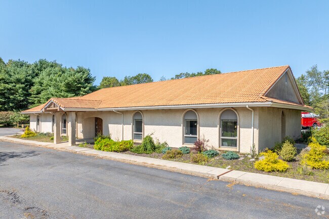
1720 E Broad St
Scranton--Wilkes-Barre--Hazelton, PA
Flavel Roan Warrantee Tract
71-U8-00A-02P-000
71-R3-C-9-D3-1-D1-D1-2-D 1720 E BROAD ST
Medicalbuilding
Luzerne
X
Pennsylvania
42079C0630E
2p
2025
0.71 AC
2025
I-81 Corridor
217300
Philadelphia
DEMOGRAPHICS near 1720 E Broad St
1 Mile
3 Mile
5 Mile
2024 Total Population
2,766
38,588
51,124
2029 Population
2,774
38,673
51,310
Pop Growth 2024-2029
+ 0.29%
+ 0.22%
+ 0.36%
Average Age
47
38
40
2024 Total Households
1,097
14,253
19,514
HH Growth 2024-2029
+ 0.27%
+ 0.20%
+ 0.37%
Median Household Inc
$58,035
$43,882
$47,446
Avg Household Size
2.30
2.60
2.50
2024 Avg HH Vehicles
2.00
1.00
2.00
Median Home Value
$242,276
$154,244
$166,717
Median Year Built
1965
1950
1953
Nearby Places
Map Layers
Map Styles
 Street
 Aerial
- Restaurants
- Banks
- Shops
- Fitness
- Groceries
PUBLIC TRANSPORTATION
AIRPORT
Wilkes-Barre/Scranton International
DRIVE
WALK
Distance
Wilkes-Barre/Scranton International
53 min
35.9 mi
Freight Ports
Port of Philadelphia
DRIVE
WALK
Distance
Port of Philadelphia
126 min
96.7 mi
Nearby Properties
Address
Land Use
TOTAL SIZE
Lot Size
Zoning
Address
Land Use
TOTAL SIZE
Lot Size
Zoning
63.03 AC
Address
Land Use
TOTAL SIZE
Lot Size
Zoning
59.39 AC
Address
Land Use
TOTAL SIZE
Lot Size
Zoning
8.29 AC
Address
Land Use
TOTAL SIZE
Lot Size
Zoning
10.83 AC
Address
Land Use
TOTAL SIZE
Lot Size
Zoning
Address
Land Use
TOTAL SIZE
Lot Size
Zoning
50 AC
Address
Land Use
TOTAL SIZE
Lot Size
Zoning
169.64 AC
Address
Land Use
TOTAL SIZE
Lot Size
Zoning
23.17 AC
Address
Land Use
TOTAL SIZE
Lot Size
Zoning
12.25 AC
Address
Land Use
TOTAL SIZE
Lot Size
Zoning
14.10 AC
Address
Land Use
TOTAL SIZE
Lot Size
Zoning
0.72 AC
Address
Land Use
TOTAL SIZE
Lot Size
Zoning
0.34 AC
Address
Land Use
TOTAL SIZE
Lot Size
Zoning
2.70 AC
Address
Land Use
TOTAL SIZE
Lot Size
Zoning
100.14 AC
Address
Land Use
TOTAL SIZE
Lot Size
Zoning
Address
Land Use
TOTAL SIZE
Lot Size
Zoning
Address
Land Use
TOTAL SIZE
Lot Size
Zoning
0.91 AC
Address
Land Use
TOTAL SIZE
Lot Size
Zoning
13.86 AC
Address
Land Use
TOTAL SIZE
Lot Size
Zoning
15.31 AC
Address
Land Use
TOTAL SIZE
Lot Size
Zoning
0.91 AC
Address
Land Use
TOTAL SIZE
Lot Size
Zoning
30.07 AC
Address
Land Use
TOTAL SIZE
Lot Size
Zoning
1.44 AC
Address
Land Use
TOTAL SIZE
Lot Size
Zoning
1.74 AC
Address
Land Use
TOTAL SIZE
Lot Size
Zoning
0.95 AC
Address
Land Use
TOTAL SIZE
Lot Size
Zoning
0.79 AC
Address
Land Use
TOTAL SIZE
Lot Size
Zoning
22.15 AC
Address
Land Use
TOTAL SIZE
Lot Size
Zoning
229.30 AC
Address
Land Use
TOTAL SIZE
Lot Size
Zoning
0.44 AC
Address
Land Use
TOTAL SIZE
Lot Size
Zoning
0.44 AC
Address
Land Use
TOTAL SIZE
Lot Size
Zoning
18.95 AC
The World's #1 Commercial Real Estate Marketplace
Connect with us
© 2026 CoStar Group
The information above has been obtained from sources believed reliable. While we do not doubt its accuracy we have not verified it and make no guarantee, warranty or representation about it. It is your responsibility to independently confirm its accuracy and completeness. Any projections, opinions, assumptions, or estimates used are for example only and do not represent the current or future performance of the property. The value of this transaction to you depends on tax and other factors which should be evaluated by your tax, financial, and legal advisors. You and your advisors should conduct a careful, independent investigation of the property to determine to your satisfaction the suitability of the property for your needs.