Property Record
1720 S Bertelsen Rd, Eugene, OR 97402
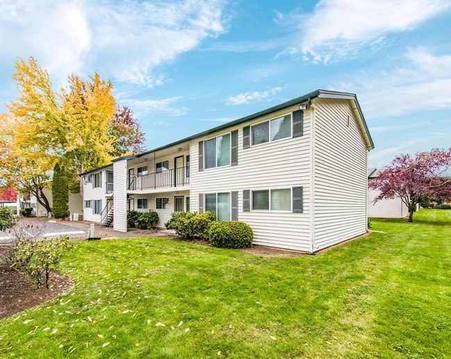
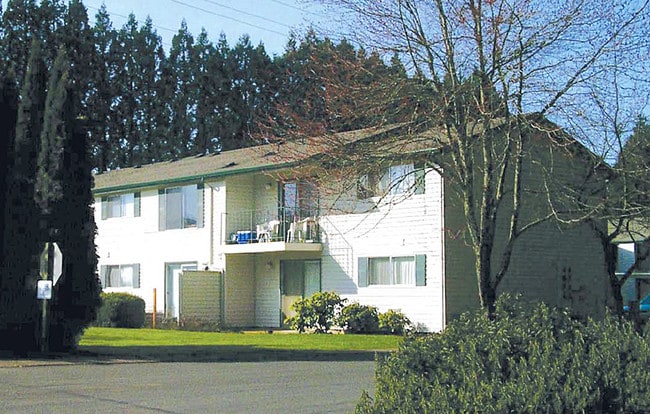

Property Detail
1720 S Bertelsen Rd
Eugene-Springfield, OR
TL 02400
0718955
LANE
Multifamilydwelling
Oregon
AG
2400
B and X Area of moderate flood hazard, usually the area between the limits of the 100-year and 500-year floods.
7.38 AC
0
Churchill
2025
Portland
001002
NEARBY LISTINGS FOR SALE OR LEASE
DEMOGRAPHICS near 1720 S Bertelsen Rd
1 mile
3 mile
5 mile
2025 Total Population
7,091
52,234
149,984
2030 Population
7,069
51,628
148,734
Pop Growth 2025-2030
(0.31%)
(1.16%)
(0.83%)
Average Age
41
41
40
2025 Total Households
2,922
20,698
61,488
HH Growth 2025-2030
(0.21%)
(1.32%)
(0.94%)
Median Household Inc
$73,107
$63,407
$63,511
Avg Household Size
2.30
2.30
2.20
2025 Avg HH Vehicles
2.00
2.00
2.00
Median Home Value
$429,961
$410,121
$446,510
Median Year Built
1983
1974
1975
Nearby Places
Map Layers
Map Styles
 Street
 Aerial
Transit
 Traffic
 Biking
Places
Listings with unknown addresses are not visible on the map
- Restaurants
- Banks
- Shops
- Fitness
- Groceries
PUBLIC TRANSPORTATION
COMMUTER RAIL
Eugene (Amtrak Cascades - Amtrak, Coast Starlight - Amtrak)
Drive
Walk
Distance
Eugene (Amtrak Cascades - Amtrak, Coast Starlight - Amtrak)
9 min
4.7 mi
AIRPORT
Mahlon Sweet Field
Drive
Walk
Distance
Mahlon Sweet Field
16 min
8.5 mi
Freight Ports
Port of Coos Bay, OR
Drive
Walk
Distance
Port of Coos Bay, OR
145 min
104.9 mi
Nearby Properties
Address
Land Use
TOTAL SIZE
Lot Size
Zoning
Address
Land Use
TOTAL SIZE
Lot Size
Zoning
44.56 AC
PL
Address
Land Use
TOTAL SIZE
Lot Size
Zoning
Address
Land Use
TOTAL SIZE
Lot Size
Zoning
12.12 AC
C-2
Address
Land Use
TOTAL SIZE
Lot Size
Zoning
45.78 AC
I-3
Address
Land Use
TOTAL SIZE
Lot Size
Zoning
75.36 AC
PL
Address
Land Use
TOTAL SIZE
Lot Size
Zoning
14.14 AC
R-1
Address
Land Use
TOTAL SIZE
Lot Size
Zoning
19.65 AC
C-2
Address
Land Use
TOTAL SIZE
Lot Size
Zoning
3,324 SF
8.70 AC
NR
Address
Land Use
TOTAL SIZE
Lot Size
Zoning
12.07 AC
NR
Address
Land Use
TOTAL SIZE
Lot Size
Zoning
29.96 AC
AG
Address
Land Use
TOTAL SIZE
Lot Size
Zoning
17.68 AC
PL
Address
Land Use
TOTAL SIZE
Lot Size
Zoning
Address
Land Use
TOTAL SIZE
Lot Size
Zoning
Address
Land Use
TOTAL SIZE
Lot Size
Zoning
13.14 AC
I-2
Address
Land Use
TOTAL SIZE
Lot Size
Zoning
4.97 AC
I-3
Address
Land Use
TOTAL SIZE
Lot Size
Zoning
10.50 AC
C-2
Address
Land Use
TOTAL SIZE
Lot Size
Zoning
5.13 AC
I-3
Address
Land Use
TOTAL SIZE
Lot Size
Zoning
3.12 AC
I-2
Address
Land Use
TOTAL SIZE
Lot Size
Zoning
7.68 AC
PL
Address
Land Use
TOTAL SIZE
Lot Size
Zoning
12.30 AC
C-2
Address
Land Use
TOTAL SIZE
Lot Size
Zoning
Address
Land Use
TOTAL SIZE
Lot Size
Zoning
16.18 AC
E-1
Address
Land Use
TOTAL SIZE
Lot Size
Zoning
11.13 AC
C-2
Address
Land Use
TOTAL SIZE
Lot Size
Zoning
25.02 AC
PL
Address
Land Use
TOTAL SIZE
Lot Size
Zoning
560 SF
11.02 AC
I-2
Address
Land Use
TOTAL SIZE
Lot Size
Zoning
2.32 AC
E-2
Address
Land Use
TOTAL SIZE
Lot Size
Zoning
13.55 AC
R-1
Address
Land Use
TOTAL SIZE
Lot Size
Zoning
9.46 AC
C-2
Address
Land Use
TOTAL SIZE
Lot Size
Zoning
5.58 AC
E-2
Address
Land Use
TOTAL SIZE
Lot Size
Zoning
13.64 AC
R-1
The World's #1 Commercial Real Estate Marketplace
Connect with us
© 2026 CoStar Group
The information above has been obtained from sources believed reliable. While we do not doubt its accuracy we have not verified it and make no guarantee, warranty or representation about it. It is your responsibility to independently confirm its accuracy and completeness. Any projections, opinions, assumptions, or estimates used are for example only and do not represent the current or future performance of the property. The value of this transaction to you depends on tax and other factors which should be evaluated by your tax, financial, and legal advisors. You and your advisors should conduct a careful, independent investigation of the property to determine to your satisfaction the suitability of the property for your needs.