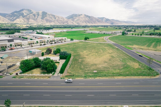
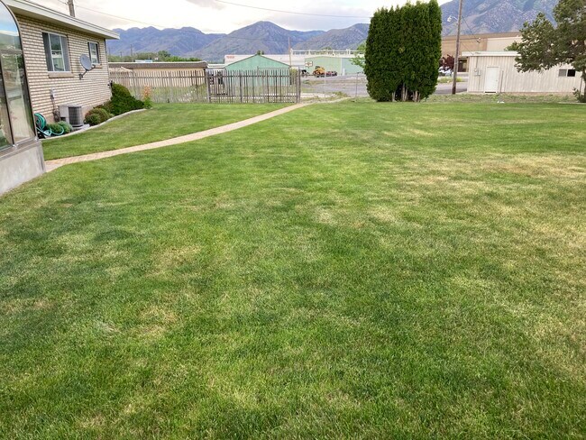
Property Record
1720 S State Highway 89, Logan, UT 84321


Property Detail
1720 S State Highway 89
02-083-0013
BEG 25.5 FT W OF SE COR SEC 8 T 11NR 1E W 34.11 RDS N 17.89 RDS N 4539' E 11.5 CHS S 12.8 CHS TO BEG 6.74 AC SUBJ TO EASEMENT
Realpropertynec
CACHE
B and X Area of moderate flood hazard, usually the area between the limits of the 100-year and 500-year floods.
Utah
2025
5.63 AC
2025
Cache County
000302
Salt Lake City
3,376 SF
Logan, UT-ID
NEARBY LISTINGS FOR SALE OR LEASE
-
-
View all Logan listings for sale on LoopNet.com
DEMOGRAPHICS near 1720 S State Highway 89
1 mile
3 mile
5 mile
2025 Total Population
6,045
46,914
89,682
2030 Population
6,544
49,964
95,089
Pop Growth 2025-2030
+ 8.25%
+ 6.50%
+ 6.03%
Average Age
30
32
31
2025 Total Households
1,839
15,243
28,901
HH Growth 2025-2030
+ 8.70%
+ 6.84%
+ 6.46%
Median Household Inc
$81,940
$81,578
$73,145
Avg Household Size
3.30
3.00
2.90
2025 Avg HH Vehicles
2.00
2.00
2.00
Median Home Value
$398,746
$446,739
$448,928
Median Year Built
2004
1992
1991
Nearby Places
Map Layers
Map Styles
 Street
 Aerial
Transit
 Traffic
 Biking
Places
Listings with unknown addresses are not visible on the map
- Restaurants
- Banks
- Shops
- Fitness
- Groceries
SALE & LEASE HISTORY
LISTING DATE
SALE/LEASE

Aug 27, 2021
For Sale
Nearby Properties
Address
Land Use
TOTAL SIZE
Lot Size
Zoning
Address
Land Use
TOTAL SIZE
Lot Size
Zoning
24,369 SF
16.66 AC
Address
Land Use
TOTAL SIZE
Lot Size
Zoning
48,423 SF
10.73 AC
Address
Land Use
TOTAL SIZE
Lot Size
Zoning
30,274 SF
12.21 AC
Address
Land Use
TOTAL SIZE
Lot Size
Zoning
18.85 AC
Address
Land Use
TOTAL SIZE
Lot Size
Zoning
63,059 SF
9.79 AC
Address
Land Use
TOTAL SIZE
Lot Size
Zoning
29,529 SF
6.90 AC
Address
Land Use
TOTAL SIZE
Lot Size
Zoning
85,350 SF
5.51 AC
Address
Land Use
TOTAL SIZE
Lot Size
Zoning
81,109 SF
5.28 AC
Address
Land Use
TOTAL SIZE
Lot Size
Zoning
197,564 SF
20.85 AC
Address
Land Use
TOTAL SIZE
Lot Size
Zoning
31,347 SF
8.64 AC
Address
Land Use
TOTAL SIZE
Lot Size
Zoning
193,015 SF
17.96 AC
Address
Land Use
TOTAL SIZE
Lot Size
Zoning
82,691 SF
4.65 AC
Address
Land Use
TOTAL SIZE
Lot Size
Zoning
27,423 SF
5.27 AC
Address
Land Use
TOTAL SIZE
Lot Size
Zoning
1 SF
12.46 AC
Address
Land Use
TOTAL SIZE
Lot Size
Zoning
67,591 SF
3.43 AC
Address
Land Use
TOTAL SIZE
Lot Size
Zoning
202,037 SF
25.49 AC
Address
Land Use
TOTAL SIZE
Lot Size
Zoning
33,600 SF
14.65 AC
Address
Land Use
TOTAL SIZE
Lot Size
Zoning
81,897 SF
0.92 AC
Address
Land Use
TOTAL SIZE
Lot Size
Zoning
51,420 SF
11.71 AC
Address
Land Use
TOTAL SIZE
Lot Size
Zoning
88,165 SF
1.84 AC
Address
Land Use
TOTAL SIZE
Lot Size
Zoning
27,792 SF
8 AC
Address
Land Use
TOTAL SIZE
Lot Size
Zoning
2.10 AC
Address
Land Use
TOTAL SIZE
Lot Size
Zoning
73,724 SF
1.64 AC
Address
Land Use
TOTAL SIZE
Lot Size
Zoning
10.91 AC
Address
Land Use
TOTAL SIZE
Lot Size
Zoning
27,022 SF
7.55 AC
Address
Land Use
TOTAL SIZE
Lot Size
Zoning
80,587 SF
8.03 AC
Address
Land Use
TOTAL SIZE
Lot Size
Zoning
16,325 SF
2.67 AC
The World's #1 Commercial Real Estate Marketplace
Connect with us
© 2026 CoStar Group
The information above has been obtained from sources believed reliable. While we do not doubt its accuracy we have not verified it and make no guarantee, warranty or representation about it. It is your responsibility to independently confirm its accuracy and completeness. Any projections, opinions, assumptions, or estimates used are for example only and do not represent the current or future performance of the property. The value of this transaction to you depends on tax and other factors which should be evaluated by your tax, financial, and legal advisors. You and your advisors should conduct a careful, independent investigation of the property to determine to your satisfaction the suitability of the property for your needs.