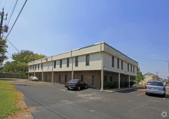
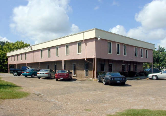
Property Record
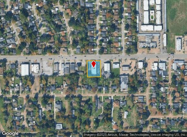
1720 Southmore Ave, Pasadena, TX 77502
NEARBY LISTINGS FOR SALE OR LEASE
Property Detail
1720 Southmore Ave
Houston-The Woodlands-Sugar Land, TX
Blakesley
0650310000029
TR 10B W 147 FT OF N 1/2 OF LT 10 BLAKESLEY
Officebuilding
Harris
X
Texas
48201C0905N
10
2024
0.61 AC
2025
Gulf Freeway/Pasadena
323200
Houston
9,432 SF
DEMOGRAPHICS near 1720 Southmore Ave
1 Mile
3 Mile
5 Mile
2024 Total Population
24,932
123,833
253,307
2029 Population
25,381
126,503
258,577
Pop Growth 2024-2029
+ 1.80%
+ 2.16%
+ 2.08%
Average Age
34
35
36
2024 Total Households
7,892
39,757
82,266
HH Growth 2024-2029
+ 1.79%
+ 2.12%
+ 2.07%
Median Household Inc
$48,449
$51,670
$55,678
Avg Household Size
3.10
3.00
3.00
2024 Avg HH Vehicles
2.00
2.00
2.00
Median Home Value
$130,821
$141,759
$156,087
Median Year Built
1967
1969
1972
Nearby Places
Map Layers
Map Styles
 Street
 Aerial
- Restaurants
- Banks
- Shops
- Fitness
- Groceries
PUBLIC TRANSPORTATION
AIRPORT
William P Hobby
DRIVE
WALK
Distance
William P Hobby
21 min
9.2 mi
George Bush Intcntl/Houston
DRIVE
WALK
Distance
George Bush Intcntl/Houston
40 min
30.7 mi
Freight Ports
Port of Houston
DRIVE
WALK
Distance
Port of Houston
18 min
8.5 mi
Nearby Properties
Address
Land Use
TOTAL SIZE
Lot Size
Zoning
Address
Land Use
TOTAL SIZE
Lot Size
Zoning
Address
Land Use
TOTAL SIZE
Lot Size
Zoning
188.11 AC
Address
Land Use
TOTAL SIZE
Lot Size
Zoning
5,379,424 SF
145.51 AC
Address
Land Use
TOTAL SIZE
Lot Size
Zoning
134.46 AC
Address
Land Use
TOTAL SIZE
Lot Size
Zoning
1,456,582 SF
93.83 AC
Address
Land Use
TOTAL SIZE
Lot Size
Zoning
3,934,000 SF
Address
Land Use
TOTAL SIZE
Lot Size
Zoning
72.68 AC
Address
Land Use
TOTAL SIZE
Lot Size
Zoning
606,550 SF
31.17 AC
Address
Land Use
TOTAL SIZE
Lot Size
Zoning
552,961 SF
25.01 AC
Address
Land Use
TOTAL SIZE
Lot Size
Zoning
188.11 AC
Address
Land Use
TOTAL SIZE
Lot Size
Zoning
3,568,104 SF
61.61 AC
Address
Land Use
TOTAL SIZE
Lot Size
Zoning
345,420 SF
4.02 AC
Address
Land Use
TOTAL SIZE
Lot Size
Zoning
7.19 AC
Address
Land Use
TOTAL SIZE
Lot Size
Zoning
411,046 SF
46.92 AC
Address
Land Use
TOTAL SIZE
Lot Size
Zoning
1,978,100 SF
50.02 AC
Address
Land Use
TOTAL SIZE
Lot Size
Zoning
265,567 SF
14.86 AC
Address
Land Use
TOTAL SIZE
Lot Size
Zoning
488,281 SF
26.48 AC
Address
Land Use
TOTAL SIZE
Lot Size
Zoning
4,580,000 SF
42.82 AC
Address
Land Use
TOTAL SIZE
Lot Size
Zoning
2,367,893 SF
39.85 AC
Address
Land Use
TOTAL SIZE
Lot Size
Zoning
403,776 SF
21.06 AC
Address
Land Use
TOTAL SIZE
Lot Size
Zoning
2,131,181 SF
118.10 AC
Address
Land Use
TOTAL SIZE
Lot Size
Zoning
218,787 SF
10 AC
Address
Land Use
TOTAL SIZE
Lot Size
Zoning
2,778,876 SF
51.42 AC
Address
Land Use
TOTAL SIZE
Lot Size
Zoning
281,470 SF
11.24 AC
Address
Land Use
TOTAL SIZE
Lot Size
Zoning
Address
Land Use
TOTAL SIZE
Lot Size
Zoning
297,900 SF
17.72 AC
Address
Land Use
TOTAL SIZE
Lot Size
Zoning
504,938 SF
28.96 AC
Address
Land Use
TOTAL SIZE
Lot Size
Zoning
363,740 SF
16.92 AC
Address
Land Use
TOTAL SIZE
Lot Size
Zoning
148.53 AC
Address
Land Use
TOTAL SIZE
Lot Size
Zoning
2,220,000 SF
28.19 AC
The World's #1 Commercial Real Estate Marketplace
Connect with us
© 2025 CoStar Group
The information above has been obtained from sources believed reliable. While we do not doubt its accuracy we have not verified it and make no guarantee, warranty or representation about it. It is your responsibility to independently confirm its accuracy and completeness. Any projections, opinions, assumptions, or estimates used are for example only and do not represent the current or future performance of the property. The value of this transaction to you depends on tax and other factors which should be evaluated by your tax, financial, and legal advisors. You and your advisors should conduct a careful, independent investigation of the property to determine to your satisfaction the suitability of the property for your needs.