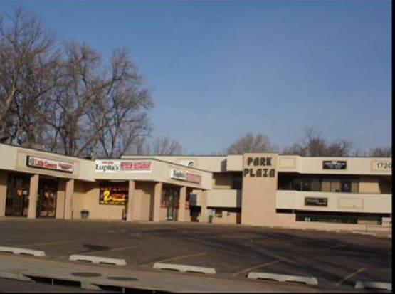
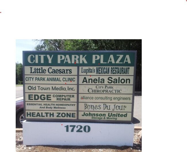
Property Record
1720 W Mulberry St, Fort Collins, CO 80521

Property Detail
1720 W Mulberry St
97103-00-002
BEG AT PT ON NRLY LN W MULBERRY ST WH BEARS N 30 FT AND E 2083 FT FROM SW COR 10-7-69, TH N 222.90 FT, E 206.10 FT, S 24 14 E 109.68 FT, W 88.11 FT, S 122.90 FT TO PT ON NRLY LN W MULBERRY ST, TH W 163 FT TPOB
Commercialnec
LARIMER
LMN
Colorado
B and X Area of moderate flood hazard, usually the area between the limits of the 100-year and 500-year floods.
1.18 AC
2024
Fort Collins
2025
Denver
000402
Fort Collins-Loveland, CO
13,130 SF
NEARBY LISTINGS FOR SALE OR LEASE
DEMOGRAPHICS near 1720 W Mulberry St
1 mile
3 mile
5 mile
2024 Total Population
21,169
91,479
153,445
2029 Population
21,925
95,183
158,856
Pop Growth 2024-2029
+ 3.57%
+ 4.05%
+ 3.53%
Average Age
31
34
36
2024 Total Households
7,862
36,764
62,668
HH Growth 2024-2029
+ 4.22%
+ 4.71%
+ 4.00%
Median Household Inc
$48,060
$63,794
$73,610
Avg Household Size
2.20
2.20
2.20
2024 Avg HH Vehicles
2.00
2.00
2.00
Median Home Value
$549,342
$560,902
$592,843
Median Year Built
1979
1984
1987
Nearby Places
Map Layers
Map Styles
 Street
 Aerial
Transit
 Traffic
 Biking
Places
Listings with unknown addresses are not visible on the map
- Restaurants
- Banks
- Shops
- Fitness
- Groceries
SALE & LEASE HISTORY
LISTING DATE
SALE/LEASE

Sep 25, 2016
For Lease
Nov 14, 2016
For Lease
Nearby Properties
Address
Land Use
TOTAL SIZE
Lot Size
Zoning
Address
Land Use
TOTAL SIZE
Lot Size
Zoning
850,000 SF
21.76 AC
E
Address
Land Use
TOTAL SIZE
Lot Size
Zoning
1,096,874 SF
72 AC
CSU
Address
Land Use
TOTAL SIZE
Lot Size
Zoning
219,925 SF
255.47 AC
FA1
Address
Land Use
TOTAL SIZE
Lot Size
Zoning
440,160 SF
29 AC
CSU
Address
Land Use
TOTAL SIZE
Lot Size
Zoning
333,130 SF
47.74 AC
Address
Land Use
TOTAL SIZE
Lot Size
Zoning
397,677 SF
28.87 AC
FA
Address
Land Use
TOTAL SIZE
Lot Size
Zoning
521,085 SF
80.60 AC
CSU
Address
Land Use
TOTAL SIZE
Lot Size
Zoning
283,141 SF
24 AC
RL
Address
Land Use
TOTAL SIZE
Lot Size
Zoning
172,211 SF
1.92 AC
D
Address
Land Use
TOTAL SIZE
Lot Size
Zoning
281,945 SF
15.01 AC
NCL
Address
Land Use
TOTAL SIZE
Lot Size
Zoning
295,400 SF
429.46 AC
FA1
Address
Land Use
TOTAL SIZE
Lot Size
Zoning
170,119 SF
12.83 AC
C
Address
Land Use
TOTAL SIZE
Lot Size
Zoning
155,149 SF
3.67 AC
D
Address
Land Use
TOTAL SIZE
Lot Size
Zoning
290,000 SF
3.67 AC
D
Address
Land Use
TOTAL SIZE
Lot Size
Zoning
139,965 SF
8.62 AC
CSU
Address
Land Use
TOTAL SIZE
Lot Size
Zoning
191,673 SF
17.39 AC
I
Address
Land Use
TOTAL SIZE
Lot Size
Zoning
211,255 SF
20.73 AC
C
Address
Land Use
TOTAL SIZE
Lot Size
Zoning
71,244 SF
5.96 AC
C
Address
Land Use
TOTAL SIZE
Lot Size
Zoning
400,000 SF
1.31 AC
D
Address
Land Use
TOTAL SIZE
Lot Size
Zoning
87,563 SF
3.15 AC
Address
Land Use
TOTAL SIZE
Lot Size
Zoning
110,700 SF
44.74 AC
FA
Address
Land Use
TOTAL SIZE
Lot Size
Zoning
107,170 SF
14.61 AC
Address
Land Use
TOTAL SIZE
Lot Size
Zoning
189,920 SF
6 AC
E
Address
Land Use
TOTAL SIZE
Lot Size
Zoning
116,589 SF
0.87 AC
Address
Land Use
TOTAL SIZE
Lot Size
Zoning
94,079 SF
7 AC
NC
Address
Land Use
TOTAL SIZE
Lot Size
Zoning
363,294 SF
20.28 AC
MMN
Address
Land Use
TOTAL SIZE
Lot Size
Zoning
123,006 SF
10.27 AC
Address
Land Use
TOTAL SIZE
Lot Size
Zoning
367,359 SF
13.36 AC
The World's #1 Commercial Real Estate Marketplace
Connect with us
© 2026 CoStar Group
The information above has been obtained from sources believed reliable. While we do not doubt its accuracy we have not verified it and make no guarantee, warranty or representation about it. It is your responsibility to independently confirm its accuracy and completeness. Any projections, opinions, assumptions, or estimates used are for example only and do not represent the current or future performance of the property. The value of this transaction to you depends on tax and other factors which should be evaluated by your tax, financial, and legal advisors. You and your advisors should conduct a careful, independent investigation of the property to determine to your satisfaction the suitability of the property for your needs.