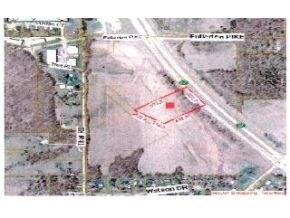
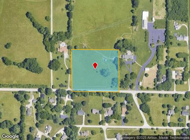
Property Record
1720 W That Rd, Bloomington, IN 47403
NEARBY LISTINGS FOR SALE OR LEASE
Property Detail
1720 W That Rd
Bloomington, IN
Arthur & Josephine May Minor
53-08-19-100-009.000-008
PT NE 19-8-1W 5.10A
Agriculturalland
Monroe
X
Indiana
18105C0231D
5.10 AC
2024
Bloomington/Terre Haute
2024
Other Market Areas
001103
DEMOGRAPHICS near 1720 W That Rd
1 Mile
3 Mile
5 Mile
2024 Total Population
2,951
30,398
93,237
2029 Population
2,907
30,149
92,939
Pop Growth 2024-2029
(1.49%)
(0.82%)
(0.32%)
Average Age
39
38
35
2024 Total Households
1,109
13,989
38,762
HH Growth 2024-2029
(1.53%)
(0.86%)
(0.34%)
Median Household Inc
$95,154
$56,647
$44,488
Avg Household Size
2.60
2.10
2.10
2024 Avg HH Vehicles
2.00
2.00
2.00
Median Home Value
$240,714
$201,175
$237,747
Median Year Built
1997
1990
1987
Nearby Places
Map Layers
Map Styles
 Street
 Aerial
- Restaurants
- Banks
- Shops
- Fitness
- Groceries
Nearby Properties
Address
Land Use
TOTAL SIZE
Lot Size
Zoning
Address
Land Use
TOTAL SIZE
Lot Size
Zoning
442,250 SF
37.15 AC
Address
Land Use
TOTAL SIZE
Lot Size
Zoning
35,777 SF
11.68 AC
Address
Land Use
TOTAL SIZE
Lot Size
Zoning
64,687 SF
9.96 AC
Address
Land Use
TOTAL SIZE
Lot Size
Zoning
17,312 SF
31.90 AC
Address
Land Use
TOTAL SIZE
Lot Size
Zoning
14,376 SF
11.03 AC
Address
Land Use
TOTAL SIZE
Lot Size
Zoning
576 SF
13 AC
Address
Land Use
TOTAL SIZE
Lot Size
Zoning
1,986 SF
3.28 AC
Address
Land Use
TOTAL SIZE
Lot Size
Zoning
1,120 SF
11.95 AC
Address
Land Use
TOTAL SIZE
Lot Size
Zoning
87,842 SF
11.14 AC
GB
Address
Land Use
TOTAL SIZE
Lot Size
Zoning
19,623 SF
8.21 AC
Address
Land Use
TOTAL SIZE
Lot Size
Zoning
17,950 SF
12.06 AC
Address
Land Use
TOTAL SIZE
Lot Size
Zoning
218,783 SF
24.97 AC
GB
Address
Land Use
TOTAL SIZE
Lot Size
Zoning
2,715 SF
22.92 AC
Address
Land Use
TOTAL SIZE
Lot Size
Zoning
17,550 SF
9.05 AC
Address
Land Use
TOTAL SIZE
Lot Size
Zoning
19,800 SF
12.08 AC
Address
Land Use
TOTAL SIZE
Lot Size
Zoning
65,216 SF
7.04 AC
Address
Land Use
TOTAL SIZE
Lot Size
Zoning
22,280 SF
4.52 AC
Address
Land Use
TOTAL SIZE
Lot Size
Zoning
89,376 SF
6.26 AC
Address
Land Use
TOTAL SIZE
Lot Size
Zoning
2,562 SF
8.09 AC
RM15
Address
Land Use
TOTAL SIZE
Lot Size
Zoning
3,600 SF
15.59 AC
Address
Land Use
TOTAL SIZE
Lot Size
Zoning
6,600 SF
9.84 AC
Address
Land Use
TOTAL SIZE
Lot Size
Zoning
6,068 SF
11.86 AC
Address
Land Use
TOTAL SIZE
Lot Size
Zoning
13,104 SF
6.39 AC
Address
Land Use
TOTAL SIZE
Lot Size
Zoning
15,008 SF
13 AC
Address
Land Use
TOTAL SIZE
Lot Size
Zoning
61,689 SF
4.70 AC
Address
Land Use
TOTAL SIZE
Lot Size
Zoning
97,912 SF
86.62 AC
Address
Land Use
TOTAL SIZE
Lot Size
Zoning
10,124 SF
1.58 AC
Address
Land Use
TOTAL SIZE
Lot Size
Zoning
52,802 SF
6.24 AC
PUD
Address
Land Use
TOTAL SIZE
Lot Size
Zoning
193,202 SF
10.39 AC
PUD
Address
Land Use
TOTAL SIZE
Lot Size
Zoning
9,000 SF
32.54 AC
IL
The World's #1 Commercial Real Estate Marketplace
Connect with us
© 2025 CoStar Group
The information above has been obtained from sources believed reliable. While we do not doubt its accuracy we have not verified it and make no guarantee, warranty or representation about it. It is your responsibility to independently confirm its accuracy and completeness. Any projections, opinions, assumptions, or estimates used are for example only and do not represent the current or future performance of the property. The value of this transaction to you depends on tax and other factors which should be evaluated by your tax, financial, and legal advisors. You and your advisors should conduct a careful, independent investigation of the property to determine to your satisfaction the suitability of the property for your needs.