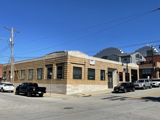
Property Record
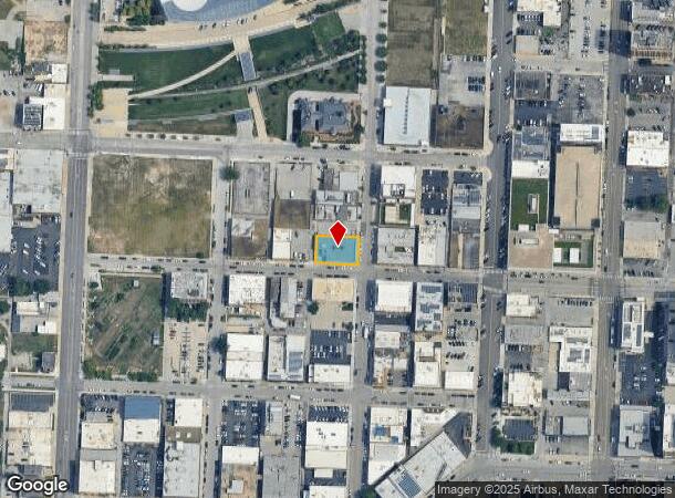
1720 Wyandotte St, Kansas City, MO 64108


Current Lease Availabilities
NEARBY LISTINGS FOR SALE OR LEASE
Property Detail
1720 Wyandotte St
Kansas City, MO-KS
Goodrich Add
29-520-07-06-00-0-00-000
GOODRICH ADD---LOTS 24-26 BLK 3
Storebuilding
Jackson
X
Missouri
29095C0254G
24-26
2024
0.19 AC
2025
Freight House District
015800
Kansas City
7,447 SF
DEMOGRAPHICS near 1720 Wyandotte St
1 Mile
3 Mile
5 Mile
2024 Total Population
15,358
108,400
256,801
2029 Population
15,659
110,491
260,225
Pop Growth 2024-2029
+ 1.96%
+ 1.93%
+ 1.33%
Average Age
36
36
36
2024 Total Households
9,167
50,776
110,978
HH Growth 2024-2029
+ 2.06%
+ 2.13%
+ 1.53%
Median Household Inc
$70,263
$50,309
$50,309
Avg Household Size
1.50
2.00
2.20
2024 Avg HH Vehicles
1.00
1.00
1.00
Median Home Value
$271,246
$186,924
$157,464
Median Year Built
1963
1954
1952
Nearby Places
- Restaurants
- Banks
- Shops
- Fitness
- Groceries
PUBLIC TRANSPORTATION
TRANSIT/SUBWAY
Crossroads On Main At 19Th St Sb (KC Streetcar - KCATA)
DRIVE
WALK
Distance
Crossroads On Main At 19Th St Sb (KC Streetcar - KCATA)
1 min
4 min
0.2 mi
Kauffman Center On Main At 16Th St Sb (KC Streetcar - KCATA)
DRIVE
WALK
Distance
Kauffman Center On Main At 16Th St Sb (KC Streetcar - KCATA)
1 min
5 min
0.3 mi
Power & Light On Main At 14Th St Sb (KC Streetcar - KCATA)
DRIVE
WALK
Distance
Power & Light On Main At 14Th St Sb (KC Streetcar - KCATA)
1 min
8 min
0.5 mi
Union Station On Main At Pershing Sb (KC Streetcar - Kansas City Area Transportation Authority)
DRIVE
WALK
Distance
Union Station On Main At Pershing Sb (KC Streetcar - Kansas City Area Transportation Authority)
1 min
11 min
0.6 mi
Union Station On Main At Pershing Sb (KC Streetcar - KCATA)
DRIVE
WALK
Distance
Union Station On Main At Pershing Sb (KC Streetcar - KCATA)
2 min
12 min
0.6 mi
COMMUTER RAIL
Kansas City (Lincoln Service Missouri River Runner - Amtrak, Missouri River Runner - Amtrak, Southwest Chief - Amtrak)
DRIVE
WALK
Distance
Kansas City (Lincoln Service Missouri River Runner - Amtrak, Missouri River Runner - Amtrak, Southwest Chief - Amtrak)
3 min
12 min
0.7 mi
AIRPORT
Kansas City International
DRIVE
WALK
Distance
Kansas City International
28 min
19.7 mi
Freight Ports
Tulsa Port Of Catoosa
DRIVE
WALK
Distance
Tulsa Port Of Catoosa
266 min
237.8 mi
Nearby Properties
Address
Land Use
TOTAL SIZE
Lot Size
Zoning
Address
Land Use
TOTAL SIZE
Lot Size
Zoning
761,113 SF
17.78 AC
KC3
Address
Land Use
TOTAL SIZE
Lot Size
Zoning
91,485 SF
10.11 AC
Address
Land Use
TOTAL SIZE
Lot Size
Zoning
208,800 SF
5.57 AC
KRP5
Address
Land Use
TOTAL SIZE
Lot Size
Zoning
172,810 SF
Address
Land Use
TOTAL SIZE
Lot Size
Zoning
191,956 SF
10.45 AC
KR1B
Address
Land Use
TOTAL SIZE
Lot Size
Zoning
568,235 SF
9.59 AC
Address
Land Use
TOTAL SIZE
Lot Size
Zoning
126,962 SF
4.50 AC
KC0
Address
Land Use
TOTAL SIZE
Lot Size
Zoning
488,351 SF
8.34 AC
Address
Land Use
TOTAL SIZE
Lot Size
Zoning
132,304 SF
3.72 AC
KCD
Address
Land Use
TOTAL SIZE
Lot Size
Zoning
1,825,083 SF
25.77 AC
Address
Land Use
TOTAL SIZE
Lot Size
Zoning
63,748 SF
3.92 AC
Address
Land Use
TOTAL SIZE
Lot Size
Zoning
404,524 SF
5.51 AC
Address
Land Use
TOTAL SIZE
Lot Size
Zoning
711,196 SF
15.58 AC
Address
Land Use
TOTAL SIZE
Lot Size
Zoning
277,042 SF
0.40 AC
Address
Land Use
TOTAL SIZE
Lot Size
Zoning
257,647 SF
3.63 AC
Address
Land Use
TOTAL SIZE
Lot Size
Zoning
277,267 SF
4.18 AC
KCD
Address
Land Use
TOTAL SIZE
Lot Size
Zoning
124,492 SF
4.24 AC
Address
Land Use
TOTAL SIZE
Lot Size
Zoning
44,491 SF
1.96 AC
C3A2
Address
Land Use
TOTAL SIZE
Lot Size
Zoning
81,578 SF
1.63 AC
Address
Land Use
TOTAL SIZE
Lot Size
Zoning
115,627 SF
1.56 AC
Address
Land Use
TOTAL SIZE
Lot Size
Zoning
261,570 SF
1.82 AC
Address
Land Use
TOTAL SIZE
Lot Size
Zoning
162,989 SF
3.92 AC
KC0
Address
Land Use
TOTAL SIZE
Lot Size
Zoning
157,488 SF
1.60 AC
Address
Land Use
TOTAL SIZE
Lot Size
Zoning
87,294 SF
0.70 AC
Address
Land Use
TOTAL SIZE
Lot Size
Zoning
803,812 SF
5.85 AC
Address
Land Use
TOTAL SIZE
Lot Size
Zoning
384,543 SF
5.40 AC
Address
Land Use
TOTAL SIZE
Lot Size
Zoning
614,978 SF
31.56 AC
Address
Land Use
TOTAL SIZE
Lot Size
Zoning
274,622 SF
1.35 AC
Address
Land Use
TOTAL SIZE
Lot Size
Zoning
342,989 SF
1.84 AC
Address
Land Use
TOTAL SIZE
Lot Size
Zoning
93,870 SF
3.31 AC
KC0
The World's #1 Commercial Real Estate Marketplace
Connect with us
© 2025 CoStar Group
The information above has been obtained from sources believed reliable. While we do not doubt its accuracy we have not verified it and make no guarantee, warranty or representation about it. It is your responsibility to independently confirm its accuracy and completeness. Any projections, opinions, assumptions, or estimates used are for example only and do not represent the current or future performance of the property. The value of this transaction to you depends on tax and other factors which should be evaluated by your tax, financial, and legal advisors. You and your advisors should conduct a careful, independent investigation of the property to determine to your satisfaction the suitability of the property for your needs.