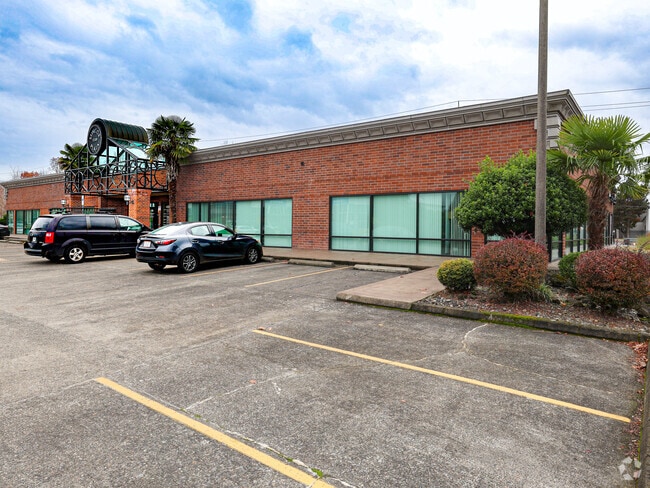
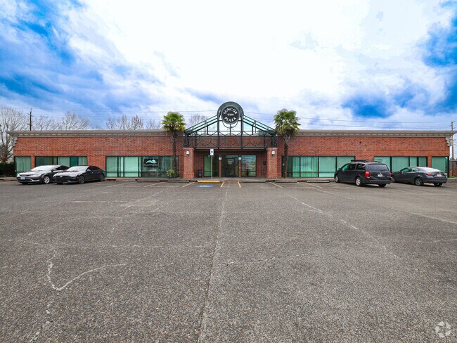
Property Record
17200 Nw Corridor Ct, Beaverton, OR 97006

Property Detail
17200 Nw Corridor Ct
R1299696
CORRIDOR CENTER, LOT PT 5, ACRES 0.79
Commercialbuilding
Washington
CS
Oregon
B and X Area of moderate flood hazard, usually the area between the limits of the 100-year and 500-year floods.
5
2024
0.79 AC
2026
Sunset Corridor/Hillsboro
031621
Portland
11,280 SF
Portland-Vancouver-Hillsboro, OR-WA
NEARBY LISTINGS FOR SALE OR LEASE
DEMOGRAPHICS near 17200 Nw Corridor Ct
1 mile
3 mile
5 mile
2024 Total Population
17,644
156,519
296,405
2029 Population
17,670
158,382
299,943
Pop Growth 2024-2029
+ 0.15%
+ 1.19%
+ 1.19%
Average Age
40
38
39
2024 Total Households
6,864
60,642
113,408
HH Growth 2024-2029
+ 0.34%
+ 1.28%
+ 1.32%
Median Household Inc
$108,318
$110,361
$108,823
Avg Household Size
2.50
2.50
2.60
2024 Avg HH Vehicles
2.00
2.00
2.00
Median Home Value
$667,642
$646,521
$638,814
Median Year Built
1989
1996
1992
Nearby Places
Map Layers
Map Styles
 Street
 Aerial
Transit
 Traffic
 Biking
Places
Listings with unknown addresses are not visible on the map
- Restaurants
- Banks
- Shops
- Fitness
- Groceries
PUBLIC TRANSPORTATION
COMMUTER RAIL
Beaverton Transit Center (West Side Express) (Westside Express Service - Tri-County Metropolitan Transportation District of Oregon Rail (TriMet Rail))
Drive
Walk
Distance
Beaverton Transit Center (West Side Express) (Westside Express Service - Tri-County Metropolitan Transportation District of Oregon Rail (TriMet Rail))
12 min
6.3 mi
Hall/Nimbus (Westside Express Service - Tri-County Metropolitan Transportation District of Oregon Rail (TriMet Rail))
Drive
Walk
Distance
Hall/Nimbus (Westside Express Service - Tri-County Metropolitan Transportation District of Oregon Rail (TriMet Rail))
13 min
8.1 mi
AIRPORT
Portland International
Drive
Walk
Distance
Portland International
36 min
22.8 mi
Freight Ports
Port of Portland
Drive
Walk
Distance
Port of Portland
19 min
11.9 mi
SALE & LEASE HISTORY
LISTING DATE
SALE/LEASE

Oct 06, 2022
For Lease
Nearby Properties
Address
Land Use
TOTAL SIZE
Lot Size
Zoning
Address
Land Use
TOTAL SIZE
Lot Size
Zoning
0.13 AC
I-P
Address
Land Use
TOTAL SIZE
Lot Size
Zoning
0.05 AC
IND
Address
Land Use
TOTAL SIZE
Lot Size
Zoning
2,936,291 SF
72.49 AC
TO:EMP
Address
Land Use
TOTAL SIZE
Lot Size
Zoning
562,350 SF
203.06 AC
INST
Address
Land Use
TOTAL SIZE
Lot Size
Zoning
58.68 AC
IND
Address
Land Use
TOTAL SIZE
Lot Size
Zoning
373,884 SF
153.56 AC
UC-RP
Address
Land Use
TOTAL SIZE
Lot Size
Zoning
1,004,655 SF
24.55 AC
SCR-V
Address
Land Use
TOTAL SIZE
Lot Size
Zoning
716,311 SF
75.07 AC
TO:EMP
Address
Land Use
TOTAL SIZE
Lot Size
Zoning
Address
Land Use
TOTAL SIZE
Lot Size
Zoning
194.52 AC
R1
Address
Land Use
TOTAL SIZE
Lot Size
Zoning
0.03 AC
I-P
Address
Land Use
TOTAL SIZE
Lot Size
Zoning
1,031,421 SF
22.20 AC
SC-HDR
Address
Land Use
TOTAL SIZE
Lot Size
Zoning
316,321 SF
0.11 AC
I-P
Address
Land Use
TOTAL SIZE
Lot Size
Zoning
704,877 SF
18.72 AC
OI-NC
Address
Land Use
TOTAL SIZE
Lot Size
Zoning
791,581 SF
22.58 AC
MFR-3
Address
Land Use
TOTAL SIZE
Lot Size
Zoning
281,695 SF
7.41 AC
SC-HDR
Address
Land Use
TOTAL SIZE
Lot Size
Zoning
482,173 SF
14.99 AC
C-G
Address
Land Use
TOTAL SIZE
Lot Size
Zoning
281,183 SF
44.96 AC
R-5
Address
Land Use
TOTAL SIZE
Lot Size
Zoning
152,339 SF
28.70 AC
R1
Address
Land Use
TOTAL SIZE
Lot Size
Zoning
253,727 SF
38.06 AC
OI
Address
Land Use
TOTAL SIZE
Lot Size
Zoning
120,400 SF
16.28 AC
TC-HDR
Address
Land Use
TOTAL SIZE
Lot Size
Zoning
22.13 AC
R-15
Address
Land Use
TOTAL SIZE
Lot Size
Zoning
495,454 SF
16.99 AC
SCR-V
Address
Land Use
TOTAL SIZE
Lot Size
Zoning
409,887 SF
20.03 AC
MFR-3
Address
Land Use
TOTAL SIZE
Lot Size
Zoning
71.43 AC
I-P
Address
Land Use
TOTAL SIZE
Lot Size
Zoning
210,649 SF
15.51 AC
R-15
Address
Land Use
TOTAL SIZE
Lot Size
Zoning
834,910 SF
14.87 AC
C-G
Address
Land Use
TOTAL SIZE
Lot Size
Zoning
324,326 SF
4.23 AC
SCC-SC
Address
Land Use
TOTAL SIZE
Lot Size
Zoning
360,916 SF
18.60 AC
MFR-2
Address
Land Use
TOTAL SIZE
Lot Size
Zoning
18.15 AC
SC-E
The World's #1 Commercial Real Estate Marketplace
Connect with us
© 2026 CoStar Group
The information above has been obtained from sources believed reliable. While we do not doubt its accuracy we have not verified it and make no guarantee, warranty or representation about it. It is your responsibility to independently confirm its accuracy and completeness. Any projections, opinions, assumptions, or estimates used are for example only and do not represent the current or future performance of the property. The value of this transaction to you depends on tax and other factors which should be evaluated by your tax, financial, and legal advisors. You and your advisors should conduct a careful, independent investigation of the property to determine to your satisfaction the suitability of the property for your needs.