Property Record
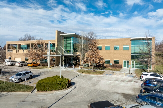
17201 Wright St, Omaha, NE 68130


Property Detail
17201 Wright St
1957-0616-16
LEGACY LOT 10 BLOCK 0 IRREG 3.72 AC
Medicalbuilding
Douglas
MU
Nebraska
B and X Area of moderate flood hazard, usually the area between the limits of the 100-year and 500-year floods.
10
2024
3.72 AC
2025
Southwest Omaha
007451
Omaha/Council Bluffs
52,502 SF
Omaha, NE-IA
NEARBY LISTINGS FOR SALE OR LEASE
DEMOGRAPHICS near 17201 Wright St
1 mile
3 mile
5 mile
2025 Total Population
8,044
85,670
214,578
2030 Population
8,172
87,256
221,828
Pop Growth 2025-2030
+ 1.59%
+ 1.85%
+ 3.38%
Average Age
43
39
39
2025 Total Households
3,235
31,118
79,493
HH Growth 2025-2030
+ 1.85%
+ 2.01%
+ 3.45%
Median Household Inc
$111,276
$122,937
$114,423
Avg Household Size
2.40
2.70
2.70
2025 Avg HH Vehicles
2.00
2.00
2.00
Median Home Value
$360,447
$352,349
$342,953
Median Year Built
1991
1996
1995
Nearby Places
Map Layers
Map Styles
 Street
 Aerial
Layers
 Traffic
 Biking
Places
Listings with unknown addresses are not visible on the map
- Restaurants
- Banks
- Shops
- Fitness
- Groceries
PUBLIC TRANSPORTATION
AIRPORT
Eppley Airfield
Drive
Walk
Distance
Eppley Airfield
34 min
19.7 mi
Freight Ports
Tulsa Port Of Catoosa
Drive
Walk
Distance
Tulsa Port Of Catoosa
479 min
428.8 mi
Nearby Properties
Address
Land Use
TOTAL SIZE
Lot Size
Zoning
Address
Land Use
TOTAL SIZE
Lot Size
Zoning
394,017 SF
11.62 AC
Address
Land Use
TOTAL SIZE
Lot Size
Zoning
449,891 SF
11.32 AC
Address
Land Use
TOTAL SIZE
Lot Size
Zoning
410,657 SF
18.25 AC
Address
Land Use
TOTAL SIZE
Lot Size
Zoning
223,975 SF
11.91 AC
Address
Land Use
TOTAL SIZE
Lot Size
Zoning
369,614 SF
18.03 AC
CC
Address
Land Use
TOTAL SIZE
Lot Size
Zoning
299,172 SF
13.80 AC
R7
Address
Land Use
TOTAL SIZE
Lot Size
Zoning
264,001 SF
10.33 AC
Address
Land Use
TOTAL SIZE
Lot Size
Zoning
294,334 SF
19.14 AC
R6
Address
Land Use
TOTAL SIZE
Lot Size
Zoning
114,840 SF
4.50 AC
Address
Land Use
TOTAL SIZE
Lot Size
Zoning
282,180 SF
13.96 AC
Address
Land Use
TOTAL SIZE
Lot Size
Zoning
104,473 SF
0.78 AC
MU
Address
Land Use
TOTAL SIZE
Lot Size
Zoning
240,630 SF
5.38 AC
Address
Land Use
TOTAL SIZE
Lot Size
Zoning
241,312 SF
14.51 AC
Address
Land Use
TOTAL SIZE
Lot Size
Zoning
281,964 SF
18.15 AC
R6
Address
Land Use
TOTAL SIZE
Lot Size
Zoning
88,928 SF
6.17 AC
Address
Land Use
TOTAL SIZE
Lot Size
Zoning
226,780 SF
8.23 AC
Address
Land Use
TOTAL SIZE
Lot Size
Zoning
341,379 SF
18.08 AC
Address
Land Use
TOTAL SIZE
Lot Size
Zoning
274,072 SF
12.06 AC
Address
Land Use
TOTAL SIZE
Lot Size
Zoning
232,559 SF
13.53 AC
R6
Address
Land Use
TOTAL SIZE
Lot Size
Zoning
376,653 SF
7.36 AC
Address
Land Use
TOTAL SIZE
Lot Size
Zoning
121,017 SF
13.23 AC
Address
Land Use
TOTAL SIZE
Lot Size
Zoning
268,545 SF
7.53 AC
Address
Land Use
TOTAL SIZE
Lot Size
Zoning
222,090 SF
7.74 AC
R6
Address
Land Use
TOTAL SIZE
Lot Size
Zoning
144,271 SF
4.75 AC
Address
Land Use
TOTAL SIZE
Lot Size
Zoning
137,800 SF
6.69 AC
Address
Land Use
TOTAL SIZE
Lot Size
Zoning
238,428 SF
18.64 AC
R5
Address
Land Use
TOTAL SIZE
Lot Size
Zoning
142,950 SF
5.94 AC
Address
Land Use
TOTAL SIZE
Lot Size
Zoning
143,817 SF
12.27 AC
Address
Land Use
TOTAL SIZE
Lot Size
Zoning
99,347 SF
4.50 AC
The World's #1 Commercial Real Estate Marketplace
Connect with us
© 2026 CoStar Group
The information above has been obtained from sources believed reliable. While we do not doubt its accuracy we have not verified it and make no guarantee, warranty or representation about it. It is your responsibility to independently confirm its accuracy and completeness. Any projections, opinions, assumptions, or estimates used are for example only and do not represent the current or future performance of the property. The value of this transaction to you depends on tax and other factors which should be evaluated by your tax, financial, and legal advisors. You and your advisors should conduct a careful, independent investigation of the property to determine to your satisfaction the suitability of the property for your needs.