Property Record
1721 8Th Ave N, Seattle, WA 98109

NEARBY LISTINGS FOR SALE OR LEASE
Property Detail
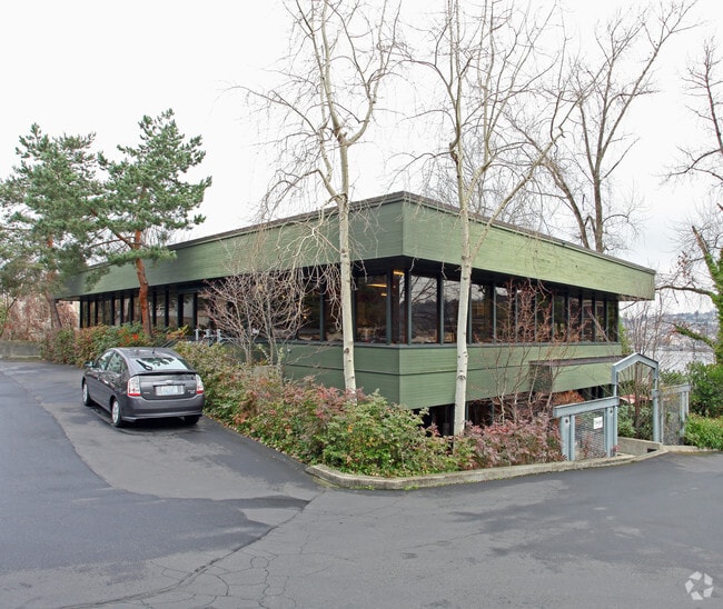
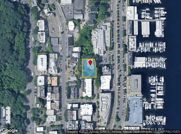
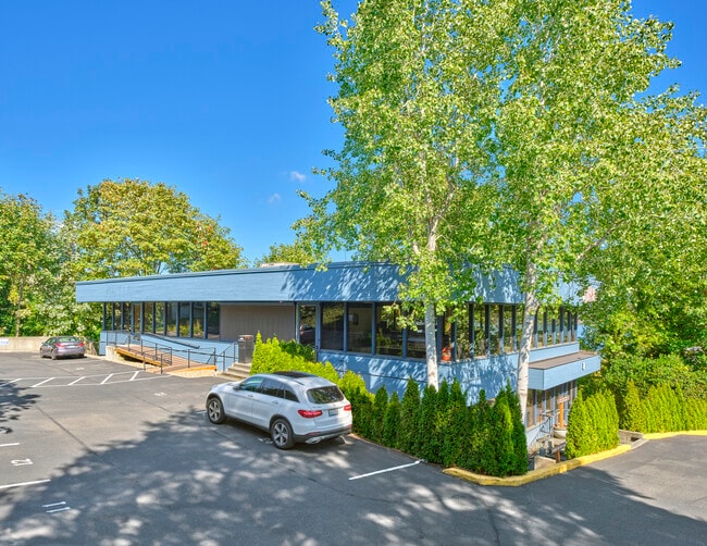
1721 8Th Ave N
Seattle-Tacoma-Bellevue, WA
Ly N Of Union Lake Supl Add
192504-9026
POR GL 5 DAF-BEG INTSN OF S LN OF GL 5 LY N OF UNION LAKE SUPL ADD & C/L OF 8TH AVE N TH S 89-59-23 W ALG SD S LN 129.95 FT TH N 00-19-32 E 160 FT TH N 89-59-23 E 115.91 FT TH S 08-46-20 E 81 FT TH S 00-32-42 E 80 FT TO BEG
Officebuilding
King
X
Washington
53033C0340G
192504
2025
0.46 AC
2024
Lake Union
006701
Seattle/Puget Sound
8,888 SF
DEMOGRAPHICS near 1721 8Th Ave N
1 Mile
3 Mile
5 Mile
2024 Total Population
39,551
322,324
528,623
2029 Population
40,303
328,933
537,316
Pop Growth 2024-2029
+ 1.90%
+ 2.05%
+ 1.64%
Average Age
37
37
38
2024 Total Households
22,951
171,656
262,228
HH Growth 2024-2029
+ 1.86%
+ 2.14%
+ 1.72%
Median Household Inc
$123,431
$109,747
$117,494
Avg Household Size
1.70
1.70
1.90
2024 Avg HH Vehicles
1.00
1.00
1.00
Median Home Value
$1,042,111
$1,003,290
$966,135
Median Year Built
1990
1988
1979
Nearby Places
Map Layers
Map Styles
 Street
 Aerial
- Restaurants
- Banks
- Shops
- Fitness
- Groceries
PUBLIC TRANSPORTATION
TRANSIT/SUBWAY
Lake Union Park (South Lake Union Streetcar - Seattle Streetcar)
DRIVE
WALK
Distance
Lake Union Park (South Lake Union Streetcar - Seattle Streetcar)
3 min
14 min
0.7 mi
Westlake & Mercer (South Lake Union Streetcar - Seattle Streetcar)
DRIVE
WALK
Distance
Westlake & Mercer (South Lake Union Streetcar - Seattle Streetcar)
3 min
15 min
0.7 mi
Terry & Mercer (South Lake Union Streetcar - Seattle Streetcar)
DRIVE
WALK
Distance
Terry & Mercer (South Lake Union Streetcar - Seattle Streetcar)
3 min
17 min
0.9 mi
Westlake & Thomas (South Lake Union Streetcar - Seattle Streetcar)
DRIVE
WALK
Distance
Westlake & Thomas (South Lake Union Streetcar - Seattle Streetcar)
4 min
18 min
0.9 mi
Fairview & Campus Drive (South Lake Union Streetcar - Seattle Streetcar)
DRIVE
WALK
Distance
Fairview & Campus Drive (South Lake Union Streetcar - Seattle Streetcar)
4 min
19 min
1.0 mi
COMMUTER RAIL
King Street (Seattle) Station (Sounder South Line - Central Puget Sound Regional Transit Authority Rail (Link Light Rail/Sounder))
DRIVE
WALK
Distance
King Street (Seattle) Station (Sounder South Line - Central Puget Sound Regional Transit Authority Rail (Link Light Rail/Sounder))
9 min
3.4 mi
AIRPORT
Seattle-Tacoma International
DRIVE
WALK
Distance
Seattle-Tacoma International
28 min
16.6 mi
Seattle Paine Field International
DRIVE
WALK
Distance
Seattle Paine Field International
36 min
23.4 mi
SALE & LEASE HISTORY
LISTING DATE
SALE/LEASE

Sep 08, 2020
For Sale
Oct 02, 2024
For Sale
Mar 05, 2020
For Lease
Apr 16, 2018
For Lease
Nearby Properties
Address
Land Use
TOTAL SIZE
Lot Size
Zoning
Address
Land Use
TOTAL SIZE
Lot Size
Zoning
800,000 SF
8.57 AC
SM-UP 95 (
Address
Land Use
TOTAL SIZE
Lot Size
Zoning
471.20 AC
MIO-37-LR1
Address
Land Use
TOTAL SIZE
Lot Size
Zoning
2.84 AC
DMC 340/29
Address
Land Use
TOTAL SIZE
Lot Size
Zoning
793,990 SF
30.81 AC
UI U/85
Address
Land Use
TOTAL SIZE
Lot Size
Zoning
946,212 SF
1.58 AC
DMC 340/29
Address
Land Use
TOTAL SIZE
Lot Size
Zoning
686,722 SF
1.26 AC
SM-SLU 240
Address
Land Use
TOTAL SIZE
Lot Size
Zoning
36,864 SF
8.02 AC
SM-UP 95 (
Address
Land Use
TOTAL SIZE
Lot Size
Zoning
992,925 SF
4.28 AC
MIO-240-HR
Address
Land Use
TOTAL SIZE
Lot Size
Zoning
1,526,621 SF
1.36 AC
DOC1 U/450
Address
Land Use
TOTAL SIZE
Lot Size
Zoning
716,128 SF
1.41 AC
SM-SLU 175
Address
Land Use
TOTAL SIZE
Lot Size
Zoning
1,062,251 SF
1.47 AC
DOC2 500/3
Address
Land Use
TOTAL SIZE
Lot Size
Zoning
763,898 SF
2.03 AC
DOC2 500/3
Address
Land Use
TOTAL SIZE
Lot Size
Zoning
1,137,666 SF
2.07 AC
DOC1 U/450
Address
Land Use
TOTAL SIZE
Lot Size
Zoning
7,930 SF
4.14 AC
MIO-240-HR
Address
Land Use
TOTAL SIZE
Lot Size
Zoning
1,128,575 SF
1.30 AC
DOC1 U/450
Address
Land Use
TOTAL SIZE
Lot Size
Zoning
615,000 SF
0.88 AC
DOC2 500/3
Address
Land Use
TOTAL SIZE
Lot Size
Zoning
861,221 SF
1.30 AC
DMC 340/29
Address
Land Use
TOTAL SIZE
Lot Size
Zoning
565,110 SF
29.11 AC
II U/85
Address
Land Use
TOTAL SIZE
Lot Size
Zoning
377,813 SF
1.65 AC
DOC2 500/3
Address
Land Use
TOTAL SIZE
Lot Size
Zoning
1,011,547 SF
0.35 AC
DOC1 U/450
Address
Land Use
TOTAL SIZE
Lot Size
Zoning
1,478,612 SF
0.80 AC
DOC2 500/3
Address
Land Use
TOTAL SIZE
Lot Size
Zoning
67,235 SF
0.45 AC
DOC2 500/3
Address
Land Use
TOTAL SIZE
Lot Size
Zoning
922,344 SF
1.33 AC
DRC 85-170
Address
Land Use
TOTAL SIZE
Lot Size
Zoning
413,982 SF
0.58 AC
DMC 340/29
Address
Land Use
TOTAL SIZE
Lot Size
Zoning
412,000 SF
1.27 AC
DOC1 U/450
Address
Land Use
TOTAL SIZE
Lot Size
Zoning
943,610 SF
1.24 AC
DOC1 U/450
Address
Land Use
TOTAL SIZE
Lot Size
Zoning
155,795 SF
7.89 AC
SM-UP 95 (
Address
Land Use
TOTAL SIZE
Lot Size
Zoning
612,844 SF
0.09 AC
SM-U/R 75-
Address
Land Use
TOTAL SIZE
Lot Size
Zoning
411,654 SF
0.59 AC
DMC 240/29
The World's #1 Commercial Real Estate Marketplace
Connect with us
© 2025 CoStar Group
The information above has been obtained from sources believed reliable. While we do not doubt its accuracy we have not verified it and make no guarantee, warranty or representation about it. It is your responsibility to independently confirm its accuracy and completeness. Any projections, opinions, assumptions, or estimates used are for example only and do not represent the current or future performance of the property. The value of this transaction to you depends on tax and other factors which should be evaluated by your tax, financial, and legal advisors. You and your advisors should conduct a careful, independent investigation of the property to determine to your satisfaction the suitability of the property for your needs.