Property Record
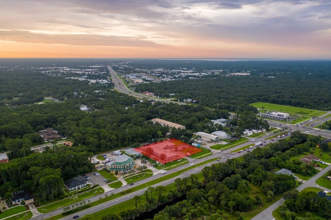
17218 Toledo Blade Blvd, Port Charlotte, FL 33954


NEARBY LISTINGS FOR SALE OR LEASE
Property Detail
17218 Toledo Blade Blvd
Punta Gorda, FL
Port Charlotte
402101452005
PORT CHARLOTTE SEC16 BLK1084 LT 1 275/617 TD1726/1514 QT1895/485 2160/1564 2400/952 RES2625/1635 2625/1641 ORD2449/380 4747/1752 PCH 016 1084 0018 PORT CHARLOTTE SEC16 BLK1084 LT 18 261/462 570/559 2411/1625 RES2625/16
Storemultistory
Charlotte
X
Florida
12015C0043G
1
2024
1.50 AC
2025
Charlotte County
020402
Southwest Florida
14,493 SF
DEMOGRAPHICS near 17218 Toledo Blade Blvd
1 Mile
3 Mile
5 Mile
2024 Total Population
876
31,469
98,831
2029 Population
1,036
36,870
115,742
Pop Growth 2024-2029
+ 18.26%
+ 17.16%
+ 17.11%
Average Age
44
46
47
2024 Total Households
346
12,804
40,888
HH Growth 2024-2029
+ 18.21%
+ 17.48%
+ 17.38%
Median Household Inc
$61,470
$57,632
$62,092
Avg Household Size
2.40
2.40
2.30
2024 Avg HH Vehicles
2.00
2.00
2.00
Median Home Value
$294,117
$243,479
$243,687
Median Year Built
2002
2000
1995
Nearby Places
Map Layers
Map Styles
 Street
 Aerial
- Restaurants
- Banks
- Shops
- Fitness
- Groceries
PUBLIC TRANSPORTATION
AIRPORT
Punta Gorda
DRIVE
WALK
Distance
Punta Gorda
27 min
13.8 mi
SALE & LEASE HISTORY
LISTING DATE
SALE/LEASE

Sep 25, 2016
For Lease
May 31, 2017
For Lease
Jun 03, 2020
For Sale
Dec 04, 2018
For Lease
Nearby Properties
Address
Land Use
TOTAL SIZE
Lot Size
Zoning
Address
Land Use
TOTAL SIZE
Lot Size
Zoning
316,994 SF
40.88 AC
V
Address
Land Use
TOTAL SIZE
Lot Size
Zoning
103,886 SF
21.48 AC
PD
Address
Land Use
TOTAL SIZE
Lot Size
Zoning
198,132 SF
17.61 AC
RMF15
Address
Land Use
TOTAL SIZE
Lot Size
Zoning
132,969 SF
80.28 AC
PKR
Address
Land Use
TOTAL SIZE
Lot Size
Zoning
53,564 SF
22 AC
PD
Address
Land Use
TOTAL SIZE
Lot Size
Zoning
261,557 SF
46.25 AC
OMI
Address
Land Use
TOTAL SIZE
Lot Size
Zoning
196,676 SF
30 AC
OMI
Address
Land Use
TOTAL SIZE
Lot Size
Zoning
174,965 SF
13.52 AC
CG
Address
Land Use
TOTAL SIZE
Lot Size
Zoning
131,053 SF
14.40 AC
PD
Address
Land Use
TOTAL SIZE
Lot Size
Zoning
583,831 SF
54.32 AC
CG
Address
Land Use
TOTAL SIZE
Lot Size
Zoning
9,511 SF
40.53 AC
PD
Address
Land Use
TOTAL SIZE
Lot Size
Zoning
141,619 SF
12.39 AC
II
Address
Land Use
TOTAL SIZE
Lot Size
Zoning
208,372 SF
21.98 AC
II
Address
Land Use
TOTAL SIZE
Lot Size
Zoning
122,030 SF
7.43 AC
CG
Address
Land Use
TOTAL SIZE
Lot Size
Zoning
114,985 SF
29.77 AC
GU
Address
Land Use
TOTAL SIZE
Lot Size
Zoning
141,647 SF
20.29 AC
CG
Address
Land Use
TOTAL SIZE
Lot Size
Zoning
94,423 SF
12.87 AC
V
Address
Land Use
TOTAL SIZE
Lot Size
Zoning
52,706 SF
4.81 AC
V
Address
Land Use
TOTAL SIZE
Lot Size
Zoning
98,599 SF
9.75 AC
CG
Address
Land Use
TOTAL SIZE
Lot Size
Zoning
107,237 SF
20.14 AC
CG
Address
Land Use
TOTAL SIZE
Lot Size
Zoning
91,281 SF
10 AC
CG
Address
Land Use
TOTAL SIZE
Lot Size
Zoning
95.20 AC
PD
Address
Land Use
TOTAL SIZE
Lot Size
Zoning
96,253 SF
7.89 AC
CG
Address
Land Use
TOTAL SIZE
Lot Size
Zoning
37,045 SF
21.20 AC
PD
Address
Land Use
TOTAL SIZE
Lot Size
Zoning
88,259 SF
4.71 AC
CG
Address
Land Use
TOTAL SIZE
Lot Size
Zoning
52,925 SF
7.49 AC
V
Address
Land Use
TOTAL SIZE
Lot Size
Zoning
37,567 SF
36.76 AC
PKR
Address
Land Use
TOTAL SIZE
Lot Size
Zoning
4,562 SF
8.08 AC
CG
Address
Land Use
TOTAL SIZE
Lot Size
Zoning
135,717 SF
10.55 AC
CG
Address
Land Use
TOTAL SIZE
Lot Size
Zoning
82,800 SF
9.45 AC
CG
The World's #1 Commercial Real Estate Marketplace
Connect with us
© 2026 CoStar Group
The information above has been obtained from sources believed reliable. While we do not doubt its accuracy we have not verified it and make no guarantee, warranty or representation about it. It is your responsibility to independently confirm its accuracy and completeness. Any projections, opinions, assumptions, or estimates used are for example only and do not represent the current or future performance of the property. The value of this transaction to you depends on tax and other factors which should be evaluated by your tax, financial, and legal advisors. You and your advisors should conduct a careful, independent investigation of the property to determine to your satisfaction the suitability of the property for your needs.