Property Record
17225 Westheimer Rd, Houston, TX 77082


Save to a Folder
{{folder.Name}}
{{folder.ListingIds.length}} Properties
{{folder.ListingIds.length}} Property
Create a New Folder
Current Lease Availabilities
Property Detail
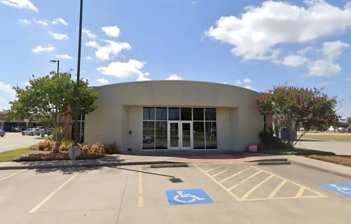
17225 Westheimer Rd
0451-00-000-0607-907
0451 DAY LAND AND CATTLE, ACRES 0.9559, UNRESTRICTED RESERVE A, BLOCK 1, CHASE COMMERCIAL RESERVE
Commercialnec
FORT BEND
B and X Area of moderate flood hazard, usually the area between the limits of the 100-year and 500-year floods.
Texas
2024
0.96 AC
2025
Far Katy South
673007
Houston
4,127 SF
Houston-Pasadena-The Woodlands, TX
NEARBY LISTINGS FOR SALE OR LEASE
DEMOGRAPHICS near 17225 Westheimer Rd
1 mile
3 mile
5 mile
2025 Total Population
9,414
107,780
348,493
2030 Population
10,339
119,215
382,362
Pop Growth 2025-2030
+ 9.83%
+ 10.61%
+ 9.72%
Average Age
38
37
38
2025 Total Households
2,850
33,223
113,185
HH Growth 2025-2030
+ 10.11%
+ 10.79%
+ 9.77%
Median Household Inc
$80,000
$74,249
$83,964
Avg Household Size
3.20
3.20
3.00
2025 Avg HH Vehicles
2.00
2.00
2.00
Median Home Value
$275,768
$282,784
$334,455
Median Year Built
1994
2000
2000
Nearby Places
Map Layers
Map Styles
 Street
 Aerial
Layers
 Traffic
 Biking
Places
Listings with unknown addresses are not visible on the map
- Restaurants
- Banks
- Shops
- Fitness
- Groceries
PUBLIC TRANSPORTATION
AIRPORT
William P Hobby
Drive
Walk
Distance
William P Hobby
48 min
31.3 mi
George Bush Intcntl/Houston
Drive
Walk
Distance
George Bush Intcntl/Houston
49 min
39.7 mi
Freight Ports
Port of Houston
Drive
Walk
Distance
Port of Houston
44 min
30.6 mi
Nearby Properties
Address
Land Use
TOTAL SIZE
Lot Size
Zoning
Address
Land Use
TOTAL SIZE
Lot Size
Zoning
1,376,776 SF
113.43 AC
Address
Land Use
TOTAL SIZE
Lot Size
Zoning
900 SF
20.64 AC
MS
Address
Land Use
TOTAL SIZE
Lot Size
Zoning
403,080 SF
19.17 AC
Address
Land Use
TOTAL SIZE
Lot Size
Zoning
14.01 AC
Address
Land Use
TOTAL SIZE
Lot Size
Zoning
8.32 AC
Address
Land Use
TOTAL SIZE
Lot Size
Zoning
12.38 AC
Address
Land Use
TOTAL SIZE
Lot Size
Zoning
363,177 SF
36.37 AC
YOS
Address
Land Use
TOTAL SIZE
Lot Size
Zoning
11.02 AC
Address
Land Use
TOTAL SIZE
Lot Size
Zoning
690,119 SF
23 AC
Address
Land Use
TOTAL SIZE
Lot Size
Zoning
364,571 SF
19.23 AC
Address
Land Use
TOTAL SIZE
Lot Size
Zoning
9.97 AC
MS
Address
Land Use
TOTAL SIZE
Lot Size
Zoning
14.18 AC
Address
Land Use
TOTAL SIZE
Lot Size
Zoning
443,209 SF
25.13 AC
Address
Land Use
TOTAL SIZE
Lot Size
Zoning
332,872 SF
13 AC
Address
Land Use
TOTAL SIZE
Lot Size
Zoning
300,014 SF
14.13 AC
Address
Land Use
TOTAL SIZE
Lot Size
Zoning
351,177 SF
15.81 AC
Address
Land Use
TOTAL SIZE
Lot Size
Zoning
10.48 AC
Address
Land Use
TOTAL SIZE
Lot Size
Zoning
205,950 SF
8.50 AC
Address
Land Use
TOTAL SIZE
Lot Size
Zoning
158,975 SF
46.38 AC
YQ
Address
Land Use
TOTAL SIZE
Lot Size
Zoning
206,121 SF
23.28 AC
Address
Land Use
TOTAL SIZE
Lot Size
Zoning
311,010 SF
12.36 AC
Address
Land Use
TOTAL SIZE
Lot Size
Zoning
330,612 SF
13.41 AC
Address
Land Use
TOTAL SIZE
Lot Size
Zoning
181,840 SF
4.53 AC
Address
Land Use
TOTAL SIZE
Lot Size
Zoning
89,021 SF
12 AC
Address
Land Use
TOTAL SIZE
Lot Size
Zoning
173,134 SF
7.60 AC
Address
Land Use
TOTAL SIZE
Lot Size
Zoning
169,058 SF
5.43 AC
Address
Land Use
TOTAL SIZE
Lot Size
Zoning
185,225 SF
22.43 AC
Address
Land Use
TOTAL SIZE
Lot Size
Zoning
9.88 AC
YS
Address
Land Use
TOTAL SIZE
Lot Size
Zoning
211,796 SF
19.38 AC
Address
Land Use
TOTAL SIZE
Lot Size
Zoning
87,361 SF
11.95 AC
The World's #1 Commercial Real Estate Marketplace
Connect with us
© 2026 CoStar Group
The information above has been obtained from sources believed reliable. While we do not doubt its accuracy we have not verified it and make no guarantee, warranty or representation about it. It is your responsibility to independently confirm its accuracy and completeness. Any projections, opinions, assumptions, or estimates used are for example only and do not represent the current or future performance of the property. The value of this transaction to you depends on tax and other factors which should be evaluated by your tax, financial, and legal advisors. You and your advisors should conduct a careful, independent investigation of the property to determine to your satisfaction the suitability of the property for your needs.