Property Record
1723 W State Highway 100, Port Isabel, TX 78578
NEARBY LISTINGS FOR SALE OR LEASE
-
-
View all Port Isabel listings for sale on LoopNet.com
Property Detail
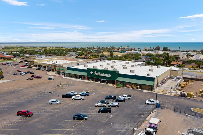
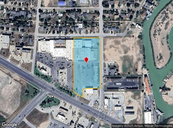
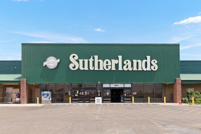
1723 W State Highway 100
Brownsville-Harlingen, TX
Wal Mart #413 Subdivision
479300-0010-001010
PORT ISABEL - WAL-MART #413 SUBD BLK 3, 4.7318 ACS OUT OF 5.868 ACRES
Commercialnec
Cameron
AE
Texas
48061C0505F
10
2024
4.73 AC
2025
Outlying Cameron County
012304
Brownsville/Harlingen
52,446 SF
DEMOGRAPHICS near 1723 W State Highway 100
1 Mile
3 Mile
5 Mile
2024 Total Population
2,694
6,153
10,660
2029 Population
2,676
6,174
10,984
Pop Growth 2024-2029
(0.67%)
+ 0.34%
+ 3.04%
Average Age
41
42
45
2024 Total Households
1,021
2,364
4,360
HH Growth 2024-2029
(0.39%)
+ 1.14%
+ 3.85%
Median Household Inc
$47,321
$50,522
$57,909
Avg Household Size
2.60
2.50
2.40
2024 Avg HH Vehicles
1.00
1.00
2.00
Median Home Value
$150,757
$185,027
$235,140
Median Year Built
1981
1985
1986
Nearby Places
Map Layers
Map Styles
 Street
 Aerial
- Restaurants
- Banks
- Shops
- Fitness
- Groceries
PUBLIC TRANSPORTATION
AIRPORT
Brownsville/South Padre Island International
DRIVE
WALK
Distance
Brownsville/South Padre Island International
25 min
19.6 mi
Valley International
DRIVE
WALK
Distance
Valley International
51 min
42.5 mi
Freight Ports
Port of Brownsville
DRIVE
WALK
Distance
Port of Brownsville
18 min
15.8 mi
Nearby Properties
Address
Land Use
TOTAL SIZE
Lot Size
Zoning
Address
Land Use
TOTAL SIZE
Lot Size
Zoning
194,092 SF
40 AC
C
Address
Land Use
TOTAL SIZE
Lot Size
Zoning
90,794 SF
22.76 AC
C
Address
Land Use
TOTAL SIZE
Lot Size
Zoning
159,538 SF
22.34 AC
Address
Land Use
TOTAL SIZE
Lot Size
Zoning
83,500 SF
4.80 AC
A-C
Address
Land Use
TOTAL SIZE
Lot Size
Zoning
983.97 AC
Address
Land Use
TOTAL SIZE
Lot Size
Zoning
15,193 SF
15.34 AC
M-R
Address
Land Use
TOTAL SIZE
Lot Size
Zoning
78,345 SF
7.05 AC
A-C
Address
Land Use
TOTAL SIZE
Lot Size
Zoning
Address
Land Use
TOTAL SIZE
Lot Size
Zoning
62,486 SF
9.83 AC
C
Address
Land Use
TOTAL SIZE
Lot Size
Zoning
92,749 SF
8.58 AC
Address
Land Use
TOTAL SIZE
Lot Size
Zoning
48,150 SF
3.14 AC
C
Address
Land Use
TOTAL SIZE
Lot Size
Zoning
9,093 SF
0.83 AC
C
Address
Land Use
TOTAL SIZE
Lot Size
Zoning
78,361 SF
9.60 AC
B
Address
Land Use
TOTAL SIZE
Lot Size
Zoning
106,404 SF
7.25 AC
Address
Land Use
TOTAL SIZE
Lot Size
Zoning
70,789 SF
Address
Land Use
TOTAL SIZE
Lot Size
Zoning
60,083 SF
10.84 AC
C
Address
Land Use
TOTAL SIZE
Lot Size
Zoning
45,591 SF
3.36 AC
Address
Land Use
TOTAL SIZE
Lot Size
Zoning
17,616 SF
1.13 AC
C
Address
Land Use
TOTAL SIZE
Lot Size
Zoning
5,514 SF
0.35 AC
A-C
Address
Land Use
TOTAL SIZE
Lot Size
Zoning
14,991 SF
1.37 AC
Address
Land Use
TOTAL SIZE
Lot Size
Zoning
21,756 SF
2.48 AC
Address
Land Use
TOTAL SIZE
Lot Size
Zoning
6,329 SF
1.35 AC
Address
Land Use
TOTAL SIZE
Lot Size
Zoning
17,352 SF
0.28 AC
Address
Land Use
TOTAL SIZE
Lot Size
Zoning
25,996 SF
1.65 AC
C
Address
Land Use
TOTAL SIZE
Lot Size
Zoning
25,257 SF
2.72 AC
C
Address
Land Use
TOTAL SIZE
Lot Size
Zoning
41,639 SF
1.68 AC
AC
Address
Land Use
TOTAL SIZE
Lot Size
Zoning
11,100 SF
0.94 AC
Address
Land Use
TOTAL SIZE
Lot Size
Zoning
16,700 SF
2.12 AC
Address
Land Use
TOTAL SIZE
Lot Size
Zoning
10,143 SF
0.57 AC
C
The World's #1 Commercial Real Estate Marketplace
Connect with us
© 2026 CoStar Group
The information above has been obtained from sources believed reliable. While we do not doubt its accuracy we have not verified it and make no guarantee, warranty or representation about it. It is your responsibility to independently confirm its accuracy and completeness. Any projections, opinions, assumptions, or estimates used are for example only and do not represent the current or future performance of the property. The value of this transaction to you depends on tax and other factors which should be evaluated by your tax, financial, and legal advisors. You and your advisors should conduct a careful, independent investigation of the property to determine to your satisfaction the suitability of the property for your needs.