Property Record
1725 Kidd Ave Se, Port Orchard, WA 98366


NEARBY LISTINGS FOR SALE OR LEASE
Property Detail
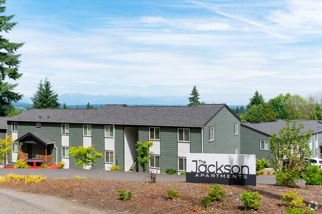
1725 Kidd Ave Se
Bremerton-Silverdale-Port Orchard, WA
Liberty Heights
4684-001-009-01-03
LOTS 7, 8, 33 AND 34, BLOCK 1, LIBERTY HEIGHTS, ACCORDING TO THE PLAT THEREOF RECORDED IN VOLUME 4 OF PLATS, PAGE 44, RECORDS OF KITSAP COUNTY, WASHINGTON; EXCEPT THE EAST 10 FEET OF LOTS 7 AND 8.
Multifamilydwelling
Kitsap
X
Washington
53035C0390F
s,7
2025
1.97 AC
2026
South Kitsap County
0923001013
Bremerton/Silverdale
28,652 SF
DEMOGRAPHICS near 1725 Kidd Ave Se
1 Mile
3 Mile
5 Mile
2024 Total Population
9,368
50,355
108,094
2029 Population
9,410
50,823
109,543
Pop Growth 2024-2029
+ 0.45%
+ 0.93%
+ 1.34%
Average Age
40
39
40
2024 Total Households
3,569
18,271
41,477
HH Growth 2024-2029
+ 0.25%
+ 1.08%
+ 1.48%
Median Household Inc
$76,424
$72,041
$71,545
Avg Household Size
2.40
2.40
2.40
2024 Avg HH Vehicles
2.00
2.00
2.00
Median Home Value
$376,401
$386,993
$413,878
Median Year Built
1977
1978
1979
Nearby Places
Map Layers
Map Styles
 Street
 Aerial
- Restaurants
- Banks
- Shops
- Fitness
- Groceries
PUBLIC TRANSPORTATION
AIRPORT
Seattle-Tacoma International
DRIVE
WALK
Distance
Seattle-Tacoma International
71 min
49.0 mi
Freight Ports
Port of Tacoma
DRIVE
WALK
Distance
Port of Tacoma
43 min
30.6 mi
SALE & LEASE HISTORY
LISTING DATE
SALE/LEASE

Aug 04, 2023
For Sale
Nearby Properties
Address
Land Use
TOTAL SIZE
Lot Size
Zoning
Address
Land Use
TOTAL SIZE
Lot Size
Zoning
552 SF
17.39 AC
CITY
Address
Land Use
TOTAL SIZE
Lot Size
Zoning
143,022 SF
11.24 AC
R4
Address
Land Use
TOTAL SIZE
Lot Size
Zoning
127,853 SF
7.41 AC
R4
Address
Land Use
TOTAL SIZE
Lot Size
Zoning
135,371 SF
6.04 AC
R4
Address
Land Use
TOTAL SIZE
Lot Size
Zoning
17,592 SF
11.61 AC
UM
Address
Land Use
TOTAL SIZE
Lot Size
Zoning
25,973 SF
8.20 AC
CC
Address
Land Use
TOTAL SIZE
Lot Size
Zoning
110,994 SF
5.35 AC
R4
Address
Land Use
TOTAL SIZE
Lot Size
Zoning
1,092 SF
5.70 AC
CC
Address
Land Use
TOTAL SIZE
Lot Size
Zoning
125,582 SF
4.02 AC
NC
Address
Land Use
TOTAL SIZE
Lot Size
Zoning
0.54 AC
CITY
Address
Land Use
TOTAL SIZE
Lot Size
Zoning
110,778 SF
9.24 AC
CC
Address
Land Use
TOTAL SIZE
Lot Size
Zoning
Address
Land Use
TOTAL SIZE
Lot Size
Zoning
1,344 SF
5.47 AC
R-40
Address
Land Use
TOTAL SIZE
Lot Size
Zoning
79,615 SF
1.25 AC
DSAP
Address
Land Use
TOTAL SIZE
Lot Size
Zoning
158,870 SF
14.62 AC
CC
Address
Land Use
TOTAL SIZE
Lot Size
Zoning
185,893 SF
17.89 AC
CC
Address
Land Use
TOTAL SIZE
Lot Size
Zoning
77,580 SF
8.62 AC
UM
Address
Land Use
TOTAL SIZE
Lot Size
Zoning
14,660 SF
6.14 AC
UM
Address
Land Use
TOTAL SIZE
Lot Size
Zoning
14,660 SF
6.07 AC
UM
Address
Land Use
TOTAL SIZE
Lot Size
Zoning
49,604 SF
5.49 AC
UM
Address
Land Use
TOTAL SIZE
Lot Size
Zoning
62,642 SF
4.91 AC
UM
Address
Land Use
TOTAL SIZE
Lot Size
Zoning
56,006 SF
4.72 AC
UM
Address
Land Use
TOTAL SIZE
Lot Size
Zoning
45,379 SF
6.74 AC
UM
Address
Land Use
TOTAL SIZE
Lot Size
Zoning
69,192 SF
3.36 AC
UM
Address
Land Use
TOTAL SIZE
Lot Size
Zoning
2.33 AC
CITY
Address
Land Use
TOTAL SIZE
Lot Size
Zoning
138,087 SF
14.24 AC
CC
Address
Land Use
TOTAL SIZE
Lot Size
Zoning
60,977 SF
0.47 AC
DSAP
Address
Land Use
TOTAL SIZE
Lot Size
Zoning
68,708 SF
7.89 AC
PF
Address
Land Use
TOTAL SIZE
Lot Size
Zoning
24,930 SF
0.33 AC
DSAP
Address
Land Use
TOTAL SIZE
Lot Size
Zoning
520 SF
7.79 AC
C
The World's #1 Commercial Real Estate Marketplace
Connect with us
© 2026 CoStar Group
The information above has been obtained from sources believed reliable. While we do not doubt its accuracy we have not verified it and make no guarantee, warranty or representation about it. It is your responsibility to independently confirm its accuracy and completeness. Any projections, opinions, assumptions, or estimates used are for example only and do not represent the current or future performance of the property. The value of this transaction to you depends on tax and other factors which should be evaluated by your tax, financial, and legal advisors. You and your advisors should conduct a careful, independent investigation of the property to determine to your satisfaction the suitability of the property for your needs.