Property Record
1725 Lor Ray Dr, North Mankato, MN 56003
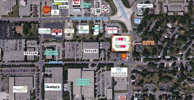

NEARBY LISTINGS FOR SALE OR LEASE
Property Detail
1725 Lor Ray Dr
18.630.0010
Nicollet
Restaurantdrivein
Minnesota
2025
1.46 AC
2025
North Mankato
480501
Other Market Areas
2,280 SF
Mankato-North Mankato, MN
DEMOGRAPHICS near 1725 Lor Ray Dr
1 Mile
3 Mile
5 Mile
2024 Total Population
7,112
37,193
64,629
2029 Population
7,098
37,601
65,786
Pop Growth 2024-2029
(0.20%)
+ 1.10%
+ 1.79%
Average Age
40
37
36
2024 Total Households
2,935
14,837
25,733
HH Growth 2024-2029
(0.07%)
+ 1.19%
+ 1.91%
Median Household Inc
$78,333
$64,745
$66,920
Avg Household Size
2.40
2.30
2.30
2024 Avg HH Vehicles
2.00
2.00
2.00
Median Home Value
$238,103
$207,151
$228,184
Median Year Built
1979
1967
1981
Nearby Places
Map Layers
Map Styles
 Street
 Aerial
- Restaurants
- Banks
- Shops
- Fitness
- Groceries
SALE & LEASE HISTORY
LISTING DATE
SALE/LEASE

Feb 14, 2022
For Lease
Nearby Properties
Address
Land Use
TOTAL SIZE
Lot Size
Zoning
Address
Land Use
TOTAL SIZE
Lot Size
Zoning
666,816 SF
6.31 AC
Address
Land Use
TOTAL SIZE
Lot Size
Zoning
184,270 SF
79.30 AC
Address
Land Use
TOTAL SIZE
Lot Size
Zoning
616,099 SF
4.06 AC
Address
Land Use
TOTAL SIZE
Lot Size
Zoning
17.90 AC
Address
Land Use
TOTAL SIZE
Lot Size
Zoning
11.75 AC
Address
Land Use
TOTAL SIZE
Lot Size
Zoning
269,842 SF
48.03 AC
Address
Land Use
TOTAL SIZE
Lot Size
Zoning
130,218 SF
39.09 AC
Address
Land Use
TOTAL SIZE
Lot Size
Zoning
219,165 SF
24.49 AC
Address
Land Use
TOTAL SIZE
Lot Size
Zoning
3.73 AC
Address
Land Use
TOTAL SIZE
Lot Size
Zoning
83,917 SF
10.08 AC
Address
Land Use
TOTAL SIZE
Lot Size
Zoning
12,400 SF
60.45 AC
Address
Land Use
TOTAL SIZE
Lot Size
Zoning
5.67 AC
Address
Land Use
TOTAL SIZE
Lot Size
Zoning
26,500 SF
3.31 AC
Address
Land Use
TOTAL SIZE
Lot Size
Zoning
97,508 SF
44.54 AC
Address
Land Use
TOTAL SIZE
Lot Size
Zoning
58,604 SF
1.19 AC
Address
Land Use
TOTAL SIZE
Lot Size
Zoning
16.15 AC
Address
Land Use
TOTAL SIZE
Lot Size
Zoning
94,135 SF
23.74 AC
Address
Land Use
TOTAL SIZE
Lot Size
Zoning
67,200 SF
13.04 AC
Address
Land Use
TOTAL SIZE
Lot Size
Zoning
24,568 SF
3.48 AC
Address
Land Use
TOTAL SIZE
Lot Size
Zoning
22,522 SF
2.49 AC
Address
Land Use
TOTAL SIZE
Lot Size
Zoning
0.75 AC
Address
Land Use
TOTAL SIZE
Lot Size
Zoning
4.28 AC
Address
Land Use
TOTAL SIZE
Lot Size
Zoning
13,886 SF
19.50 AC
Address
Land Use
TOTAL SIZE
Lot Size
Zoning
279,442 SF
24.04 AC
Address
Land Use
TOTAL SIZE
Lot Size
Zoning
10.72 AC
Address
Land Use
TOTAL SIZE
Lot Size
Zoning
60,000 SF
9.11 AC
Address
Land Use
TOTAL SIZE
Lot Size
Zoning
43,476 SF
6.37 AC
Address
Land Use
TOTAL SIZE
Lot Size
Zoning
Address
Land Use
TOTAL SIZE
Lot Size
Zoning
73,143 SF
0.24 AC
The World's #1 Commercial Real Estate Marketplace
Connect with us
© 2025 CoStar Group
The information above has been obtained from sources believed reliable. While we do not doubt its accuracy we have not verified it and make no guarantee, warranty or representation about it. It is your responsibility to independently confirm its accuracy and completeness. Any projections, opinions, assumptions, or estimates used are for example only and do not represent the current or future performance of the property. The value of this transaction to you depends on tax and other factors which should be evaluated by your tax, financial, and legal advisors. You and your advisors should conduct a careful, independent investigation of the property to determine to your satisfaction the suitability of the property for your needs.