Property Record
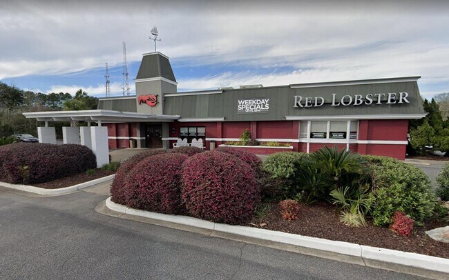
1725 Rainbow Dr, Gadsden, AL 35901


NEARBY LISTINGS FOR SALE OR LEASE
Property Detail
1725 Rainbow Dr
15-05-22-0-001-006.000-DIST13
SPLIT MUNICIPALITY COM INT NW ROW OF RAINBOW DR & S ROW OF LAKEWOOD DR TH SW 316.93 ALONG RAINBOW DR TO POB TH SW 288.45 ALON
Restaurantbuilding
Etowah
X
Alabama
01055C0332E
1.74 AC
2025
Etowah County
2025
Birmingham
001100
Gadsden, AL
7,562 SF
DEMOGRAPHICS near 1725 Rainbow Dr
1 Mile
3 Mile
5 Mile
2024 Total Population
1,206
26,581
52,192
2029 Population
1,196
26,748
52,281
Pop Growth 2024-2029
(0.83%)
+ 0.63%
+ 0.17%
Average Age
44
40
41
2024 Total Households
526
11,181
21,737
HH Growth 2024-2029
(0.76%)
+ 0.72%
+ 0.23%
Median Household Inc
$76,704
$37,952
$39,932
Avg Household Size
2.20
2.20
2.30
2024 Avg HH Vehicles
2.00
2.00
2.00
Median Home Value
$278,289
$127,406
$134,073
Median Year Built
1959
1967
1968
Nearby Places
Map Layers
Map Styles
 Street
 Aerial
- Restaurants
- Banks
- Shops
- Fitness
- Groceries
SALE & LEASE HISTORY
LISTING DATE
SALE/LEASE

Jun 20, 2023
For Sale
Nearby Properties
Address
Land Use
TOTAL SIZE
Lot Size
Zoning
Address
Land Use
TOTAL SIZE
Lot Size
Zoning
39,096 SF
99 AC
Address
Land Use
TOTAL SIZE
Lot Size
Zoning
94,357 SF
40 AC
Address
Land Use
TOTAL SIZE
Lot Size
Zoning
452,980 SF
17 AC
Address
Land Use
TOTAL SIZE
Lot Size
Zoning
275,420 SF
8.50 AC
Address
Land Use
TOTAL SIZE
Lot Size
Zoning
178,460 SF
5.70 AC
Address
Land Use
TOTAL SIZE
Lot Size
Zoning
10,158 SF
18 AC
Address
Land Use
TOTAL SIZE
Lot Size
Zoning
92,923 SF
5.30 AC
Address
Land Use
TOTAL SIZE
Lot Size
Zoning
54,404 SF
11.55 AC
Address
Land Use
TOTAL SIZE
Lot Size
Zoning
242,200 SF
77 AC
Address
Land Use
TOTAL SIZE
Lot Size
Zoning
206,914 SF
18.64 AC
Address
Land Use
TOTAL SIZE
Lot Size
Zoning
452,980 SF
5.80 AC
Address
Land Use
TOTAL SIZE
Lot Size
Zoning
117,758 SF
1.07 AC
Address
Land Use
TOTAL SIZE
Lot Size
Zoning
94,632 SF
7.70 AC
Address
Land Use
TOTAL SIZE
Lot Size
Zoning
97,580 SF
7.70 AC
Address
Land Use
TOTAL SIZE
Lot Size
Zoning
703,169 SF
13.10 AC
Address
Land Use
TOTAL SIZE
Lot Size
Zoning
31,400 SF
16 AC
Address
Land Use
TOTAL SIZE
Lot Size
Zoning
103,440 SF
10.14 AC
Address
Land Use
TOTAL SIZE
Lot Size
Zoning
114,798 SF
2.32 AC
Address
Land Use
TOTAL SIZE
Lot Size
Zoning
2,609 SF
13 AC
Address
Land Use
TOTAL SIZE
Lot Size
Zoning
9,024 SF
20 AC
Address
Land Use
TOTAL SIZE
Lot Size
Zoning
49,964 SF
10.36 AC
Address
Land Use
TOTAL SIZE
Lot Size
Zoning
126,000 SF
2.43 AC
Address
Land Use
TOTAL SIZE
Lot Size
Zoning
61,837 SF
0.66 AC
Address
Land Use
TOTAL SIZE
Lot Size
Zoning
138,483 SF
12 AC
Address
Land Use
TOTAL SIZE
Lot Size
Zoning
68,361 SF
2.88 AC
Address
Land Use
TOTAL SIZE
Lot Size
Zoning
3,000 SF
31 AC
Address
Land Use
TOTAL SIZE
Lot Size
Zoning
62,788 SF
7.40 AC
Address
Land Use
TOTAL SIZE
Lot Size
Zoning
95,939 SF
1.25 AC
Address
Land Use
TOTAL SIZE
Lot Size
Zoning
33,006 SF
5.90 AC
Address
Land Use
TOTAL SIZE
Lot Size
Zoning
1,056 SF
23 AC
The World's #1 Commercial Real Estate Marketplace
Connect with us
© 2026 CoStar Group
The information above has been obtained from sources believed reliable. While we do not doubt its accuracy we have not verified it and make no guarantee, warranty or representation about it. It is your responsibility to independently confirm its accuracy and completeness. Any projections, opinions, assumptions, or estimates used are for example only and do not represent the current or future performance of the property. The value of this transaction to you depends on tax and other factors which should be evaluated by your tax, financial, and legal advisors. You and your advisors should conduct a careful, independent investigation of the property to determine to your satisfaction the suitability of the property for your needs.