Property Record
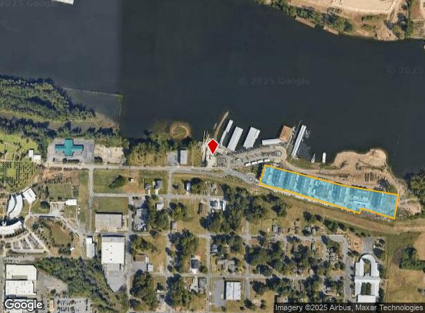
1726 E 2Nd St, Little Rock, AR 72202


NEARBY LISTINGS FOR SALE OR LEASE
Property Detail
1726 E 2Nd St
34L-001-00-029-01
PT NW SECTION 1-1N-12W MPDA COM SW COR NW TH N90*0000E1562.85 TH N00*0000E88.53 TO POB TH N01*5424E72.48 TH S75*0237E10.78 TH N14*5723E129.60 TH S75*0236E745.84 TH S80*1729E524.96 TH S09*1037W213.45 TH N74*2434W327.79 TH
Apartment
Pulaski
AE
Arkansas
05119C0476G
5.66 AC
2025
East Little Rock
2025
Little Rock/N Little Rock
980400
Little Rock-North Little Rock-Conway, AR
61,225 SF
DEMOGRAPHICS near 1726 E 2Nd St
1 Mile
3 Mile
5 Mile
2024 Total Population
2,480
37,651
101,392
2029 Population
2,617
38,825
102,748
Pop Growth 2024-2029
+ 5.52%
+ 3.12%
+ 1.34%
Average Age
41
40
40
2024 Total Households
1,174
18,223
46,254
HH Growth 2024-2029
+ 5.28%
+ 3.07%
+ 1.35%
Median Household Inc
$24,635
$36,340
$43,270
Avg Household Size
2.00
1.90
2.10
2024 Avg HH Vehicles
1.00
1.00
1.00
Median Home Value
$133,333
$124,205
$144,353
Median Year Built
1967
1965
1967
Nearby Places
Map Layers
Map Styles
 Street
 Aerial
- Restaurants
- Banks
- Shops
- Fitness
- Groceries
PUBLIC TRANSPORTATION
TRANSIT/SUBWAY
President Clinton Ave & River Market Ave (Blue Line Streetcar - Rock Region Metro)
DRIVE
WALK
Distance
President Clinton Ave & River Market Ave (Blue Line Streetcar - Rock Region Metro)
4 min
19 min
1.0 mi
COMMUTER RAIL
Little Rock Union Station (Texas Eagle - Amtrak)
DRIVE
WALK
Distance
Little Rock Union Station (Texas Eagle - Amtrak)
6 min
2.8 mi
AIRPORT
Bill and Hillary Clinton Ntl/Adams Field
DRIVE
WALK
Distance
Bill and Hillary Clinton Ntl/Adams Field
8 min
3.4 mi
Freight Ports
Port of Shreveport
DRIVE
WALK
Distance
Port of Shreveport
252 min
234.4 mi
Nearby Properties
Address
Land Use
TOTAL SIZE
Lot Size
Zoning
Address
Land Use
TOTAL SIZE
Lot Size
Zoning
1.80 AC
Address
Land Use
TOTAL SIZE
Lot Size
Zoning
0.90 AC
Address
Land Use
TOTAL SIZE
Lot Size
Zoning
0.45 AC
Address
Land Use
TOTAL SIZE
Lot Size
Zoning
1,000,000 SF
9.38 AC
Address
Land Use
TOTAL SIZE
Lot Size
Zoning
333,096 SF
11.62 AC
Address
Land Use
TOTAL SIZE
Lot Size
Zoning
237,144 SF
1.26 AC
Address
Land Use
TOTAL SIZE
Lot Size
Zoning
526,829 SF
33.78 AC
Address
Land Use
TOTAL SIZE
Lot Size
Zoning
180,616 SF
0.91 AC
Address
Land Use
TOTAL SIZE
Lot Size
Zoning
12,562 SF
2.26 AC
Address
Land Use
TOTAL SIZE
Lot Size
Zoning
412,597 SF
Address
Land Use
TOTAL SIZE
Lot Size
Zoning
22,017 SF
2.06 AC
Address
Land Use
TOTAL SIZE
Lot Size
Zoning
761,810 SF
75.61 AC
Address
Land Use
TOTAL SIZE
Lot Size
Zoning
2,636 SF
0.67 AC
Address
Land Use
TOTAL SIZE
Lot Size
Zoning
267,152 SF
Address
Land Use
TOTAL SIZE
Lot Size
Zoning
137,538 SF
31.58 AC
Address
Land Use
TOTAL SIZE
Lot Size
Zoning
260,000 SF
5.80 AC
Address
Land Use
TOTAL SIZE
Lot Size
Zoning
143,553 SF
12.76 AC
Address
Land Use
TOTAL SIZE
Lot Size
Zoning
130,742 SF
15.71 AC
Address
Land Use
TOTAL SIZE
Lot Size
Zoning
95,719 SF
32.76 AC
Address
Land Use
TOTAL SIZE
Lot Size
Zoning
346,974 SF
Address
Land Use
TOTAL SIZE
Lot Size
Zoning
138,352 SF
2.95 AC
Address
Land Use
TOTAL SIZE
Lot Size
Zoning
269,624 SF
3.40 AC
Address
Land Use
TOTAL SIZE
Lot Size
Zoning
361,910 SF
Address
Land Use
TOTAL SIZE
Lot Size
Zoning
41,925 SF
13 AC
Address
Land Use
TOTAL SIZE
Lot Size
Zoning
83,652 SF
12.55 AC
Address
Land Use
TOTAL SIZE
Lot Size
Zoning
220,800 SF
2.92 AC
Address
Land Use
TOTAL SIZE
Lot Size
Zoning
9,272 SF
0.58 AC
Address
Land Use
TOTAL SIZE
Lot Size
Zoning
57,701 SF
1.93 AC
Address
Land Use
TOTAL SIZE
Lot Size
Zoning
2,414 SF
25.25 AC
The World's #1 Commercial Real Estate Marketplace
Connect with us
© 2025 CoStar Group
The information above has been obtained from sources believed reliable. While we do not doubt its accuracy we have not verified it and make no guarantee, warranty or representation about it. It is your responsibility to independently confirm its accuracy and completeness. Any projections, opinions, assumptions, or estimates used are for example only and do not represent the current or future performance of the property. The value of this transaction to you depends on tax and other factors which should be evaluated by your tax, financial, and legal advisors. You and your advisors should conduct a careful, independent investigation of the property to determine to your satisfaction the suitability of the property for your needs.