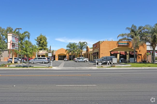
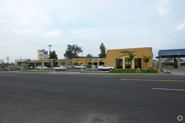
Property Record
1727 Cecil Ave, Delano, CA 93215


Property Detail
1727 Cecil Ave
034-230-19-00-0
PARCEL MAP 10208 , LOT 2
Regionalshoppingcenterormallwithanchorstore
Kern
M-1
California
B and X Area of moderate flood hazard, usually the area between the limits of the 100-year and 500-year floods.
2
2024
0.71 AC
2025
North Outlying Kern County
004904
Bakersfield
9,582 SF
Bakersfield-Delano, CA
NEARBY LISTINGS FOR SALE OR LEASE
DEMOGRAPHICS near 1727 Cecil Ave
1 mile
3 mile
5 mile
2025 Total Population
19,818
44,256
44,985
2030 Population
19,782
44,493
45,229
Pop Growth 2025-2030
(0.18%)
+ 0.54%
+ 0.54%
Average Age
36
34
34
2025 Total Households
5,033
11,281
11,457
HH Growth 2025-2030
(0.04%)
+ 0.60%
+ 0.61%
Median Household Inc
$71,192
$65,179
$65,020
Avg Household Size
3.80
3.80
3.80
2025 Avg HH Vehicles
2.00
2.00
2.00
Median Home Value
$320,991
$313,613
$313,805
Median Year Built
1983
1987
1987
Nearby Places
Map Layers
Map Styles
 Street
 Aerial
Transit
 Traffic
 Biking
Places
Listings with unknown addresses are not visible on the map
- Restaurants
- Banks
- Shops
- Fitness
- Groceries
PUBLIC TRANSPORTATION
AIRPORT
Meadows Field
Drive
Walk
Distance
Meadows Field
40 min
29.8 mi
Freight Ports
The Port of Hueneme
Drive
Walk
Distance
The Port of Hueneme
187 min
154.5 mi
Nearby Properties
Address
Land Use
TOTAL SIZE
Lot Size
Zoning
Address
Land Use
TOTAL SIZE
Lot Size
Zoning
33.33 AC
Address
Land Use
TOTAL SIZE
Lot Size
Zoning
22.76 AC
Address
Land Use
TOTAL SIZE
Lot Size
Zoning
115,071 SF
46.83 AC
R-1
Address
Land Use
TOTAL SIZE
Lot Size
Zoning
13,558 SF
5.53 AC
GC
Address
Land Use
TOTAL SIZE
Lot Size
Zoning
233,028 SF
11.76 AC
G-C
Address
Land Use
TOTAL SIZE
Lot Size
Zoning
1,891 SF
20.03 AC
A
Address
Land Use
TOTAL SIZE
Lot Size
Zoning
190,069 SF
18 AC
CRC
Address
Land Use
TOTAL SIZE
Lot Size
Zoning
6,969 SF
9.96 AC
A
Address
Land Use
TOTAL SIZE
Lot Size
Zoning
89,941 SF
11.22 AC
CRC
Address
Land Use
TOTAL SIZE
Lot Size
Zoning
80,178 SF
4.65 AC
R-3
Address
Land Use
TOTAL SIZE
Lot Size
Zoning
67,951 SF
3.42 AC
I
Address
Land Use
TOTAL SIZE
Lot Size
Zoning
68,994 SF
4.83 AC
R-2
Address
Land Use
TOTAL SIZE
Lot Size
Zoning
3,179 SF
5.45 AC
R-3
Address
Land Use
TOTAL SIZE
Lot Size
Zoning
68,077 SF
10 AC
GC
Address
Land Use
TOTAL SIZE
Lot Size
Zoning
67,645 SF
4.71 AC
Address
Land Use
TOTAL SIZE
Lot Size
Zoning
61,600 SF
4.49 AC
R-3
Address
Land Use
TOTAL SIZE
Lot Size
Zoning
1.77 AC
Address
Land Use
TOTAL SIZE
Lot Size
Zoning
1,800 SF
4.49 AC
C1
Address
Land Use
TOTAL SIZE
Lot Size
Zoning
1.35 AC
Address
Land Use
TOTAL SIZE
Lot Size
Zoning
18,538 SF
7.25 AC
R-1
Address
Land Use
TOTAL SIZE
Lot Size
Zoning
34,608 SF
1.59 AC
C1
Address
Land Use
TOTAL SIZE
Lot Size
Zoning
17,206 SF
2.27 AC
GC
Address
Land Use
TOTAL SIZE
Lot Size
Zoning
28,560 SF
9.51 AC
R-3
Address
Land Use
TOTAL SIZE
Lot Size
Zoning
34,064 SF
3.37 AC
GC
Address
Land Use
TOTAL SIZE
Lot Size
Zoning
84,767 SF
4.88 AC
Address
Land Use
TOTAL SIZE
Lot Size
Zoning
13,052 SF
1.77 AC
GC
Address
Land Use
TOTAL SIZE
Lot Size
Zoning
21,246 SF
0.54 AC
GC
Address
Land Use
TOTAL SIZE
Lot Size
Zoning
2.51 AC
The World's #1 Commercial Real Estate Marketplace
Connect with us
© 2026 CoStar Group
The information above has been obtained from sources believed reliable. While we do not doubt its accuracy we have not verified it and make no guarantee, warranty or representation about it. It is your responsibility to independently confirm its accuracy and completeness. Any projections, opinions, assumptions, or estimates used are for example only and do not represent the current or future performance of the property. The value of this transaction to you depends on tax and other factors which should be evaluated by your tax, financial, and legal advisors. You and your advisors should conduct a careful, independent investigation of the property to determine to your satisfaction the suitability of the property for your needs.