Property Record
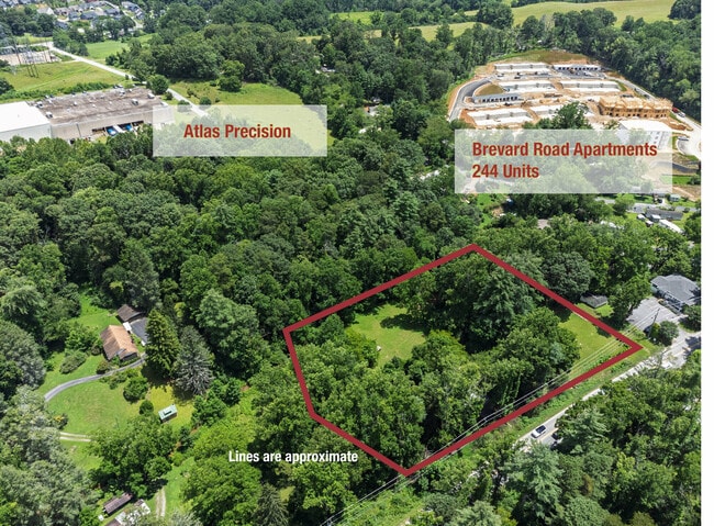
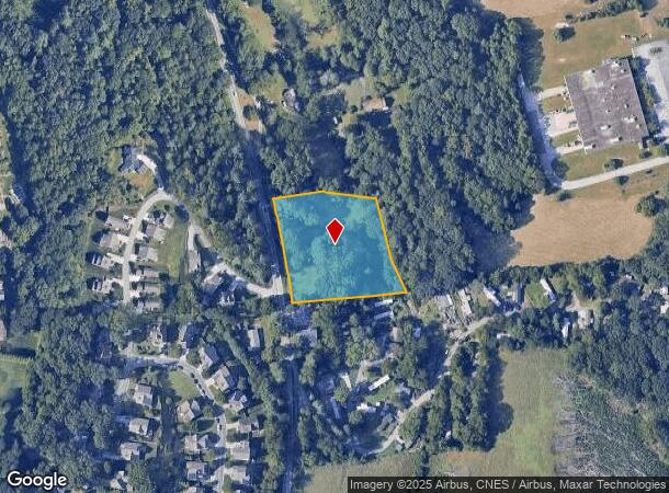
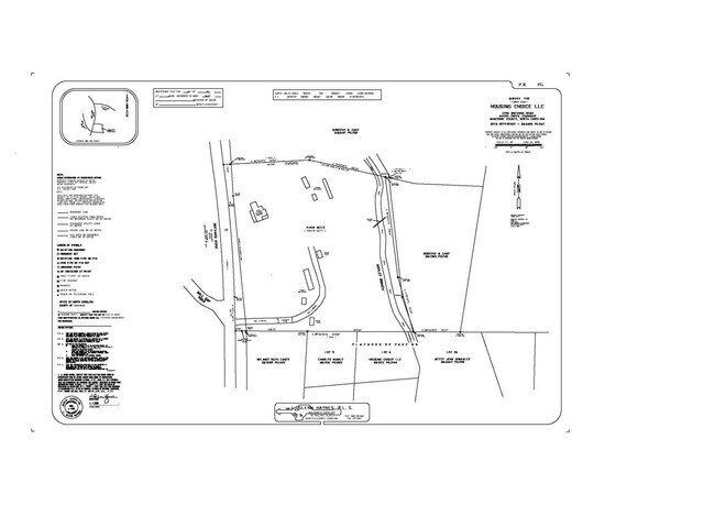
1728 Brevard Rd, Asheville, NC 28806
This Property Is For Sale
NEARBY LISTINGS FOR SALE OR LEASE
Property Detail
1728 Brevard Rd
Asheville, NC
Buncombe
9635-41-3069-00000
North Carolina
Sfr
2.16 AC
X
Buncombe County
3700963500J
Asheville
600 SF
DEMOGRAPHICS near 1728 Brevard Rd
1 Mile
3 Mile
5 Mile
2024 Total Population
3,259
16,917
52,966
2029 Population
3,597
18,455
57,132
Pop Growth 2024-2029
+ 10.37%
+ 9.09%
+ 7.87%
Average Age
38
42
43
2024 Total Households
1,571
7,506
23,435
HH Growth 2024-2029
+ 9.42%
+ 8.33%
+ 7.17%
Median Household Inc
$89,224
$87,044
$79,522
Avg Household Size
2.10
2.20
2.20
2024 Avg HH Vehicles
2.00
2.00
2.00
Median Home Value
$545,714
$577,995
$454,359
Median Year Built
2011
2005
1996
Nearby Places
- Restaurants
- Banks
- Shops
- Fitness
- Groceries
PUBLIC TRANSPORTATION
AIRPORT
Asheville Regional
DRIVE
WALK
Distance
Asheville Regional
11 min
6.3 mi
Nearby Properties
Address
Land Use
TOTAL SIZE
Lot Size
Zoning
Address
Land Use
TOTAL SIZE
Lot Size
Zoning
1,204,424 SF
100 AC
EMP
Address
Land Use
TOTAL SIZE
Lot Size
Zoning
346,375 SF
58.11 AC
INST
Address
Land Use
TOTAL SIZE
Lot Size
Zoning
118,357 SF
24.67 AC
EMP
Address
Land Use
TOTAL SIZE
Lot Size
Zoning
110,173 SF
28.13 AC
R-2
Address
Land Use
TOTAL SIZE
Lot Size
Zoning
83,129 SF
44.74 AC
EMP
Address
Land Use
TOTAL SIZE
Lot Size
Zoning
66,863 SF
7.48 AC
INST
Address
Land Use
TOTAL SIZE
Lot Size
Zoning
57,836 SF
1.09 AC
UV
Address
Land Use
TOTAL SIZE
Lot Size
Zoning
183,020 SF
22.84 AC
RM16
Address
Land Use
TOTAL SIZE
Lot Size
Zoning
77,056 SF
19.45 AC
EMP
Address
Land Use
TOTAL SIZE
Lot Size
Zoning
3,161 SF
1,161.20 AC
CR
Address
Land Use
TOTAL SIZE
Lot Size
Zoning
227,740 SF
36.18 AC
INST
Address
Land Use
TOTAL SIZE
Lot Size
Zoning
218,133 SF
15.39 AC
R-2
Address
Land Use
TOTAL SIZE
Lot Size
Zoning
62,425 SF
10.38 AC
CS
Address
Land Use
TOTAL SIZE
Lot Size
Zoning
80,872 SF
18.84 AC
RM16
Address
Land Use
TOTAL SIZE
Lot Size
Zoning
93,197 SF
6.32 AC
RES EXP
Address
Land Use
TOTAL SIZE
Lot Size
Zoning
71,574 SF
15.85 AC
RM16
Address
Land Use
TOTAL SIZE
Lot Size
Zoning
332,974 SF
8.38 AC
EMP
Address
Land Use
TOTAL SIZE
Lot Size
Zoning
63,030 SF
5.70 AC
RES EXP
Address
Land Use
TOTAL SIZE
Lot Size
Zoning
78,783 SF
9 AC
PS
Address
Land Use
TOTAL SIZE
Lot Size
Zoning
345.09 AC
EMP
Address
Land Use
TOTAL SIZE
Lot Size
Zoning
86,393 SF
15.44 AC
PS
Address
Land Use
TOTAL SIZE
Lot Size
Zoning
94,254 SF
43.17 AC
PS
Address
Land Use
TOTAL SIZE
Lot Size
Zoning
21,150 SF
1.14 AC
UV
Address
Land Use
TOTAL SIZE
Lot Size
Zoning
30,184 SF
7.55 AC
EMP
Address
Land Use
TOTAL SIZE
Lot Size
Zoning
40,068 SF
2.85 AC
RES EXP
Address
Land Use
TOTAL SIZE
Lot Size
Zoning
21,011 SF
2.40 AC
UV
Address
Land Use
TOTAL SIZE
Lot Size
Zoning
477,964 SF
65.37 AC
IND
Address
Land Use
TOTAL SIZE
Lot Size
Zoning
70,000 SF
2.31 AC
UV
Address
Land Use
TOTAL SIZE
Lot Size
Zoning
6,715 SF
1.28 AC
HB
Address
Land Use
TOTAL SIZE
Lot Size
Zoning
28,544 SF
4.97 AC
CI
The World's #1 Commercial Real Estate Marketplace
Connect with us
© 2025 CoStar Group
The information above has been obtained from sources believed reliable. While we do not doubt its accuracy we have not verified it and make no guarantee, warranty or representation about it. It is your responsibility to independently confirm its accuracy and completeness. Any projections, opinions, assumptions, or estimates used are for example only and do not represent the current or future performance of the property. The value of this transaction to you depends on tax and other factors which should be evaluated by your tax, financial, and legal advisors. You and your advisors should conduct a careful, independent investigation of the property to determine to your satisfaction the suitability of the property for your needs.