Property Record
1720 Fordham Blvd, Chapel Hill, NC 27514
NEARBY LISTINGS FOR SALE OR LEASE
Property Detail
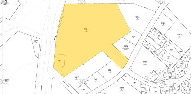
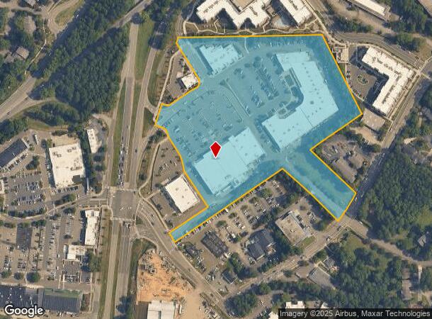
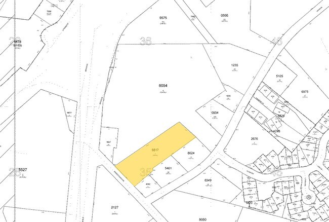
1720 Fordham Blvd
9799366150
Property Of Rams Plaza Associates
Commercialnec
3 RAMS PLAZA ASSOCIATES LLC PROP P116/41
X
Orange
3710979900L
North Carolina
2025
11.82 AC
2025
Orange County
012101
Raleigh/Durham
52,181 SF
Durham-Chapel Hill, NC
DEMOGRAPHICS near 1720 Fordham Blvd
1 Mile
3 Mile
5 Mile
2024 Total Population
10,102
62,274
132,461
2029 Population
9,314
59,736
128,363
Pop Growth 2024-2029
(7.80%)
(4.08%)
(3.09%)
Average Age
39
36
37
2024 Total Households
4,429
24,275
54,255
HH Growth 2024-2029
(8.24%)
(4.13%)
(2.95%)
Median Household Inc
$78,337
$79,505
$82,584
Avg Household Size
2.20
2.20
2.20
2024 Avg HH Vehicles
1.00
2.00
2.00
Median Home Value
$360,124
$461,547
$435,871
Median Year Built
1983
1990
1990
Nearby Places
Map Layers
Map Styles
 Street
 Aerial
- Restaurants
- Banks
- Shops
- Fitness
- Groceries
PUBLIC TRANSPORTATION
COMMUTER RAIL
DRIVE
WALK
Distance
18 min
8.7 mi
AIRPORT
Raleigh-Durham International
DRIVE
WALK
Distance
Raleigh-Durham International
25 min
17.5 mi
Nearby Properties
Address
Land Use
TOTAL SIZE
Lot Size
Zoning
Address
Land Use
TOTAL SIZE
Lot Size
Zoning
104,541 SF
404.01 AC
Address
Land Use
TOTAL SIZE
Lot Size
Zoning
216,220 SF
3.70 AC
CSD-C
Address
Land Use
TOTAL SIZE
Lot Size
Zoning
85,220 SF
20.34 AC
CSD-S1
Address
Land Use
TOTAL SIZE
Lot Size
Zoning
215,860 SF
12.28 AC
Address
Land Use
TOTAL SIZE
Lot Size
Zoning
264,710 SF
32.50 AC
R1
Address
Land Use
TOTAL SIZE
Lot Size
Zoning
116,223 SF
34.65 AC
Address
Land Use
TOTAL SIZE
Lot Size
Zoning
244,609 SF
2.72 AC
Address
Land Use
TOTAL SIZE
Lot Size
Zoning
193,344 SF
10.96 AC
MU(D)
Address
Land Use
TOTAL SIZE
Lot Size
Zoning
26,448 SF
22.07 AC
CSD-S1
Address
Land Use
TOTAL SIZE
Lot Size
Zoning
575,091 SF
3.21 AC
Address
Land Use
TOTAL SIZE
Lot Size
Zoning
4,128 SF
678.68 AC
R1
Address
Land Use
TOTAL SIZE
Lot Size
Zoning
80,120 SF
101.81 AC
Address
Land Use
TOTAL SIZE
Lot Size
Zoning
81,191 SF
12.33 AC
OI4
Address
Land Use
TOTAL SIZE
Lot Size
Zoning
419,416 SF
38.99 AC
CSD-S1
Address
Land Use
TOTAL SIZE
Lot Size
Zoning
55,318 SF
9.05 AC
R4
Address
Land Use
TOTAL SIZE
Lot Size
Zoning
2,748 SF
17.80 AC
R-5-CZD
Address
Land Use
TOTAL SIZE
Lot Size
Zoning
238,990 SF
2.43 AC
Address
Land Use
TOTAL SIZE
Lot Size
Zoning
134,448 SF
59.23 AC
Address
Land Use
TOTAL SIZE
Lot Size
Zoning
9,423 SF
43.95 AC
PDR 6.800
Address
Land Use
TOTAL SIZE
Lot Size
Zoning
287,718 SF
4.97 AC
Address
Land Use
TOTAL SIZE
Lot Size
Zoning
150,677 SF
2.93 AC
Address
Land Use
TOTAL SIZE
Lot Size
Zoning
106,812 SF
19.25 AC
Address
Land Use
TOTAL SIZE
Lot Size
Zoning
280,771 SF
6.14 AC
RC(D)
Address
Land Use
TOTAL SIZE
Lot Size
Zoning
22,038 SF
24.63 AC
CSD-S2
Address
Land Use
TOTAL SIZE
Lot Size
Zoning
25,016 SF
31.87 AC
CSD-S1
Address
Land Use
TOTAL SIZE
Lot Size
Zoning
6,720 SF
32.22 AC
PDR 4.000
Address
Land Use
TOTAL SIZE
Lot Size
Zoning
30,869 SF
20.01 AC
CSD-S2
Address
Land Use
TOTAL SIZE
Lot Size
Zoning
144,619 SF
3.22 AC
Address
Land Use
TOTAL SIZE
Lot Size
Zoning
38,300 SF
3.95 AC
MU(D)
Address
Land Use
TOTAL SIZE
Lot Size
Zoning
21,078 SF
227.43 AC
OI3R2
The World's #1 Commercial Real Estate Marketplace
Connect with us
© 2025 CoStar Group
The information above has been obtained from sources believed reliable. While we do not doubt its accuracy we have not verified it and make no guarantee, warranty or representation about it. It is your responsibility to independently confirm its accuracy and completeness. Any projections, opinions, assumptions, or estimates used are for example only and do not represent the current or future performance of the property. The value of this transaction to you depends on tax and other factors which should be evaluated by your tax, financial, and legal advisors. You and your advisors should conduct a careful, independent investigation of the property to determine to your satisfaction the suitability of the property for your needs.