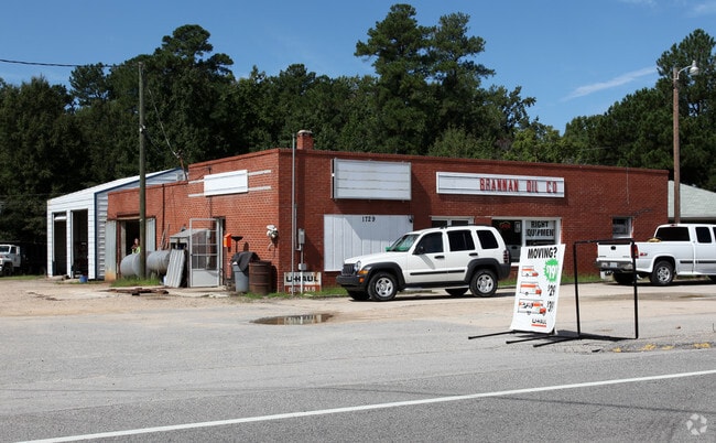
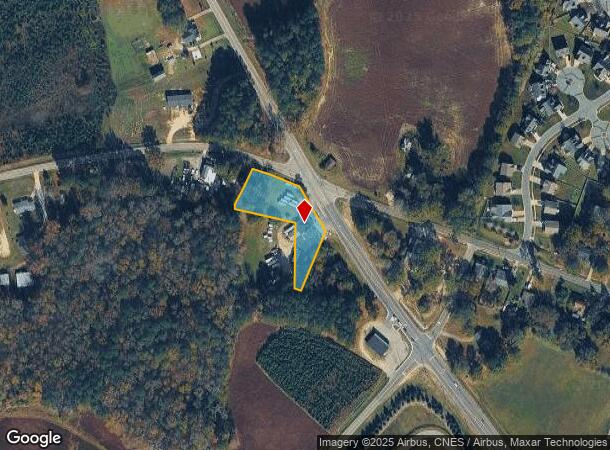
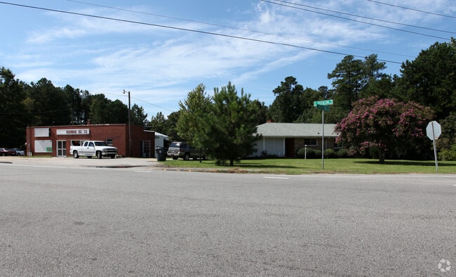
Property Record
1729 N Arendell Ave, Zebulon, NC 27597
NEARBY LISTINGS FOR SALE OR LEASE
Property Detail
1729 N Arendell Ave
1796.16-82-6529-000
WAKEFIELD LD
Autorepair
Wake
X
North Carolina
3720179600K
0.93 AC
0
Northeast Wake County
2025
Raleigh/Durham
054304
Raleigh, NC
1,752 SF
DEMOGRAPHICS near 1729 N Arendell Ave
1 Mile
3 Mile
5 Mile
2024 Total Population
1,887
15,768
31,832
2029 Population
2,125
17,592
35,599
Pop Growth 2024-2029
+ 12.61%
+ 11.57%
+ 11.83%
Average Age
39
40
39
2024 Total Households
668
5,710
11,607
HH Growth 2024-2029
+ 12.57%
+ 11.58%
+ 11.92%
Median Household Inc
$89,381
$76,290
$70,719
Avg Household Size
2.80
2.70
2.70
2024 Avg HH Vehicles
3.00
2.00
2.00
Median Home Value
$348,780
$329,236
$269,077
Median Year Built
2010
1998
1995
Nearby Places
- Restaurants
- Banks
- Shops
- Fitness
- Groceries
PUBLIC TRANSPORTATION
AIRPORT
Raleigh-Durham International
DRIVE
WALK
Distance
Raleigh-Durham International
44 min
33.1 mi
Freight Ports
Port of Wilmington
DRIVE
WALK
Distance
Port of Wilmington
168 min
144.0 mi
Nearby Properties
Address
Land Use
TOTAL SIZE
Lot Size
Zoning
Address
Land Use
TOTAL SIZE
Lot Size
Zoning
684,322 SF
128.05 AC
LI
Address
Land Use
TOTAL SIZE
Lot Size
Zoning
122,602 SF
49.13 AC
IL
Address
Land Use
TOTAL SIZE
Lot Size
Zoning
98,928 SF
34.72 AC
R-13-
Address
Land Use
TOTAL SIZE
Lot Size
Zoning
169,147 SF
18.48 AC
OI
Address
Land Use
TOTAL SIZE
Lot Size
Zoning
102,726 SF
33.59 AC
OI
Address
Land Use
TOTAL SIZE
Lot Size
Zoning
193,130 SF
24.71 AC
HC
Address
Land Use
TOTAL SIZE
Lot Size
Zoning
267,518 SF
16.18 AC
HI
Address
Land Use
TOTAL SIZE
Lot Size
Zoning
83,419 SF
23.80 AC
R2
Address
Land Use
TOTAL SIZE
Lot Size
Zoning
151,485 SF
9.45 AC
HI
Address
Land Use
TOTAL SIZE
Lot Size
Zoning
152,062 SF
8.80 AC
HI
Address
Land Use
TOTAL SIZE
Lot Size
Zoning
120,504 SF
13.76 AC
HC
Address
Land Use
TOTAL SIZE
Lot Size
Zoning
27,378 SF
12.71 AC
OI
Address
Land Use
TOTAL SIZE
Lot Size
Zoning
30,800 SF
3.79 AC
HC
Address
Land Use
TOTAL SIZE
Lot Size
Zoning
34,280 SF
5.41 AC
OI
Address
Land Use
TOTAL SIZE
Lot Size
Zoning
672 SF
197.30 AC
PUD
Address
Land Use
TOTAL SIZE
Lot Size
Zoning
249 AC
PUD
Address
Land Use
TOTAL SIZE
Lot Size
Zoning
148,004 SF
8.80 AC
HI
Address
Land Use
TOTAL SIZE
Lot Size
Zoning
43,761 SF
9 AC
LI
Address
Land Use
TOTAL SIZE
Lot Size
Zoning
68,222 SF
6.61 AC
HC
Address
Land Use
TOTAL SIZE
Lot Size
Zoning
58,776 SF
19.38 AC
HI
Address
Land Use
TOTAL SIZE
Lot Size
Zoning
36,816 SF
3.87 AC
RMF
Address
Land Use
TOTAL SIZE
Lot Size
Zoning
62,452 SF
7.07 AC
OI
Address
Land Use
TOTAL SIZE
Lot Size
Zoning
227.83 AC
R-80W
Address
Land Use
TOTAL SIZE
Lot Size
Zoning
105,897 SF
24.39 AC
HI
Address
Land Use
TOTAL SIZE
Lot Size
Zoning
39,300 SF
3.07 AC
HC
Address
Land Use
TOTAL SIZE
Lot Size
Zoning
67,103 SF
8.38 AC
HI
Address
Land Use
TOTAL SIZE
Lot Size
Zoning
72,613 SF
11.12 AC
RMF
Address
Land Use
TOTAL SIZE
Lot Size
Zoning
146.03 AC
R4
Address
Land Use
TOTAL SIZE
Lot Size
Zoning
14,459 SF
1.31 AC
DTP
Address
Land Use
TOTAL SIZE
Lot Size
Zoning
4,733 SF
3.40 AC
HC
The World's #1 Commercial Real Estate Marketplace
Connect with us
© 2025 CoStar Group
The information above has been obtained from sources believed reliable. While we do not doubt its accuracy we have not verified it and make no guarantee, warranty or representation about it. It is your responsibility to independently confirm its accuracy and completeness. Any projections, opinions, assumptions, or estimates used are for example only and do not represent the current or future performance of the property. The value of this transaction to you depends on tax and other factors which should be evaluated by your tax, financial, and legal advisors. You and your advisors should conduct a careful, independent investigation of the property to determine to your satisfaction the suitability of the property for your needs.