Property Record
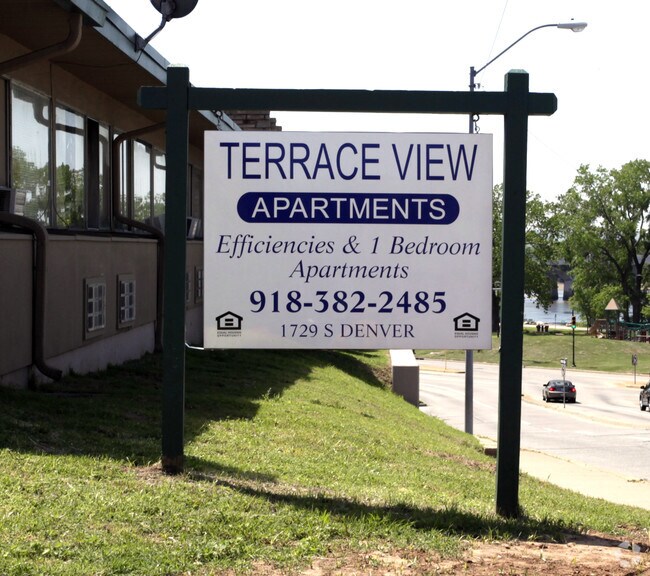
1729 S Denver Ave, Tulsa, OK 74119


NEARBY LISTINGS FOR SALE OR LEASE
Property Detail
1729 S Denver Ave
Tulsa, OK
Buena Vista Park
05700-92-12-01230
ALL LTS 7 THRU 12 & W6 VAC ALLEY ADJ ON E & N7 VAC 18TH ST ADJ ON S LESS E92 LTS 11 & 12 & LESS N9 E92 LT 10 & W6 VAC ALLEY ADJ THEREOF BLK 2
Multifamilydwelling
Tulsa
X
Oklahoma
40143C0240L
7
0
0.61 AC
2025
Buena Vista Park
003100
Tulsa
11,349 SF
DEMOGRAPHICS near 1729 S Denver Ave
1 Mile
3 Mile
5 Mile
2024 Total Population
11,202
67,924
177,234
2029 Population
11,754
70,997
184,762
Pop Growth 2024-2029
+ 4.93%
+ 4.52%
+ 4.25%
Average Age
41
39
39
2024 Total Households
6,451
30,759
78,083
HH Growth 2024-2029
+ 5.38%
+ 4.85%
+ 4.38%
Median Household Inc
$49,371
$54,459
$48,864
Avg Household Size
1.70
2.00
2.10
2024 Avg HH Vehicles
1.00
2.00
2.00
Median Home Value
$322,680
$233,781
$162,276
Median Year Built
1970
1955
1958
Nearby Places
Map Layers
Map Styles
 Street
 Aerial
- Restaurants
- Banks
- Shops
- Fitness
- Groceries
PUBLIC TRANSPORTATION
AIRPORT
Tulsa International
DRIVE
WALK
Distance
Tulsa International
16 min
10.5 mi
Freight Ports
Tulsa Port Of Catoosa
DRIVE
WALK
Distance
Tulsa Port Of Catoosa
26 min
19.5 mi
Nearby Properties
Address
Land Use
TOTAL SIZE
Lot Size
Zoning
Address
Land Use
TOTAL SIZE
Lot Size
Zoning
565,000 SF
10.62 AC
CBD
Address
Land Use
TOTAL SIZE
Lot Size
Zoning
1,303,210 SF
7.94 AC
OH
Address
Land Use
TOTAL SIZE
Lot Size
Zoning
1,673,798 SF
90.26 AC
NCU
Address
Land Use
TOTAL SIZE
Lot Size
Zoning
249,092 SF
11.75 AC
CBD
Address
Land Use
TOTAL SIZE
Lot Size
Zoning
692,068 SF
1.03 AC
CBD
Address
Land Use
TOTAL SIZE
Lot Size
Zoning
423,825 SF
23.97 AC
CBD
Address
Land Use
TOTAL SIZE
Lot Size
Zoning
483,697 SF
5.31 AC
CBD
Address
Land Use
TOTAL SIZE
Lot Size
Zoning
247,806 SF
8.40 AC
RS3
Address
Land Use
TOTAL SIZE
Lot Size
Zoning
49,992 SF
33.23 AC
AG
Address
Land Use
TOTAL SIZE
Lot Size
Zoning
528,432 SF
0.01 AC
CBD
Address
Land Use
TOTAL SIZE
Lot Size
Zoning
110,922 SF
1.59 AC
RM2
Address
Land Use
TOTAL SIZE
Lot Size
Zoning
74,284 SF
3.61 AC
IM
Address
Land Use
TOTAL SIZE
Lot Size
Zoning
254,800 SF
2.07 AC
CBD
Address
Land Use
TOTAL SIZE
Lot Size
Zoning
132,305 SF
2.07 AC
CBD
Address
Land Use
TOTAL SIZE
Lot Size
Zoning
114,791 SF
23.40 AC
RE
Address
Land Use
TOTAL SIZE
Lot Size
Zoning
87,606 SF
8.25 AC
CBD
Address
Land Use
TOTAL SIZE
Lot Size
Zoning
238,884 SF
38.79 AC
RS2
Address
Land Use
TOTAL SIZE
Lot Size
Zoning
175,176 SF
1.57 AC
RM2
Address
Land Use
TOTAL SIZE
Lot Size
Zoning
230,620 SF
16.72 AC
RM2
Address
Land Use
TOTAL SIZE
Lot Size
Zoning
303 SF
33.64 AC
RS2
Address
Land Use
TOTAL SIZE
Lot Size
Zoning
266,944 SF
2.07 AC
CBD
Address
Land Use
TOTAL SIZE
Lot Size
Zoning
124,033 SF
4.18 AC
CBD
Address
Land Use
TOTAL SIZE
Lot Size
Zoning
315,434 SF
2.07 AC
CBD
Address
Land Use
TOTAL SIZE
Lot Size
Zoning
355,620 SF
4.78 AC
CBD
Address
Land Use
TOTAL SIZE
Lot Size
Zoning
56,049 SF
1.14 AC
CBD
Address
Land Use
TOTAL SIZE
Lot Size
Zoning
161,670 SF
8.57 AC
IL
Address
Land Use
TOTAL SIZE
Lot Size
Zoning
1,264,325 SF
10.72 AC
CH
Address
Land Use
TOTAL SIZE
Lot Size
Zoning
84,560 SF
1.92 AC
CBD
Address
Land Use
TOTAL SIZE
Lot Size
Zoning
53,337 SF
3.34 AC
FBC
Address
Land Use
TOTAL SIZE
Lot Size
Zoning
60,320 SF
5.23 AC
NCU
The World's #1 Commercial Real Estate Marketplace
Connect with us
© 2025 CoStar Group
The information above has been obtained from sources believed reliable. While we do not doubt its accuracy we have not verified it and make no guarantee, warranty or representation about it. It is your responsibility to independently confirm its accuracy and completeness. Any projections, opinions, assumptions, or estimates used are for example only and do not represent the current or future performance of the property. The value of this transaction to you depends on tax and other factors which should be evaluated by your tax, financial, and legal advisors. You and your advisors should conduct a careful, independent investigation of the property to determine to your satisfaction the suitability of the property for your needs.