Property Record
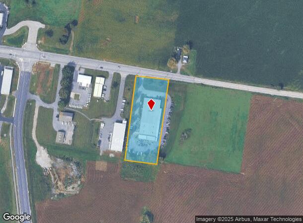
1729 W Trindle Rd, Carlisle, PA 17015


NEARBY LISTINGS FOR SALE OR LEASE
-
-
View all Carlisle listings for sale on LoopNet.com
Property Detail
1729 W Trindle Rd
Harrisburg-Carlisle, PA
Richard Curtis Company
40-08-0575-011
LOT 9 PB 73 PG 70
Foundry
Cumberland
X
Pennsylvania
42041C0234E
9
2025
2.34 AC
2025
Harrisburg Area West
012502
Philadelphia
DEMOGRAPHICS near 1729 W Trindle Rd
1 Mile
3 Mile
5 Mile
2024 Total Population
783
29,498
56,149
2029 Population
840
31,663
60,138
Pop Growth 2024-2029
+ 7.28%
+ 7.34%
+ 7.10%
Average Age
45
40
41
2024 Total Households
321
11,757
22,483
HH Growth 2024-2029
+ 7.79%
+ 7.51%
+ 7.25%
Median Household Inc
$106,024
$69,166
$74,653
Avg Household Size
2.40
2.30
2.30
2024 Avg HH Vehicles
2.00
2.00
2.00
Median Home Value
$243,010
$222,243
$233,642
Median Year Built
1978
1968
1974
Nearby Places
Map Layers
Map Styles
 Street
 Aerial
- Restaurants
- Banks
- Shops
- Fitness
- Groceries
PUBLIC TRANSPORTATION
AIRPORT
Harrisburg International
DRIVE
WALK
Distance
Harrisburg International
42 min
25.6 mi
Nearby Properties
Address
Land Use
TOTAL SIZE
Lot Size
Zoning
Address
Land Use
TOTAL SIZE
Lot Size
Zoning
213.18 AC
Address
Land Use
TOTAL SIZE
Lot Size
Zoning
13.47 AC
Address
Land Use
TOTAL SIZE
Lot Size
Zoning
34.64 AC
Address
Land Use
TOTAL SIZE
Lot Size
Zoning
Address
Land Use
TOTAL SIZE
Lot Size
Zoning
56.28 AC
Address
Land Use
TOTAL SIZE
Lot Size
Zoning
1.75 AC
Address
Land Use
TOTAL SIZE
Lot Size
Zoning
0.55 AC
Address
Land Use
TOTAL SIZE
Lot Size
Zoning
7.81 AC
Address
Land Use
TOTAL SIZE
Lot Size
Zoning
35.80 AC
Address
Land Use
TOTAL SIZE
Lot Size
Zoning
55.72 AC
Address
Land Use
TOTAL SIZE
Lot Size
Zoning
31.47 AC
Address
Land Use
TOTAL SIZE
Lot Size
Zoning
36.15 AC
Address
Land Use
TOTAL SIZE
Lot Size
Zoning
36.54 AC
Address
Land Use
TOTAL SIZE
Lot Size
Zoning
33.84 AC
Address
Land Use
TOTAL SIZE
Lot Size
Zoning
2.72 AC
Address
Land Use
TOTAL SIZE
Lot Size
Zoning
7.15 AC
Address
Land Use
TOTAL SIZE
Lot Size
Zoning
Address
Land Use
TOTAL SIZE
Lot Size
Zoning
10.20 AC
Address
Land Use
TOTAL SIZE
Lot Size
Zoning
Address
Land Use
TOTAL SIZE
Lot Size
Zoning
9.99 AC
Address
Land Use
TOTAL SIZE
Lot Size
Zoning
Address
Land Use
TOTAL SIZE
Lot Size
Zoning
2.31 AC
Address
Land Use
TOTAL SIZE
Lot Size
Zoning
12.19 AC
Address
Land Use
TOTAL SIZE
Lot Size
Zoning
120.28 AC
Address
Land Use
TOTAL SIZE
Lot Size
Zoning
40.39 AC
Address
Land Use
TOTAL SIZE
Lot Size
Zoning
Address
Land Use
TOTAL SIZE
Lot Size
Zoning
1.77 AC
Address
Land Use
TOTAL SIZE
Lot Size
Zoning
3.10 AC
Address
Land Use
TOTAL SIZE
Lot Size
Zoning
15.20 AC
Address
Land Use
TOTAL SIZE
Lot Size
Zoning
24.44 AC
The World's #1 Commercial Real Estate Marketplace
Connect with us
© 2025 CoStar Group
The information above has been obtained from sources believed reliable. While we do not doubt its accuracy we have not verified it and make no guarantee, warranty or representation about it. It is your responsibility to independently confirm its accuracy and completeness. Any projections, opinions, assumptions, or estimates used are for example only and do not represent the current or future performance of the property. The value of this transaction to you depends on tax and other factors which should be evaluated by your tax, financial, and legal advisors. You and your advisors should conduct a careful, independent investigation of the property to determine to your satisfaction the suitability of the property for your needs.