Property Record
222 Kapik Ind Rd, Horn Lake, MS 38637
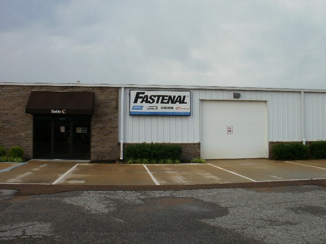

Property Detail
222 Kapik Ind Rd
2087360000000501
LOT 1 PECK INDUSTRIAL S-D
Commercialnec
DESOTO
M-1
Mississippi
AE The base floodplain where base flood elevations are provided. AE Zones are now used on new format FIRMs instead of A1-A30 Zones.
1
2025
9.35 AC
2025
DeSoto
070324
Memphis
23,530 SF
Memphis, TN-MS-AR
NEARBY LISTINGS FOR SALE OR LEASE
-
-
View all Horn Lake listings for sale on LoopNet.com
DEMOGRAPHICS near 222 Kapik Ind Rd
1 mile
3 mile
5 mile
2024 Total Population
403
13,023
43,551
2029 Population
441
14,174
48,092
Pop Growth 2024-2029
+ 9.43%
+ 8.84%
+ 10.43%
Average Age
40
40
38
2024 Total Households
145
4,759
15,899
HH Growth 2024-2029
+ 9.66%
+ 8.80%
+ 10.57%
Median Household Inc
$83,333
$79,895
$77,478
Avg Household Size
2.70
2.70
2.70
2024 Avg HH Vehicles
2.00
2.00
2.00
Median Home Value
$278,030
$268,233
$271,030
Median Year Built
2000
1999
2001
Nearby Places
Map Layers
Map Styles
 Street
 Aerial
Transit
 Traffic
 Biking
Places
Listings with unknown addresses are not visible on the map
- Restaurants
- Banks
- Shops
- Fitness
- Groceries
PUBLIC TRANSPORTATION
AIRPORT
Memphis International
Drive
Walk
Distance
Memphis International
25 min
15.4 mi
Nearby Properties
Address
Land Use
TOTAL SIZE
Lot Size
Zoning
Address
Land Use
TOTAL SIZE
Lot Size
Zoning
436,932 SF
153.19 AC
M-1
Address
Land Use
TOTAL SIZE
Lot Size
Zoning
29,738 SF
15 AC
C-2
Address
Land Use
TOTAL SIZE
Lot Size
Zoning
120,095 SF
19.42 AC
C-2
Address
Land Use
TOTAL SIZE
Lot Size
Zoning
64,797 SF
13.91 AC
M-1
Address
Land Use
TOTAL SIZE
Lot Size
Zoning
12,002 SF
1.15 AC
M-1
Address
Land Use
TOTAL SIZE
Lot Size
Zoning
15.10 AC
C-2
Address
Land Use
TOTAL SIZE
Lot Size
Zoning
24,163 SF
1.97 AC
C-2
Address
Land Use
TOTAL SIZE
Lot Size
Zoning
12,201 SF
3.44 AC
M-1
Address
Land Use
TOTAL SIZE
Lot Size
Zoning
35,000 SF
4.72 AC
PUD
Address
Land Use
TOTAL SIZE
Lot Size
Zoning
30,009 SF
4.31 AC
M-1
Address
Land Use
TOTAL SIZE
Lot Size
Zoning
40,831 SF
6.11 AC
C-2
Address
Land Use
TOTAL SIZE
Lot Size
Zoning
8,076 SF
4.04 AC
C-2
Address
Land Use
TOTAL SIZE
Lot Size
Zoning
9,450 SF
2.49 AC
C-2
Address
Land Use
TOTAL SIZE
Lot Size
Zoning
20,120 SF
3.43 AC
PUD
Address
Land Use
TOTAL SIZE
Lot Size
Zoning
10,200 SF
3.69 AC
C-2
Address
Land Use
TOTAL SIZE
Lot Size
Zoning
63,226 SF
3 AC
M-1
Address
Land Use
TOTAL SIZE
Lot Size
Zoning
6,756 SF
2.90 AC
RM-6
Address
Land Use
TOTAL SIZE
Lot Size
Zoning
5,518 SF
128.60 AC
PUD
Address
Land Use
TOTAL SIZE
Lot Size
Zoning
5,031 SF
3.05 AC
C-1
Address
Land Use
TOTAL SIZE
Lot Size
Zoning
7,500 SF
3.90 AC
C-4
Address
Land Use
TOTAL SIZE
Lot Size
Zoning
15,654 SF
2.18 AC
C-2
Address
Land Use
TOTAL SIZE
Lot Size
Zoning
987 SF
41.70 AC
A-R
Address
Land Use
TOTAL SIZE
Lot Size
Zoning
6,328 SF
1.71 AC
C-1
Address
Land Use
TOTAL SIZE
Lot Size
Zoning
11,770 SF
0.69 AC
C-2
Address
Land Use
TOTAL SIZE
Lot Size
Zoning
15,120 SF
1.82 AC
C-2
Address
Land Use
TOTAL SIZE
Lot Size
Zoning
3,611 SF
1.01 AC
C-2
Address
Land Use
TOTAL SIZE
Lot Size
Zoning
7,541 SF
1.22 AC
M-1
Address
Land Use
TOTAL SIZE
Lot Size
Zoning
15,632 SF
1.49 AC
C-2
Address
Land Use
TOTAL SIZE
Lot Size
Zoning
1.29 AC
M-1
The World's #1 Commercial Real Estate Marketplace
Connect with us
© 2026 CoStar Group
The information above has been obtained from sources believed reliable. While we do not doubt its accuracy we have not verified it and make no guarantee, warranty or representation about it. It is your responsibility to independently confirm its accuracy and completeness. Any projections, opinions, assumptions, or estimates used are for example only and do not represent the current or future performance of the property. The value of this transaction to you depends on tax and other factors which should be evaluated by your tax, financial, and legal advisors. You and your advisors should conduct a careful, independent investigation of the property to determine to your satisfaction the suitability of the property for your needs.