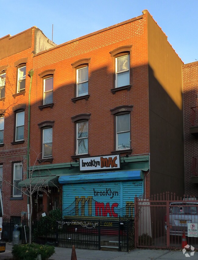
Property Record
173 Montrose Ave, Brooklyn, NY 11206
NEARBY LISTINGS FOR SALE OR LEASE
Property Detail
173 Montrose Ave
03053-0029
Kings
Commercialofficeresidentialmixeduse
New York
X
29
3604970204F
0.06 AC
2024
Williamsburg
2025
Long Island (New York)
049302
New York-Jersey City-White Plains, NY-NJ
6,000 SF
DEMOGRAPHICS near 173 Montrose Ave
1 mile
3 mile
5 mile
2024 Total Population
171,531
1,235,556
3,171,583
2029 Population
164,562
1,167,600
2,977,050
Pop Growth 2024-2029
(4.06%)
(5.50%)
(6.13%)
Average Age
34
37
39
2024 Total Households
64,307
513,488
1,334,519
HH Growth 2024-2029
(4.60%)
(5.86%)
(6.42%)
Median Household Inc
$68,162
$80,295
$84,891
Avg Household Size
2.60
2.30
2.30
2024 Avg HH Vehicles
.00
.00
.00
Median Home Value
$936,146
$919,998
$858,610
Median Year Built
1961
1949
1950
Nearby Places
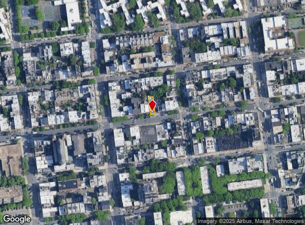
Map Layers
Map Styles
 Street
 Aerial
Transit
 Traffic
 Biking
Places
Listings with unknown addresses are not visible on the map
- Restaurants
- Banks
- Shops
- Fitness
- Groceries
PUBLIC TRANSPORTATION
TRANSIT/SUBWAY
Montrose Avenue (L - New York MTA Subway (The Subway))
Drive
Walk
Distance
Montrose Avenue (L - New York MTA Subway (The Subway))
1 min
3 min
0.1 mi
Grand Street (L Line) (L - New York MTA Subway (The Subway))
Drive
Walk
Distance
Grand Street (L Line) (L - New York MTA Subway (The Subway))
1 min
8 min
0.4 mi
Broadway (G Line) (G - New York MTA Subway (The Subway))
Drive
Walk
Distance
Broadway (G Line) (G - New York MTA Subway (The Subway))
3 min
10 min
0.5 mi
Graham Avenue (L - New York MTA Subway (The Subway))
Drive
Walk
Distance
Graham Avenue (L - New York MTA Subway (The Subway))
2 min
10 min
0.5 mi
Lorimer Street (J,M Line) (J - New York MTA Subway (The Subway), M - New York MTA Subway (The Subway))
Drive
Walk
Distance
Lorimer Street (J,M Line) (J - New York MTA Subway (The Subway), M - New York MTA Subway (The Subway))
3 min
11 min
0.5 mi
COMMUTER RAIL
Nostrand Avenue Station (Far Rockaway Branch - Long Island Rail Road, Hempstead Branch - Long Island Rail Road, Long Beach Branch - Long Island Rail Road, West Hempstead Branch - Long Island Rail Road)
Drive
Walk
Distance
Nostrand Avenue Station (Far Rockaway Branch - Long Island Rail Road, Hempstead Branch - Long Island Rail Road, Long Beach Branch - Long Island Rail Road, West Hempstead Branch - Long Island Rail Road)
9 min
2.7 mi
Hunterspoint Avenue Station (Hempstead Branch - Long Island Rail Road, Oyster Bay Branch - Long Island Rail Road)
Drive
Walk
Distance
Hunterspoint Avenue Station (Hempstead Branch - Long Island Rail Road, Oyster Bay Branch - Long Island Rail Road)
10 min
3.1 mi
AIRPORT
LaGuardia
Drive
Walk
Distance
LaGuardia
15 min
7.4 mi
John F Kennedy International
Drive
Walk
Distance
John F Kennedy International
25 min
11.3 mi
Newark Liberty International
Drive
Walk
Distance
Newark Liberty International
28 min
15.8 mi
Freight Ports
NY - Red Hook Container Terminal
Drive
Walk
Distance
NY - Red Hook Container Terminal
12 min
5.0 mi
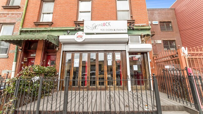
SALE & LEASE HISTORY
LISTING DATE
SALE/LEASE

Oct 31, 2018
For Lease
Jan 08, 2019
For Sale
Feb 25, 2021
For Lease
Nearby Properties
Address
Land Use
TOTAL SIZE
Lot Size
Zoning
Address
Land Use
TOTAL SIZE
Lot Size
Zoning
8,462,176 SF
61.41 AC
R7-2
Address
Land Use
TOTAL SIZE
Lot Size
Zoning
2,812,739 SF
2.10 AC
C5-3
Address
Land Use
TOTAL SIZE
Lot Size
Zoning
2,124,441 SF
17.29 AC
R8
Address
Land Use
TOTAL SIZE
Lot Size
Zoning
1,104,505 SF
2.32 AC
C4-7
Address
Land Use
TOTAL SIZE
Lot Size
Zoning
5.12 AC
C6-1G
Address
Land Use
TOTAL SIZE
Lot Size
Zoning
5.12 AC
C6-1G
Address
Land Use
TOTAL SIZE
Lot Size
Zoning
5.12 AC
C6-1G
Address
Land Use
TOTAL SIZE
Lot Size
Zoning
5.12 AC
C6-1G
Address
Land Use
TOTAL SIZE
Lot Size
Zoning
5.12 AC
C6-1G
Address
Land Use
TOTAL SIZE
Lot Size
Zoning
5.12 AC
C6-1G
Address
Land Use
TOTAL SIZE
Lot Size
Zoning
5.12 AC
C6-1G
Address
Land Use
TOTAL SIZE
Lot Size
Zoning
5.12 AC
C6-1G
Address
Land Use
TOTAL SIZE
Lot Size
Zoning
5.12 AC
C6-1G
Address
Land Use
TOTAL SIZE
Lot Size
Zoning
5.12 AC
C6-1G
Address
Land Use
TOTAL SIZE
Lot Size
Zoning
5.12 AC
C6-1G
Address
Land Use
TOTAL SIZE
Lot Size
Zoning
5.12 AC
C6-1G
Address
Land Use
TOTAL SIZE
Lot Size
Zoning
5.12 AC
C6-1G
Address
Land Use
TOTAL SIZE
Lot Size
Zoning
5.12 AC
C6-1G
Address
Land Use
TOTAL SIZE
Lot Size
Zoning
5.12 AC
C6-1G
Address
Land Use
TOTAL SIZE
Lot Size
Zoning
5.12 AC
C6-1G
Address
Land Use
TOTAL SIZE
Lot Size
Zoning
5.12 AC
C6-1G
Address
Land Use
TOTAL SIZE
Lot Size
Zoning
5.12 AC
C6-1G
Address
Land Use
TOTAL SIZE
Lot Size
Zoning
5.12 AC
C6-1G
Address
Land Use
TOTAL SIZE
Lot Size
Zoning
5.12 AC
C6-1G
Address
Land Use
TOTAL SIZE
Lot Size
Zoning
5.12 AC
C6-1G
Address
Land Use
TOTAL SIZE
Lot Size
Zoning
5.12 AC
C6-1G
Address
Land Use
TOTAL SIZE
Lot Size
Zoning
5.12 AC
C6-1G
Address
Land Use
TOTAL SIZE
Lot Size
Zoning
5.12 AC
C6-1G
Address
Land Use
TOTAL SIZE
Lot Size
Zoning
5.12 AC
C6-1G
Address
Land Use
TOTAL SIZE
Lot Size
Zoning
5.12 AC
C6-1G
The World's #1 Commercial Real Estate Marketplace
Connect with us
© 2026 CoStar Group
The information above has been obtained from sources believed reliable. While we do not doubt its accuracy we have not verified it and make no guarantee, warranty or representation about it. It is your responsibility to independently confirm its accuracy and completeness. Any projections, opinions, assumptions, or estimates used are for example only and do not represent the current or future performance of the property. The value of this transaction to you depends on tax and other factors which should be evaluated by your tax, financial, and legal advisors. You and your advisors should conduct a careful, independent investigation of the property to determine to your satisfaction the suitability of the property for your needs.