Property Record
1720 Columbus Rd, Cleveland, OH 44113
NEARBY LISTINGS FOR SALE OR LEASE
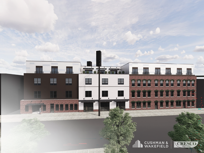
Property Detail
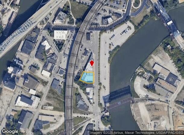
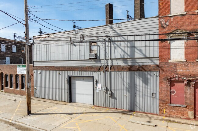
1720 Columbus Rd
Cleveland-Elyria, OH
PARCEL A AFN 202102050085 FF 107.0 D 117.0 0.2749 AC OL 206
101-17-023
Cuyahoga
Commercialnec
Ohio
2024
0.28 AC
2024
CBD
107701
Cleveland
14,801 SF
DEMOGRAPHICS near 1720 Columbus Rd
1 mile
3 mile
5 mile
2024 Total Population
17,759
94,393
241,710
2029 Population
17,880
92,585
236,008
Pop Growth 2024-2029
+ 0.68%
(1.92%)
(2.36%)
Average Age
35
36
38
2024 Total Households
10,314
44,380
112,171
HH Growth 2024-2029
+ 1.13%
(1.51%)
(2.26%)
Median Household Inc
$69,456
$38,140
$38,393
Avg Household Size
1.50
1.90
2.00
2024 Avg HH Vehicles
1.00
1.00
1.00
Median Home Value
$336,598
$139,060
$106,028
Median Year Built
1966
1948
1948
Nearby Places
Map Layers
Map Styles
 Street
 Aerial
Transit
 Traffic
 Biking
Places
Listings with unknown addresses are not visible on the map
- Restaurants
- Banks
- Shops
- Fitness
- Groceries
PUBLIC TRANSPORTATION
TRANSIT/SUBWAY
Settlers Landing Station (Blue/Green/Waterfront Lines - Greater Cleveland Regional Transit Authority)
Drive
Walk
Distance
Settlers Landing Station (Blue/Green/Waterfront Lines - Greater Cleveland Regional Transit Authority)
1 min
7 min
0.3 mi
Flats East Bank Station (Blue/Green/Waterfront Lines - Greater Cleveland Regional Transit Authority)
Drive
Walk
Distance
Flats East Bank Station (Blue/Green/Waterfront Lines - Greater Cleveland Regional Transit Authority)
2 min
11 min
0.6 mi
Tower City Station Track 10 West (Red Line - Greater Cleveland Regional Transit Authority)
Drive
Walk
Distance
Tower City Station Track 10 West (Red Line - Greater Cleveland Regional Transit Authority)
3 min
11 min
0.6 mi
Tower City Station Track 13 (Blue/Green) (Blue/Green/Waterfront Lines - Greater Cleveland Regional Transit Authority)
Drive
Walk
Distance
Tower City Station Track 13 (Blue/Green) (Blue/Green/Waterfront Lines - Greater Cleveland Regional Transit Authority)
3 min
11 min
0.6 mi
Tower City - Public Square (Blue Line - Greater Cleveland Regional Transit Authority Rapid Transit (The Rapid), Green Line - Greater Cleveland Regional Transit Authority Rapid Transit (The Rapid), Red Line - Greater Cleveland Regional Transit Authority Rapid Transit (The Rapid))
Drive
Walk
Distance
Tower City - Public Square (Blue Line - Greater Cleveland Regional Transit Authority Rapid Transit (The Rapid), Green Line - Greater Cleveland Regional Transit Authority Rapid Transit (The Rapid), Red Line - Greater Cleveland Regional Transit Authority Rapid Transit (The Rapid))
3 min
14 min
0.7 mi
COMMUTER RAIL
Cleveland Lakefront Station (Blue Line - Greater Cleveland Regional Transit Authority Rapid Transit (The Rapid), Green Line - Greater Cleveland Regional Transit Authority Rapid Transit (The Rapid))
Drive
Walk
Distance
Cleveland Lakefront Station (Blue Line - Greater Cleveland Regional Transit Authority Rapid Transit (The Rapid), Green Line - Greater Cleveland Regional Transit Authority Rapid Transit (The Rapid))
8 min
2.6 mi
AIRPORT
Cleveland-Hopkins International
Drive
Walk
Distance
Cleveland-Hopkins International
25 min
12.4 mi
Freight Ports
Port of Toledo
Drive
Walk
Distance
Port of Toledo
137 min
113.0 mi
SALE & LEASE HISTORY
LISTING DATE
SALE/LEASE

Jun 05, 2025
For Lease
Nearby Properties
Address
Land Use
TOTAL SIZE
Lot Size
Zoning
Address
Land Use
TOTAL SIZE
Lot Size
Zoning
3,491,901 SF
34.32 AC
Address
Land Use
TOTAL SIZE
Lot Size
Zoning
753,970 SF
9.31 AC
GR
Address
Land Use
TOTAL SIZE
Lot Size
Zoning
1,570,958 SF
1.33 AC
GR
Address
Land Use
TOTAL SIZE
Lot Size
Zoning
17.45 AC
GI
Address
Land Use
TOTAL SIZE
Lot Size
Zoning
16.78 AC
SI
Address
Land Use
TOTAL SIZE
Lot Size
Zoning
710,780 SF
4.33 AC
GR
Address
Land Use
TOTAL SIZE
Lot Size
Zoning
273,687 SF
22.92 AC
GI
Address
Land Use
TOTAL SIZE
Lot Size
Zoning
765,607 SF
12.15 AC
GR
Address
Land Use
TOTAL SIZE
Lot Size
Zoning
788,580 SF
4.85 AC
GR
Address
Land Use
TOTAL SIZE
Lot Size
Zoning
434,475 SF
0.53 AC
Address
Land Use
TOTAL SIZE
Lot Size
Zoning
1,191,268 SF
3.94 AC
SI
Address
Land Use
TOTAL SIZE
Lot Size
Zoning
6.98 AC
SI
Address
Land Use
TOTAL SIZE
Lot Size
Zoning
148,486 SF
489.21 AC
GI
Address
Land Use
TOTAL SIZE
Lot Size
Zoning
5,100 SF
9.41 AC
GI
Address
Land Use
TOTAL SIZE
Lot Size
Zoning
652,455 SF
2.04 AC
GR
Address
Land Use
TOTAL SIZE
Lot Size
Zoning
263,723 SF
7.48 AC
GI
Address
Land Use
TOTAL SIZE
Lot Size
Zoning
1,130,924 SF
4.02 AC
SI
Address
Land Use
TOTAL SIZE
Lot Size
Zoning
299,515 SF
1.30 AC
GR
Address
Land Use
TOTAL SIZE
Lot Size
Zoning
1,181,536 SF
27.82 AC
RO
Address
Land Use
TOTAL SIZE
Lot Size
Zoning
228,154 SF
0.48 AC
GR
Address
Land Use
TOTAL SIZE
Lot Size
Zoning
3.23 AC
LLR
Address
Land Use
TOTAL SIZE
Lot Size
Zoning
2.74 AC
Address
Land Use
TOTAL SIZE
Lot Size
Zoning
1,003,787 SF
2.12 AC
GR
Address
Land Use
TOTAL SIZE
Lot Size
Zoning
1,467,599 SF
1.66 AC
GR
Address
Land Use
TOTAL SIZE
Lot Size
Zoning
758,394 SF
2.25 AC
GR
Address
Land Use
TOTAL SIZE
Lot Size
Zoning
493,911 SF
1.88 AC
LLR
Address
Land Use
TOTAL SIZE
Lot Size
Zoning
257,857 SF
8.03 AC
GR
Address
Land Use
TOTAL SIZE
Lot Size
Zoning
1.53 AC
LLR
Address
Land Use
TOTAL SIZE
Lot Size
Zoning
299,507 SF
2.14 AC
LR
Address
Land Use
TOTAL SIZE
Lot Size
Zoning
194,478 SF
9.61 AC
SI
The World's #1 Commercial Real Estate Marketplace
Connect with us
© 2026 CoStar Group
The information above has been obtained from sources believed reliable. While we do not doubt its accuracy we have not verified it and make no guarantee, warranty or representation about it. It is your responsibility to independently confirm its accuracy and completeness. Any projections, opinions, assumptions, or estimates used are for example only and do not represent the current or future performance of the property. The value of this transaction to you depends on tax and other factors which should be evaluated by your tax, financial, and legal advisors. You and your advisors should conduct a careful, independent investigation of the property to determine to your satisfaction the suitability of the property for your needs.