Property Record
1730 Nw 9Th St, Corvallis, OR 97330
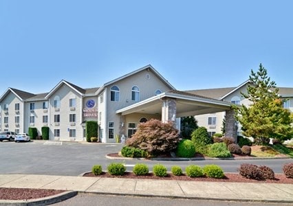
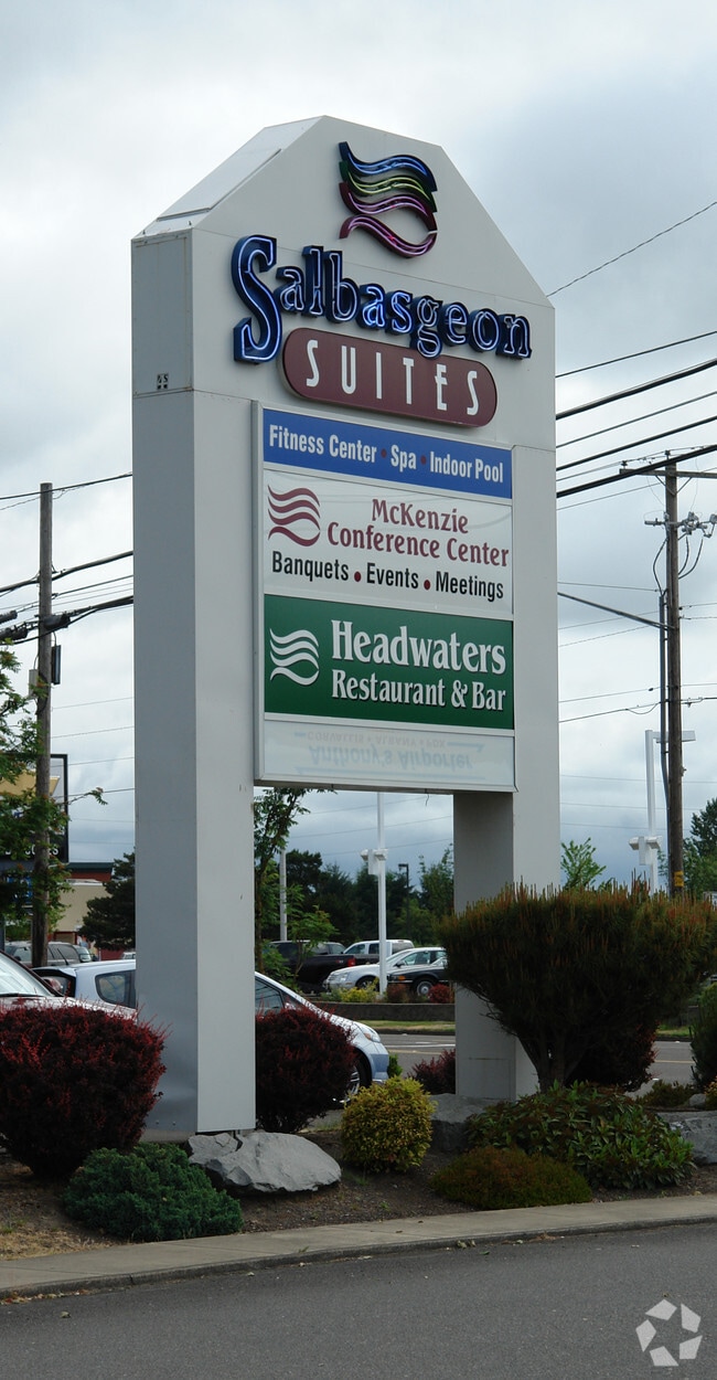
Property Detail
1730 Nw 9Th St
073878
PARKING DOR #90-2862/BC #90-22
Commercialbuilding
Benton
PD(MUCS)
Oregon
B and X Area of moderate flood hazard, usually the area between the limits of the 100-year and 500-year floods.
500
2024
3.59 AC
2025
Oregon West Area
001001
Other Market Areas
63,603 SF
Corvallis, OR
NEARBY LISTINGS FOR SALE OR LEASE
-
-
View all Corvallis listings for sale on LoopNet.com
DEMOGRAPHICS near 1730 Nw 9Th St
1 mile
3 mile
5 mile
2025 Total Population
11,853
58,600
74,939
2030 Population
12,101
61,081
77,811
Pop Growth 2025-2030
+ 2.09%
+ 4.23%
+ 3.83%
Average Age
40
36
38
2025 Total Households
5,169
23,373
30,046
HH Growth 2025-2030
+ 2.11%
+ 4.59%
+ 4.10%
Median Household Inc
$68,561
$58,652
$66,630
Avg Household Size
2.20
2.20
2.20
2025 Avg HH Vehicles
2.00
2.00
2.00
Median Home Value
$453,910
$498,709
$535,359
Median Year Built
1973
1977
1979
Nearby Places
Map Layers
Map Styles
 Street
 Aerial
Layers
 Traffic
 Biking
Places
Listings with unknown addresses are not visible on the map
- Restaurants
- Banks
- Shops
- Fitness
- Groceries
PUBLIC TRANSPORTATION
AIRPORT
Mahlon Sweet Field
Drive
Walk
Distance
Mahlon Sweet Field
63 min
37.5 mi
Nearby Properties
Address
Land Use
TOTAL SIZE
Lot Size
Zoning
Address
Land Use
TOTAL SIZE
Lot Size
Zoning
Address
Land Use
TOTAL SIZE
Lot Size
Zoning
Address
Land Use
TOTAL SIZE
Lot Size
Zoning
552,129 SF
25.99 AC
RS-12
Address
Land Use
TOTAL SIZE
Lot Size
Zoning
298,527 SF
32.61 AC
PD(RS-3.5)
Address
Land Use
TOTAL SIZE
Lot Size
Zoning
Address
Land Use
TOTAL SIZE
Lot Size
Zoning
339,006 SF
0.69 AC
RF
Address
Land Use
TOTAL SIZE
Lot Size
Zoning
330,693 SF
1.25 AC
MUE
Address
Land Use
TOTAL SIZE
Lot Size
Zoning
106,538 SF
4.38 AC
RS-12
Address
Land Use
TOTAL SIZE
Lot Size
Zoning
215,337 SF
16.20 AC
RS-20
Address
Land Use
TOTAL SIZE
Lot Size
Zoning
166,415 SF
3.04 AC
OSU
Address
Land Use
TOTAL SIZE
Lot Size
Zoning
81,113 SF
1.81 AC
PD(RS-20)
Address
Land Use
TOTAL SIZE
Lot Size
Zoning
Address
Land Use
TOTAL SIZE
Lot Size
Zoning
129,103 SF
6.95 AC
PD(RS-12)
Address
Land Use
TOTAL SIZE
Lot Size
Zoning
85,211 SF
1.15 AC
PD(RS-3.5)
Address
Land Use
TOTAL SIZE
Lot Size
Zoning
146,932 SF
6.41 AC
MUCS
Address
Land Use
TOTAL SIZE
Lot Size
Zoning
218,015 SF
11.69 AC
PD(RS-12)
Address
Land Use
TOTAL SIZE
Lot Size
Zoning
112,216 SF
11.30 AC
PD(NC-MAJO
Address
Land Use
TOTAL SIZE
Lot Size
Zoning
192,991 SF
10.19 AC
GI
Address
Land Use
TOTAL SIZE
Lot Size
Zoning
122,984 SF
2.56 AC
RS-20
Address
Land Use
TOTAL SIZE
Lot Size
Zoning
57,607 SF
29.70 AC
PD(RS-3.5)
Address
Land Use
TOTAL SIZE
Lot Size
Zoning
95,797 SF
6.03 AC
PD(P-AO)
Address
Land Use
TOTAL SIZE
Lot Size
Zoning
300,108 SF
11.08 AC
PD(GI)
Address
Land Use
TOTAL SIZE
Lot Size
Zoning
166,396 SF
4.96 AC
GI
Address
Land Use
TOTAL SIZE
Lot Size
Zoning
169.68 AC
PD(GI)
Address
Land Use
TOTAL SIZE
Lot Size
Zoning
165,589 SF
13.92 AC
RS-20
Address
Land Use
TOTAL SIZE
Lot Size
Zoning
139,752 SF
7.60 AC
RS-12
Address
Land Use
TOTAL SIZE
Lot Size
Zoning
117,960 SF
5.41 AC
RS-20
Address
Land Use
TOTAL SIZE
Lot Size
Zoning
224,384 SF
2.41 AC
MUCS
Address
Land Use
TOTAL SIZE
Lot Size
Zoning
63,978 SF
3.06 AC
PD(MUGC)
Address
Land Use
TOTAL SIZE
Lot Size
Zoning
109,984 SF
3.51 AC
RS-20
The World's #1 Commercial Real Estate Marketplace
Connect with us
© 2026 CoStar Group
The information above has been obtained from sources believed reliable. While we do not doubt its accuracy we have not verified it and make no guarantee, warranty or representation about it. It is your responsibility to independently confirm its accuracy and completeness. Any projections, opinions, assumptions, or estimates used are for example only and do not represent the current or future performance of the property. The value of this transaction to you depends on tax and other factors which should be evaluated by your tax, financial, and legal advisors. You and your advisors should conduct a careful, independent investigation of the property to determine to your satisfaction the suitability of the property for your needs.