Property Record
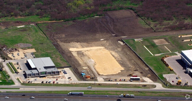
17301 Interstate 35, Buda, TX 78610

Property Detail
17301 Interstate 35
R151704
ATX SUBDIVISION, ACRES 7.496
Commercialnec
Hays
A Areas with a 1% annual chance of flooding and a 26% chance of flooding over the life of a 30-year mortgage.
Texas
2024
7.50 AC
2025
Hays County
010922
Austin
35,756 SF
Austin-Round Rock-San Marcos, TX
NEARBY LISTINGS FOR SALE OR LEASE
DEMOGRAPHICS near 17301 Interstate 35
1 mile
3 mile
5 mile
2024 Total Population
4,374
48,172
101,942
2029 Population
5,687
63,694
134,142
Pop Growth 2024-2029
+ 30.02%
+ 32.22%
+ 31.59%
Average Age
35
34
35
2024 Total Households
1,411
16,571
34,952
HH Growth 2024-2029
+ 31.25%
+ 33.34%
+ 32.64%
Median Household Inc
$94,973
$89,575
$90,868
Avg Household Size
3.10
2.90
2.90
2024 Avg HH Vehicles
2.00
2.00
2.00
Median Home Value
$260,214
$290,559
$291,502
Median Year Built
2010
2010
2010
Nearby Places
Map Layers
Map Styles
 Street
 Aerial
Transit
 Traffic
 Biking
Places
Listings with unknown addresses are not visible on the map
- Restaurants
- Banks
- Shops
- Fitness
- Groceries
PUBLIC TRANSPORTATION
AIRPORT
Austin-Bergstrom International
Drive
Walk
Distance
Austin-Bergstrom International
31 min
21.8 mi
Freight Ports
Calhoun Port
Drive
Walk
Distance
Calhoun Port
179 min
148.2 mi
Nearby Properties
Address
Land Use
TOTAL SIZE
Lot Size
Zoning
Address
Land Use
TOTAL SIZE
Lot Size
Zoning
364,569 SF
14.36 AC
Address
Land Use
TOTAL SIZE
Lot Size
Zoning
414,780 SF
15.89 AC
Address
Land Use
TOTAL SIZE
Lot Size
Zoning
305,661 SF
31.74 AC
Address
Land Use
TOTAL SIZE
Lot Size
Zoning
7,175 SF
15.09 AC
Address
Land Use
TOTAL SIZE
Lot Size
Zoning
301,466 SF
21 AC
Address
Land Use
TOTAL SIZE
Lot Size
Zoning
273,464 SF
16.14 AC
Address
Land Use
TOTAL SIZE
Lot Size
Zoning
201,966 SF
33.54 AC
Address
Land Use
TOTAL SIZE
Lot Size
Zoning
332,150 SF
7.08 AC
Address
Land Use
TOTAL SIZE
Lot Size
Zoning
161,083 SF
15 AC
Address
Land Use
TOTAL SIZE
Lot Size
Zoning
310,992 SF
16.75 AC
Address
Land Use
TOTAL SIZE
Lot Size
Zoning
491,520 SF
38.84 AC
Address
Land Use
TOTAL SIZE
Lot Size
Zoning
437,903 SF
10.76 AC
Address
Land Use
TOTAL SIZE
Lot Size
Zoning
383,970 SF
17.76 AC
Address
Land Use
TOTAL SIZE
Lot Size
Zoning
272,058 SF
12.39 AC
Address
Land Use
TOTAL SIZE
Lot Size
Zoning
230,002 SF
6.07 AC
Address
Land Use
TOTAL SIZE
Lot Size
Zoning
403,635 SF
24.01 AC
Address
Land Use
TOTAL SIZE
Lot Size
Zoning
347,316 SF
14 AC
Address
Land Use
TOTAL SIZE
Lot Size
Zoning
398,000 SF
23.28 AC
Address
Land Use
TOTAL SIZE
Lot Size
Zoning
240,168 SF
9.45 AC
Address
Land Use
TOTAL SIZE
Lot Size
Zoning
125,488 SF
3.69 AC
Address
Land Use
TOTAL SIZE
Lot Size
Zoning
190,462 SF
9.67 AC
Address
Land Use
TOTAL SIZE
Lot Size
Zoning
165,142 SF
12 AC
Address
Land Use
TOTAL SIZE
Lot Size
Zoning
144,088 SF
7.63 AC
Address
Land Use
TOTAL SIZE
Lot Size
Zoning
116,908 SF
3.58 AC
Address
Land Use
TOTAL SIZE
Lot Size
Zoning
Address
Land Use
TOTAL SIZE
Lot Size
Zoning
219,000 SF
15 AC
Address
Land Use
TOTAL SIZE
Lot Size
Zoning
78,782 SF
19.60 AC
Address
Land Use
TOTAL SIZE
Lot Size
Zoning
64,836 SF
10 AC
Address
Land Use
TOTAL SIZE
Lot Size
Zoning
258,960 SF
18.31 AC
Address
Land Use
TOTAL SIZE
Lot Size
Zoning
96.18 AC
The World's #1 Commercial Real Estate Marketplace
Connect with us
© 2026 CoStar Group
The information above has been obtained from sources believed reliable. While we do not doubt its accuracy we have not verified it and make no guarantee, warranty or representation about it. It is your responsibility to independently confirm its accuracy and completeness. Any projections, opinions, assumptions, or estimates used are for example only and do not represent the current or future performance of the property. The value of this transaction to you depends on tax and other factors which should be evaluated by your tax, financial, and legal advisors. You and your advisors should conduct a careful, independent investigation of the property to determine to your satisfaction the suitability of the property for your needs.