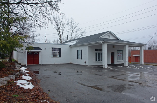
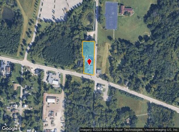
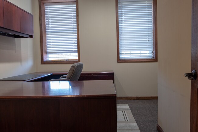
Property Record
17301 Manchester Rd, Wildwood, MO 63038

NEARBY LISTINGS FOR SALE OR LEASE
Property Detail
17301 Manchester Rd
23W-31-0241
Survey 0000 Sec 02 Twn 44 Range 3
Storebuilding
SECTION 2-44-3 LOC W OF POND RD
X
St. Louis
29071C0225E
Missouri
2024
0.90 AC
2025
West County
221621
St. Louis
3,840 SF
St. Louis, MO-IL
DEMOGRAPHICS near 17301 Manchester Rd
1 Mile
3 Mile
5 Mile
2024 Total Population
2,054
24,375
56,400
2029 Population
2,040
23,822
55,276
Pop Growth 2024-2029
(0.68%)
(2.27%)
(1.99%)
Average Age
42
41
42
2024 Total Households
768
8,875
20,532
HH Growth 2024-2029
(0.65%)
(2.29%)
(2.03%)
Median Household Inc
$144,270
$135,649
$135,425
Avg Household Size
2.60
2.70
2.70
2024 Avg HH Vehicles
2.00
2.00
2.00
Median Home Value
$405,674
$388,521
$405,620
Median Year Built
1995
1991
1990
Nearby Places
Map Layers
Map Styles
 Street
 Aerial
- Restaurants
- Banks
- Shops
- Fitness
- Groceries
PUBLIC TRANSPORTATION
AIRPORT
St Louis Lambert International
DRIVE
WALK
Distance
St Louis Lambert International
45 min
29.5 mi
SALE & LEASE HISTORY
LISTING DATE
SALE/LEASE

Mar 09, 2020
For Sale
Feb 11, 2021
For Sale
Nearby Properties
Address
Land Use
TOTAL SIZE
Lot Size
Zoning
Address
Land Use
TOTAL SIZE
Lot Size
Zoning
62,362 SF
2,133.73 AC
PS
Address
Land Use
TOTAL SIZE
Lot Size
Zoning
51.20 AC
NU
Address
Land Use
TOTAL SIZE
Lot Size
Zoning
5,675 SF
1,382.01 AC
PS
Address
Land Use
TOTAL SIZE
Lot Size
Zoning
85,946 SF
60.44 AC
NU
Address
Land Use
TOTAL SIZE
Lot Size
Zoning
313,104 SF
14.66 AC
MXD
Address
Land Use
TOTAL SIZE
Lot Size
Zoning
138,056 SF
17.42 AC
NU
Address
Land Use
TOTAL SIZE
Lot Size
Zoning
27.86 AC
107NU
Address
Land Use
TOTAL SIZE
Lot Size
Zoning
68.69 AC
107NU
Address
Land Use
TOTAL SIZE
Lot Size
Zoning
30 AC
107NU
Address
Land Use
TOTAL SIZE
Lot Size
Zoning
16.80 AC
NU
Address
Land Use
TOTAL SIZE
Lot Size
Zoning
164,430 SF
9.85 AC
19C-4
Address
Land Use
TOTAL SIZE
Lot Size
Zoning
3,750 SF
169.58 AC
107NU
Address
Land Use
TOTAL SIZE
Lot Size
Zoning
4,464 SF
12.30 AC
107NU
Address
Land Use
TOTAL SIZE
Lot Size
Zoning
185,087 SF
8 AC
19C-4
Address
Land Use
TOTAL SIZE
Lot Size
Zoning
118,097 SF
14.32 AC
19C-4
Address
Land Use
TOTAL SIZE
Lot Size
Zoning
109,550 SF
14.21 AC
107R6A
Address
Land Use
TOTAL SIZE
Lot Size
Zoning
7,208 SF
29.36 AC
107NU
Address
Land Use
TOTAL SIZE
Lot Size
Zoning
17.18 AC
R1A
Address
Land Use
TOTAL SIZE
Lot Size
Zoning
72.37 AC
107PS
Address
Land Use
TOTAL SIZE
Lot Size
Zoning
11.91 AC
107R3
Address
Land Use
TOTAL SIZE
Lot Size
Zoning
9.89 AC
19R-1
Address
Land Use
TOTAL SIZE
Lot Size
Zoning
37.37 AC
107NU
Address
Land Use
TOTAL SIZE
Lot Size
Zoning
73,053 SF
1.65 AC
107NU
Address
Land Use
TOTAL SIZE
Lot Size
Zoning
50,846 SF
6.52 AC
107NU
Address
Land Use
TOTAL SIZE
Lot Size
Zoning
15.82 AC
107NU
Address
Land Use
TOTAL SIZE
Lot Size
Zoning
89,832 SF
10.68 AC
19C-4
Address
Land Use
TOTAL SIZE
Lot Size
Zoning
42,657 SF
5.86 AC
19C-4
Address
Land Use
TOTAL SIZE
Lot Size
Zoning
27.07 AC
107PS
Address
Land Use
TOTAL SIZE
Lot Size
Zoning
21.40 AC
107NU
Address
Land Use
TOTAL SIZE
Lot Size
Zoning
26,917 SF
5.37 AC
107NU
The World's #1 Commercial Real Estate Marketplace
Connect with us
© 2025 CoStar Group
The information above has been obtained from sources believed reliable. While we do not doubt its accuracy we have not verified it and make no guarantee, warranty or representation about it. It is your responsibility to independently confirm its accuracy and completeness. Any projections, opinions, assumptions, or estimates used are for example only and do not represent the current or future performance of the property. The value of this transaction to you depends on tax and other factors which should be evaluated by your tax, financial, and legal advisors. You and your advisors should conduct a careful, independent investigation of the property to determine to your satisfaction the suitability of the property for your needs.