Property Record
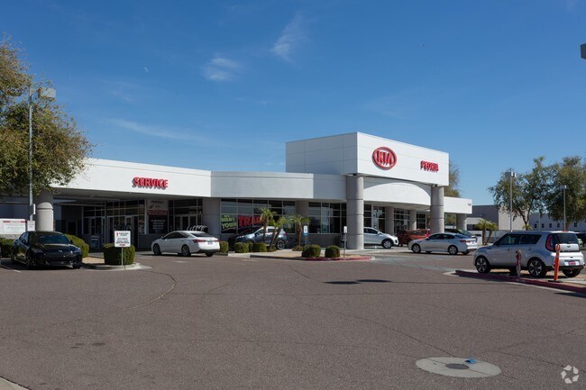
17311 N 91St Ave, Peoria, AZ 85382


NEARBY LISTINGS FOR SALE OR LEASE
Property Detail
17311 N 91St Ave
Phoenix-Mesa-Scottsdale, AZ
91St Avenue And Bell Road 2
200-43-618
91ST AVENUE AND BELL ROAD 2 MCR 1204-35
Vehiclerentalsvehiclesales
Maricopa
X
Arizona
04013C1245L
2b
2025
2.88 AC
2025
Ctrl Peoria/Arrowhead
617600
Phoenix
27,890 SF
DEMOGRAPHICS near 17311 N 91St Ave
1 Mile
3 Mile
5 Mile
2024 Total Population
14,022
108,373
278,456
2029 Population
15,216
117,559
301,193
Pop Growth 2024-2029
+ 8.52%
+ 8.48%
+ 8.17%
Average Age
51
50
45
2024 Total Households
6,205
49,085
112,675
HH Growth 2024-2029
+ 8.70%
+ 8.69%
+ 8.36%
Median Household Inc
$68,385
$68,137
$69,501
Avg Household Size
2.10
2.10
2.40
2024 Avg HH Vehicles
2.00
2.00
2.00
Median Home Value
$318,973
$334,609
$329,268
Median Year Built
1988
1990
1989
Nearby Places
Map Layers
Map Styles
 Street
 Aerial
- Restaurants
- Banks
- Shops
- Fitness
- Groceries
PUBLIC TRANSPORTATION
AIRPORT
Phoenix Sky Harbor International
DRIVE
WALK
Distance
Phoenix Sky Harbor International
41 min
31.6 mi
Freight Ports
Port of San Diego
DRIVE
WALK
Distance
Port of San Diego
398 min
357.4 mi
Nearby Properties
Address
Land Use
TOTAL SIZE
Lot Size
Zoning
Address
Land Use
TOTAL SIZE
Lot Size
Zoning
81,100 SF
9.48 AC
PAD
Address
Land Use
TOTAL SIZE
Lot Size
Zoning
45,900 SF
11.09 AC
PAD
Address
Land Use
TOTAL SIZE
Lot Size
Zoning
708,928 SF
44.86 AC
Address
Land Use
TOTAL SIZE
Lot Size
Zoning
238,942 SF
36.87 AC
R1-8
Address
Land Use
TOTAL SIZE
Lot Size
Zoning
19.95 AC
AG
Address
Land Use
TOTAL SIZE
Lot Size
Zoning
235,399 SF
41.79 AC
M-M
Address
Land Use
TOTAL SIZE
Lot Size
Zoning
399,561 SF
16.30 AC
Address
Land Use
TOTAL SIZE
Lot Size
Zoning
348,803 SF
15.91 AC
PAD
Address
Land Use
TOTAL SIZE
Lot Size
Zoning
547,083 SF
10.94 AC
C-C
Address
Land Use
TOTAL SIZE
Lot Size
Zoning
353,859 SF
11.71 AC
PAD
Address
Land Use
TOTAL SIZE
Lot Size
Zoning
133,377 SF
17.52 AC
PAD
Address
Land Use
TOTAL SIZE
Lot Size
Zoning
318,282 SF
15.23 AC
PAD
Address
Land Use
TOTAL SIZE
Lot Size
Zoning
280,356 SF
12.73 AC
PAD
Address
Land Use
TOTAL SIZE
Lot Size
Zoning
440,494 SF
26.25 AC
PAD
Address
Land Use
TOTAL SIZE
Lot Size
Zoning
392,885 SF
17.67 AC
M-H
Address
Land Use
TOTAL SIZE
Lot Size
Zoning
375,604 SF
6.31 AC
M-M
Address
Land Use
TOTAL SIZE
Lot Size
Zoning
284,715 SF
7.15 AC
M-M
Address
Land Use
TOTAL SIZE
Lot Size
Zoning
245,400 SF
22.90 AC
PAD
Address
Land Use
TOTAL SIZE
Lot Size
Zoning
150,002 SF
10.91 AC
C-C
Address
Land Use
TOTAL SIZE
Lot Size
Zoning
112,300 SF
13.72 AC
PAD
Address
Land Use
TOTAL SIZE
Lot Size
Zoning
283,107 SF
14.60 AC
M-M
Address
Land Use
TOTAL SIZE
Lot Size
Zoning
96,045 SF
13.69 AC
PAD
Address
Land Use
TOTAL SIZE
Lot Size
Zoning
319,723 SF
10.79 AC
PAD
Address
Land Use
TOTAL SIZE
Lot Size
Zoning
311,614 SF
19.03 AC
PAD
Address
Land Use
TOTAL SIZE
Lot Size
Zoning
187,392 SF
10.36 AC
PAD
Address
Land Use
TOTAL SIZE
Lot Size
Zoning
18.76 AC
M1
Address
Land Use
TOTAL SIZE
Lot Size
Zoning
86,343 SF
13.52 AC
M-M
Address
Land Use
TOTAL SIZE
Lot Size
Zoning
210,605 SF
6.76 AC
PAD
Address
Land Use
TOTAL SIZE
Lot Size
Zoning
82,688 SF
18.70 AC
PAD
Address
Land Use
TOTAL SIZE
Lot Size
Zoning
301,213 SF
18.86 AC
PAD
The World's #1 Commercial Real Estate Marketplace
Connect with us
© 2025 CoStar Group
The information above has been obtained from sources believed reliable. While we do not doubt its accuracy we have not verified it and make no guarantee, warranty or representation about it. It is your responsibility to independently confirm its accuracy and completeness. Any projections, opinions, assumptions, or estimates used are for example only and do not represent the current or future performance of the property. The value of this transaction to you depends on tax and other factors which should be evaluated by your tax, financial, and legal advisors. You and your advisors should conduct a careful, independent investigation of the property to determine to your satisfaction the suitability of the property for your needs.