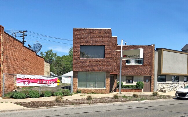
Property Record
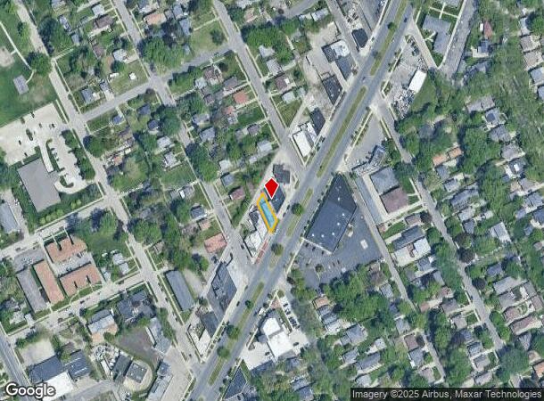
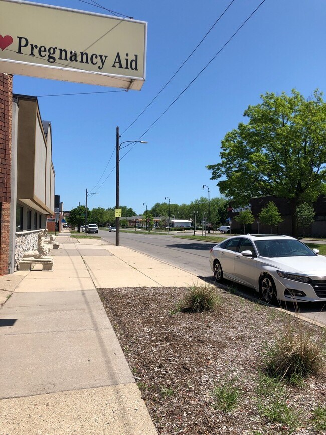
17323 Mack Ave, Detroit, MI 48224
NEARBY LISTINGS FOR SALE OR LEASE
Property Detail
17323 Mack Ave
21-00153-940
Pointe Highlands
Dentalbldg
N MACK 15 & 14GROSSE POINTE HIGHLANDS SUB L36 P61 PLATS, W C R 21/814 40 X 100
X
Wayne
26163C0143F
Michigan
2025
0.07 AC
2025
The Pointes/Harper Woods
501700
Detroit
3,446 SF
Detroit-Warren-Dearborn, MI
DEMOGRAPHICS near 17323 Mack Ave
1 Mile
3 Mile
5 Mile
2024 Total Population
17,690
107,361
232,928
2029 Population
17,103
105,836
232,152
Pop Growth 2024-2029
(3.32%)
(1.42%)
(0.33%)
Average Age
41
39
39
2024 Total Households
6,782
40,668
90,801
HH Growth 2024-2029
(3.33%)
(1.49%)
(0.43%)
Median Household Inc
$92,523
$55,206
$50,639
Avg Household Size
2.50
2.60
2.50
2024 Avg HH Vehicles
2.00
1.00
1.00
Median Home Value
$283,631
$190,562
$144,783
Median Year Built
1946
1949
1951
Nearby Places
Map Layers
Map Styles
 Street
 Aerial
- Restaurants
- Banks
- Shops
- Fitness
- Groceries
PUBLIC TRANSPORTATION
AIRPORT
Windsor International
DRIVE
WALK
Distance
Windsor International
44 min
21.5 mi
Detroit Metro Wayne County
DRIVE
WALK
Distance
Detroit Metro Wayne County
47 min
31.0 mi
Freight Ports
DRIVE
WALK
Distance
92 min
71.8 mi
SALE & LEASE HISTORY
LISTING DATE
SALE/LEASE

Jul 23, 2020
For Lease
Jul 23, 2020
For Sale
Aug 22, 2022
For Lease
Aug 22, 2022
For Sale
Nearby Properties
Address
Land Use
TOTAL SIZE
Lot Size
Zoning
Address
Land Use
TOTAL SIZE
Lot Size
Zoning
2,958,207 SF
277.38 AC
M4
Address
Land Use
TOTAL SIZE
Lot Size
Zoning
211,065 SF
8.84 AC
C.F
Address
Land Use
TOTAL SIZE
Lot Size
Zoning
575,081 SF
8.53 AC
R6
Address
Land Use
TOTAL SIZE
Lot Size
Zoning
298,117 SF
15.97 AC
PD
Address
Land Use
TOTAL SIZE
Lot Size
Zoning
101,733 SF
1.10 AC
C-2
Address
Land Use
TOTAL SIZE
Lot Size
Zoning
49,437 SF
0.47 AC
Address
Land Use
TOTAL SIZE
Lot Size
Zoning
93,296 SF
1.05 AC
C-2
Address
Land Use
TOTAL SIZE
Lot Size
Zoning
62,195 SF
1.50 AC
Address
Land Use
TOTAL SIZE
Lot Size
Zoning
17,558 SF
3.15 AC
Address
Land Use
TOTAL SIZE
Lot Size
Zoning
41,000 SF
C-1
Address
Land Use
TOTAL SIZE
Lot Size
Zoning
89,897 SF
2.23 AC
Address
Land Use
TOTAL SIZE
Lot Size
Zoning
72,940 SF
83.37 AC
M4
Address
Land Use
TOTAL SIZE
Lot Size
Zoning
115,839 SF
8.54 AC
M4
Address
Land Use
TOTAL SIZE
Lot Size
Zoning
28,055 SF
0.44 AC
Address
Land Use
TOTAL SIZE
Lot Size
Zoning
42,113 SF
0.54 AC
Address
Land Use
TOTAL SIZE
Lot Size
Zoning
102,205 SF
214.30 AC
Address
Land Use
TOTAL SIZE
Lot Size
Zoning
20,625 SF
0.48 AC
C-2
Address
Land Use
TOTAL SIZE
Lot Size
Zoning
47,227 SF
6.29 AC
PD
Address
Land Use
TOTAL SIZE
Lot Size
Zoning
10,704 SF
1.84 AC
Address
Land Use
TOTAL SIZE
Lot Size
Zoning
25,500 SF
0.23 AC
Address
Land Use
TOTAL SIZE
Lot Size
Zoning
101,814 SF
3.74 AC
R-2
Address
Land Use
TOTAL SIZE
Lot Size
Zoning
60,484 SF
4.85 AC
PD
Address
Land Use
TOTAL SIZE
Lot Size
Zoning
38,577 SF
1.91 AC
C
Address
Land Use
TOTAL SIZE
Lot Size
Zoning
43,967 SF
2.80 AC
O-1
Address
Land Use
TOTAL SIZE
Lot Size
Zoning
16.16 AC
PD
Address
Land Use
TOTAL SIZE
Lot Size
Zoning
14,820 SF
0.41 AC
C-1
Address
Land Use
TOTAL SIZE
Lot Size
Zoning
18,113 SF
0.42 AC
C-2
Address
Land Use
TOTAL SIZE
Lot Size
Zoning
6,152 SF
4.30 AC
Address
Land Use
TOTAL SIZE
Lot Size
Zoning
24,120 SF
4.89 AC
B4
Address
Land Use
TOTAL SIZE
Lot Size
Zoning
10,630 SF
0.20 AC
C-2
The World's #1 Commercial Real Estate Marketplace
Connect with us
© 2025 CoStar Group
The information above has been obtained from sources believed reliable. While we do not doubt its accuracy we have not verified it and make no guarantee, warranty or representation about it. It is your responsibility to independently confirm its accuracy and completeness. Any projections, opinions, assumptions, or estimates used are for example only and do not represent the current or future performance of the property. The value of this transaction to you depends on tax and other factors which should be evaluated by your tax, financial, and legal advisors. You and your advisors should conduct a careful, independent investigation of the property to determine to your satisfaction the suitability of the property for your needs.