Property Record
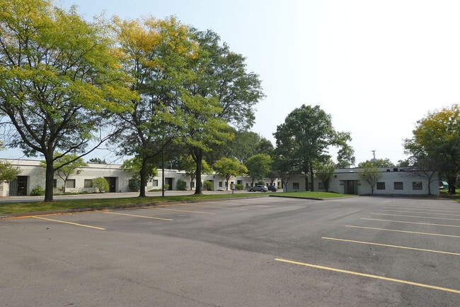
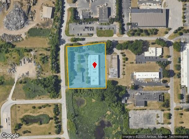
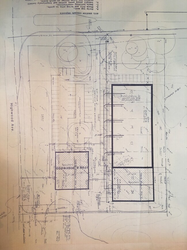
1733 Highwood E, Pontiac, MI 48340

NEARBY LISTINGS FOR SALE OR LEASE
Property Detail
1733 Highwood E
14-09-301-008
T3N, R10E, SEC 9 PART OF NW 1/4 OF SW 1/4 BEG AT PT DIST S 02-09-28 E 28.01 FT FROM W 1/4 COR, TH N 89-19-03 E 99.23 FT, TH N
Scientificpharmaceuticalmedicalresearchfacility
Oakland
X
Michigan
26125C0366F
3.29 AC
2024
Auburn Hills, Pontiac & Rochester
2025
Detroit
141400
Detroit-Warren-Dearborn, MI
35,220 SF
DEMOGRAPHICS near 1733 Highwood E
1 Mile
3 Mile
5 Mile
2024 Total Population
5,340
51,825
148,830
2029 Population
5,311
51,649
148,419
Pop Growth 2024-2029
(0.54%)
(0.34%)
(0.28%)
Average Age
38
37
39
2024 Total Households
2,124
20,546
59,640
HH Growth 2024-2029
(0.47%)
(0.47%)
(0.34%)
Median Household Inc
$48,987
$50,276
$58,021
Avg Household Size
2.40
2.40
2.30
2024 Avg HH Vehicles
1.00
2.00
2.00
Median Home Value
$112,174
$127,314
$197,821
Median Year Built
1974
1966
1972
Nearby Places
Map Layers
Map Styles
 Street
 Aerial
- Restaurants
- Banks
- Shops
- Fitness
- Groceries
PUBLIC TRANSPORTATION
COMMUTER RAIL
DRIVE
WALK
Distance
12 min
4.4 mi
AIRPORT
Bishop International
DRIVE
WALK
Distance
Bishop International
54 min
36.0 mi
Windsor International
DRIVE
WALK
Distance
Windsor International
64 min
43.6 mi
SALE & LEASE HISTORY
LISTING DATE
SALE/LEASE

Sep 24, 2016
For Lease
Sep 21, 2020
For Lease
Jun 17, 2021
For Sale
Nearby Properties
Address
Land Use
TOTAL SIZE
Lot Size
Zoning
Address
Land Use
TOTAL SIZE
Lot Size
Zoning
6,255,758 SF
Address
Land Use
TOTAL SIZE
Lot Size
Zoning
1,421,000 SF
170.30 AC
B2
Address
Land Use
TOTAL SIZE
Lot Size
Zoning
715,400 SF
Address
Land Use
TOTAL SIZE
Lot Size
Zoning
316,358 SF
20.89 AC
P
Address
Land Use
TOTAL SIZE
Lot Size
Zoning
527,000 SF
36.03 AC
Address
Land Use
TOTAL SIZE
Lot Size
Zoning
420,858 SF
65.07 AC
Address
Land Use
TOTAL SIZE
Lot Size
Zoning
430,338 SF
46.09 AC
Address
Land Use
TOTAL SIZE
Lot Size
Zoning
1,771,589 SF
96.73 AC
Address
Land Use
TOTAL SIZE
Lot Size
Zoning
247,500 SF
Address
Land Use
TOTAL SIZE
Lot Size
Zoning
6,255,758 SF
223.95 AC
Address
Land Use
TOTAL SIZE
Lot Size
Zoning
6,255,758 SF
233.05 AC
II
Address
Land Use
TOTAL SIZE
Lot Size
Zoning
246,150 SF
26.64 AC
TR
Address
Land Use
TOTAL SIZE
Lot Size
Zoning
6,255,758 SF
Address
Land Use
TOTAL SIZE
Lot Size
Zoning
430,338 SF
43.22 AC
Address
Land Use
TOTAL SIZE
Lot Size
Zoning
280,000 SF
Address
Land Use
TOTAL SIZE
Lot Size
Zoning
213,112 SF
12.17 AC
I1
Address
Land Use
TOTAL SIZE
Lot Size
Zoning
144,349 SF
12.42 AC
SP
Address
Land Use
TOTAL SIZE
Lot Size
Zoning
455,045 SF
23.47 AC
I1
Address
Land Use
TOTAL SIZE
Lot Size
Zoning
172,076 SF
11.18 AC
Address
Land Use
TOTAL SIZE
Lot Size
Zoning
232,860 SF
28.30 AC
I1
Address
Land Use
TOTAL SIZE
Lot Size
Zoning
70,710 SF
13.38 AC
BI
Address
Land Use
TOTAL SIZE
Lot Size
Zoning
186,242 SF
Address
Land Use
TOTAL SIZE
Lot Size
Zoning
173,974 SF
31.37 AC
TR
Address
Land Use
TOTAL SIZE
Lot Size
Zoning
30,720 SF
103.14 AC
I2
Address
Land Use
TOTAL SIZE
Lot Size
Zoning
174,019 SF
9.66 AC
Address
Land Use
TOTAL SIZE
Lot Size
Zoning
148,825 SF
Address
Land Use
TOTAL SIZE
Lot Size
Zoning
171,242 SF
11.86 AC
Address
Land Use
TOTAL SIZE
Lot Size
Zoning
107,376 SF
10.18 AC
Address
Land Use
TOTAL SIZE
Lot Size
Zoning
137,086 SF
9.29 AC
I1
Address
Land Use
TOTAL SIZE
Lot Size
Zoning
102,379 SF
28.20 AC
The World's #1 Commercial Real Estate Marketplace
Connect with us
© 2026 CoStar Group
The information above has been obtained from sources believed reliable. While we do not doubt its accuracy we have not verified it and make no guarantee, warranty or representation about it. It is your responsibility to independently confirm its accuracy and completeness. Any projections, opinions, assumptions, or estimates used are for example only and do not represent the current or future performance of the property. The value of this transaction to you depends on tax and other factors which should be evaluated by your tax, financial, and legal advisors. You and your advisors should conduct a careful, independent investigation of the property to determine to your satisfaction the suitability of the property for your needs.