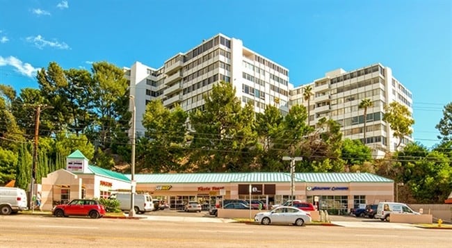
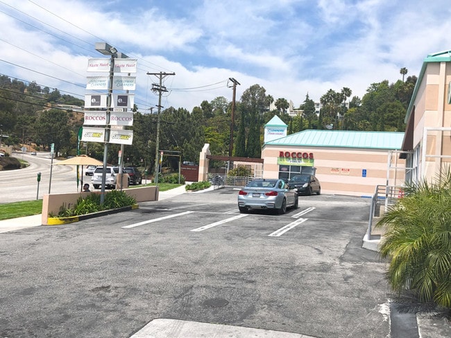
Property Record
17340 W Sunset Blvd, Pacific Palisades, CA 90272


NEARBY LISTINGS FOR SALE OR LEASE
Property Detail
17340 W Sunset Blvd
Los Angeles-Long Beach-Glendale, CA
Parcel Map La No 3068
4415-018-019
*TR=PARCEL MAP AS PER BK 87 P 13-14 OF PM LOT B
Storemultistory
Los Angeles
X
California
06037C1566G
b
2024
0.36 AC
2025
Pacific Palisades/Malibu
262704
Los Angeles
4,315 SF
DEMOGRAPHICS near 17340 W Sunset Blvd
1 Mile
3 Mile
5 Mile
2024 Total Population
6,082
32,396
128,272
2029 Population
5,961
31,794
126,042
Pop Growth 2024-2029
(1.99%)
(1.86%)
(1.74%)
Average Age
47
46
44
2024 Total Households
2,620
13,666
61,182
HH Growth 2024-2029
(2.14%)
(1.79%)
(1.78%)
Median Household Inc
$147,562
$167,625
$124,199
Avg Household Size
2.30
2.30
2.00
2024 Avg HH Vehicles
2.00
2.00
2.00
Median Home Value
$1,135,775
$1,138,534
$1,127,619
Median Year Built
1964
1968
1968
Nearby Places
Map Layers
Map Styles
 Street
 Aerial
- Restaurants
- Banks
- Shops
- Fitness
- Groceries
PUBLIC TRANSPORTATION
AIRPORT
Los Angeles International
DRIVE
WALK
Distance
Los Angeles International
25 min
13.1 mi
Bob Hope
DRIVE
WALK
Distance
Bob Hope
40 min
26.9 mi
Long Beach (Daugherty Field)
DRIVE
WALK
Distance
Long Beach (Daugherty Field)
44 min
33.3 mi
SALE & LEASE HISTORY
LISTING DATE
SALE/LEASE

Sep 24, 2016
For Sale
Sep 24, 2016
For Sale
Jun 12, 2018
For Lease
Nearby Properties
Address
Land Use
TOTAL SIZE
Lot Size
Zoning
Address
Land Use
TOTAL SIZE
Lot Size
Zoning
193,462 SF
64.72 AC
LAA1
Address
Land Use
TOTAL SIZE
Lot Size
Zoning
89,748 SF
2.13 AC
Address
Land Use
TOTAL SIZE
Lot Size
Zoning
37,989 SF
1 AC
SMR4*
Address
Land Use
TOTAL SIZE
Lot Size
Zoning
93,900 SF
1.73 AC
LAC2
Address
Land Use
TOTAL SIZE
Lot Size
Zoning
92,957 SF
0.56 AC
SMR2*
Address
Land Use
TOTAL SIZE
Lot Size
Zoning
22,751 SF
0.43 AC
Address
Land Use
TOTAL SIZE
Lot Size
Zoning
105,909 SF
2.08 AC
LAC2
Address
Land Use
TOTAL SIZE
Lot Size
Zoning
32,904 SF
5.60 AC
LAA1
Address
Land Use
TOTAL SIZE
Lot Size
Zoning
54,955 SF
0.52 AC
SMR3*
Address
Land Use
TOTAL SIZE
Lot Size
Zoning
44,199 SF
0.50 AC
SMR2*
Address
Land Use
TOTAL SIZE
Lot Size
Zoning
40,412 SF
0.51 AC
SMR2*
Address
Land Use
TOTAL SIZE
Lot Size
Zoning
43,738 SF
0.51 AC
SMR2*
Address
Land Use
TOTAL SIZE
Lot Size
Zoning
64,344 SF
1.04 AC
LAR3
Address
Land Use
TOTAL SIZE
Lot Size
Zoning
22,426 SF
0.43 AC
SMR4*
Address
Land Use
TOTAL SIZE
Lot Size
Zoning
41,077 SF
0.51 AC
SMR2*
Address
Land Use
TOTAL SIZE
Lot Size
Zoning
20,490 SF
0.49 AC
SMR2*
Address
Land Use
TOTAL SIZE
Lot Size
Zoning
41,832 SF
0.51 AC
SMR2*
Address
Land Use
TOTAL SIZE
Lot Size
Zoning
25,040 SF
4.19 AC
LAC2
Address
Land Use
TOTAL SIZE
Lot Size
Zoning
4,869 SF
0.45 AC
SMR1*
Address
Land Use
TOTAL SIZE
Lot Size
Zoning
89,671 SF
1.34 AC
LAC2
Address
Land Use
TOTAL SIZE
Lot Size
Zoning
16,200 SF
0.41 AC
LAR3
Address
Land Use
TOTAL SIZE
Lot Size
Zoning
10,413 SF
0.17 AC
LAC2
Address
Land Use
TOTAL SIZE
Lot Size
Zoning
7,085 SF
0.13 AC
LAC2
Address
Land Use
TOTAL SIZE
Lot Size
Zoning
2,342 SF
0.56 AC
SMRVC*
Address
Land Use
TOTAL SIZE
Lot Size
Zoning
30,603 SF
0.48 AC
LAC2
Address
Land Use
TOTAL SIZE
Lot Size
Zoning
24,813 SF
13.23 AC
LARE40
Address
Land Use
TOTAL SIZE
Lot Size
Zoning
21,576 SF
0.53 AC
SMR2*
Address
Land Use
TOTAL SIZE
Lot Size
Zoning
3,163 SF
0.40 AC
SMR1*
Address
Land Use
TOTAL SIZE
Lot Size
Zoning
0.99 AC
LAC1
The World's #1 Commercial Real Estate Marketplace
Connect with us
© 2026 CoStar Group
The information above has been obtained from sources believed reliable. While we do not doubt its accuracy we have not verified it and make no guarantee, warranty or representation about it. It is your responsibility to independently confirm its accuracy and completeness. Any projections, opinions, assumptions, or estimates used are for example only and do not represent the current or future performance of the property. The value of this transaction to you depends on tax and other factors which should be evaluated by your tax, financial, and legal advisors. You and your advisors should conduct a careful, independent investigation of the property to determine to your satisfaction the suitability of the property for your needs.