Property Record
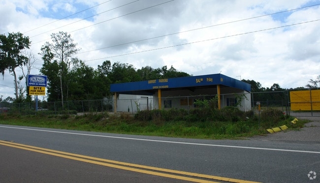
1735 Airport Rd, Jacksonville, FL 32218


NEARBY LISTINGS FOR SALE OR LEASE
Property Detail
1735 Airport Rd
019354-0200
Section Land
Parkinglot
24-1N-26E 7.251 PT S1/2 OF SW1/4 RECD O/R 14278-1550 BEING PARCEL A
X
Duval
12031C0181H
Florida
2024
7.15 AC
2025
Northeast Jacksonville
010301
Jacksonville (Florida)
14,448 SF
Jacksonville, FL
DEMOGRAPHICS near 1735 Airport Rd
1 Mile
3 Mile
5 Mile
2024 Total Population
1,178
20,177
64,280
2029 Population
1,299
21,508
68,015
Pop Growth 2024-2029
+ 10.27%
+ 6.60%
+ 5.81%
Average Age
37
38
38
2024 Total Households
589
7,958
24,174
HH Growth 2024-2029
+ 10.53%
+ 7.02%
+ 6.04%
Median Household Inc
$48,012
$59,463
$58,705
Avg Household Size
2.00
2.50
2.60
2024 Avg HH Vehicles
2.00
2.00
2.00
Median Home Value
$240,697
$229,690
$229,623
Median Year Built
2010
2004
2000
Nearby Places
Map Layers
Map Styles
 Street
 Aerial
- Restaurants
- Banks
- Shops
- Fitness
- Groceries
PUBLIC TRANSPORTATION
AIRPORT
Jacksonville International
DRIVE
WALK
Distance
Jacksonville International
6 min
1.9 mi
Freight Ports
Jacksonville Port
DRIVE
WALK
Distance
Jacksonville Port
21 min
13.9 mi
Nearby Properties
Address
Land Use
TOTAL SIZE
Lot Size
Zoning
Address
Land Use
TOTAL SIZE
Lot Size
Zoning
2,547,783 SF
5,204.78 AC
PUD
Address
Land Use
TOTAL SIZE
Lot Size
Zoning
877,030 SF
135.59 AC
IBP
Address
Land Use
TOTAL SIZE
Lot Size
Zoning
371,466 SF
42.67 AC
PUD
Address
Land Use
TOTAL SIZE
Lot Size
Zoning
226,421 SF
1.89 AC
PUD
Address
Land Use
TOTAL SIZE
Lot Size
Zoning
226,596 SF
13.23 AC
PUD
Address
Land Use
TOTAL SIZE
Lot Size
Zoning
189,895 SF
35.11 AC
PUD
Address
Land Use
TOTAL SIZE
Lot Size
Zoning
307,351 SF
34.25 AC
PUD
Address
Land Use
TOTAL SIZE
Lot Size
Zoning
658,743 SF
36.71 AC
PUD
Address
Land Use
TOTAL SIZE
Lot Size
Zoning
328,039 SF
18.88 AC
PUD
Address
Land Use
TOTAL SIZE
Lot Size
Zoning
846,897 SF
47.02 AC
PUD
Address
Land Use
TOTAL SIZE
Lot Size
Zoning
240,988 SF
18.11 AC
PUD
Address
Land Use
TOTAL SIZE
Lot Size
Zoning
201,630 SF
21.59 AC
PUD
Address
Land Use
TOTAL SIZE
Lot Size
Zoning
210,341 SF
8.84 AC
PUD
Address
Land Use
TOTAL SIZE
Lot Size
Zoning
205,093 SF
10.93 AC
CRO
Address
Land Use
TOTAL SIZE
Lot Size
Zoning
237,807 SF
13.52 AC
CRO
Address
Land Use
TOTAL SIZE
Lot Size
Zoning
556,924 SF
29.11 AC
PUD
Address
Land Use
TOTAL SIZE
Lot Size
Zoning
640,660 SF
28.30 AC
PUD
Address
Land Use
TOTAL SIZE
Lot Size
Zoning
317,695 SF
15.88 AC
PUD
Address
Land Use
TOTAL SIZE
Lot Size
Zoning
317,815 SF
17.56 AC
PUD
Address
Land Use
TOTAL SIZE
Lot Size
Zoning
163,276 SF
8.39 AC
PUD
Address
Land Use
TOTAL SIZE
Lot Size
Zoning
197,526 SF
11.98 AC
PUD
Address
Land Use
TOTAL SIZE
Lot Size
Zoning
395,655 SF
21.86 AC
PUD
Address
Land Use
TOTAL SIZE
Lot Size
Zoning
170,638 SF
10.77 AC
PUD
Address
Land Use
TOTAL SIZE
Lot Size
Zoning
287,410 SF
43.31 AC
RMD-C
Address
Land Use
TOTAL SIZE
Lot Size
Zoning
336,566 SF
25.63 AC
PUD
Address
Land Use
TOTAL SIZE
Lot Size
Zoning
149,367 SF
810.98 AC
PUD
Address
Land Use
TOTAL SIZE
Lot Size
Zoning
320,372 SF
18.41 AC
PUD
Address
Land Use
TOTAL SIZE
Lot Size
Zoning
117,647 SF
10.17 AC
PUD
Address
Land Use
TOTAL SIZE
Lot Size
Zoning
264,117 SF
22.48 AC
PUD
Address
Land Use
TOTAL SIZE
Lot Size
Zoning
201,300 SF
15.83 AC
PUD
The World's #1 Commercial Real Estate Marketplace
Connect with us
© 2025 CoStar Group
The information above has been obtained from sources believed reliable. While we do not doubt its accuracy we have not verified it and make no guarantee, warranty or representation about it. It is your responsibility to independently confirm its accuracy and completeness. Any projections, opinions, assumptions, or estimates used are for example only and do not represent the current or future performance of the property. The value of this transaction to you depends on tax and other factors which should be evaluated by your tax, financial, and legal advisors. You and your advisors should conduct a careful, independent investigation of the property to determine to your satisfaction the suitability of the property for your needs.