Property Record
17350 Interstate 20 S Access Rd, Canton, TX 75103

Save to a Folder
{{folder.Name}}
{{folder.ListingIds.length}} Properties
{{folder.ListingIds.length}} Property
Create a New Folder
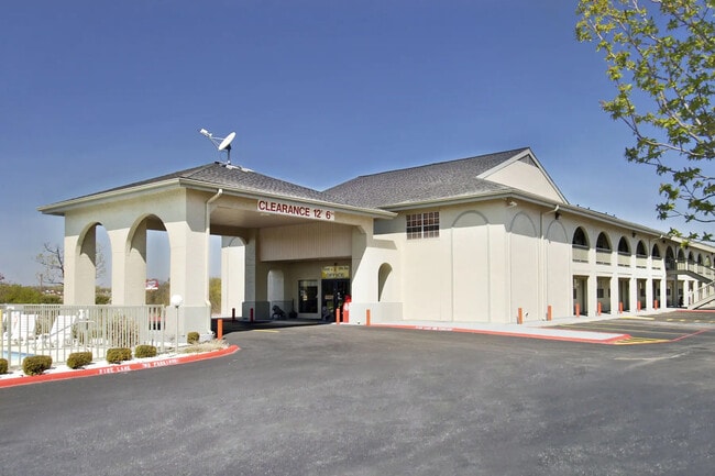
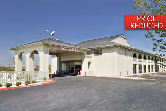
Property Detail
17350 Interstate 20 S Access Rd
R000049595
ACRES: 2.317 ABST: 618 SUR: Q C NUGENT SUPER 8
Commercialnec
VAN ZANDT
B and X Area of moderate flood hazard, usually the area between the limits of the 100-year and 500-year floods.
Texas
2025
2.32 AC
2025
Texas East Area
950601
Other Market Areas
9,720 SF
NEARBY LISTINGS FOR SALE OR LEASE
-
-
View all Canton listings for sale on LoopNet.com
DEMOGRAPHICS near 17350 Interstate 20 S Access Rd
1 mile
3 mile
5 mile
2025 Total Population
372
5,755
10,961
2030 Population
401
6,218
11,827
Pop Growth 2025-2030
+ 7.80%
+ 8.05%
+ 7.90%
Average Age
43
41
42
2025 Total Households
144
2,218
4,201
HH Growth 2025-2030
+ 7.64%
+ 7.98%
+ 7.78%
Median Household Inc
$55,416
$66,129
$67,746
Avg Household Size
2.50
2.50
2.50
2025 Avg HH Vehicles
2.00
2.00
2.00
Median Home Value
$279,166
$235,046
$247,947
Median Year Built
1990
1983
1988
Nearby Places
Map Layers
Map Styles
 Street
 Aerial
Layers
 Traffic
 Biking
Places
Listings with unknown addresses are not visible on the map
- Restaurants
- Banks
- Shops
- Fitness
- Groceries
PUBLIC TRANSPORTATION
AIRPORT
Tyler Pounds Regional
Drive
Walk
Distance
Tyler Pounds Regional
43 min
35.7 mi
SALE & LEASE HISTORY
LISTING DATE
SALE/LEASE

May 11, 2022
For Sale
Nearby Properties
Address
Land Use
TOTAL SIZE
Lot Size
Zoning
Address
Land Use
TOTAL SIZE
Lot Size
Zoning
3,852 SF
58.33 AC
Address
Land Use
TOTAL SIZE
Lot Size
Zoning
33,835 SF
10 AC
Address
Land Use
TOTAL SIZE
Lot Size
Zoning
151,270 SF
18.77 AC
Address
Land Use
TOTAL SIZE
Lot Size
Zoning
20,776 SF
14.81 AC
Address
Land Use
TOTAL SIZE
Lot Size
Zoning
37,200 SF
4.50 AC
Address
Land Use
TOTAL SIZE
Lot Size
Zoning
1,576 SF
77.36 AC
Address
Land Use
TOTAL SIZE
Lot Size
Zoning
2,244 SF
34.37 AC
Address
Land Use
TOTAL SIZE
Lot Size
Zoning
427.99 AC
Address
Land Use
TOTAL SIZE
Lot Size
Zoning
72,880 SF
7.59 AC
Address
Land Use
TOTAL SIZE
Lot Size
Zoning
37,696 SF
7.97 AC
Address
Land Use
TOTAL SIZE
Lot Size
Zoning
30,400 SF
6.37 AC
Address
Land Use
TOTAL SIZE
Lot Size
Zoning
75,450 SF
10.84 AC
Address
Land Use
TOTAL SIZE
Lot Size
Zoning
58,436 SF
6.57 AC
Address
Land Use
TOTAL SIZE
Lot Size
Zoning
Address
Land Use
TOTAL SIZE
Lot Size
Zoning
5,960 SF
40.31 AC
Address
Land Use
TOTAL SIZE
Lot Size
Zoning
47,780 SF
4.90 AC
Address
Land Use
TOTAL SIZE
Lot Size
Zoning
37,320 SF
9 AC
Address
Land Use
TOTAL SIZE
Lot Size
Zoning
38,120 SF
2.05 AC
Address
Land Use
TOTAL SIZE
Lot Size
Zoning
196,909 SF
9.81 AC
Address
Land Use
TOTAL SIZE
Lot Size
Zoning
10,200 SF
40.42 AC
Address
Land Use
TOTAL SIZE
Lot Size
Zoning
19,096 SF
5 AC
Address
Land Use
TOTAL SIZE
Lot Size
Zoning
9,450 SF
3.48 AC
Address
Land Use
TOTAL SIZE
Lot Size
Zoning
92,271 SF
10.98 AC
Address
Land Use
TOTAL SIZE
Lot Size
Zoning
14,848 SF
3.03 AC
Address
Land Use
TOTAL SIZE
Lot Size
Zoning
16,000 SF
5 AC
Address
Land Use
TOTAL SIZE
Lot Size
Zoning
36,476 SF
9.53 AC
Address
Land Use
TOTAL SIZE
Lot Size
Zoning
8,388 SF
0.36 AC
Address
Land Use
TOTAL SIZE
Lot Size
Zoning
20,352 SF
114.28 AC
The World's #1 Commercial Real Estate Marketplace
Connect with us
© 2026 CoStar Group
The information above has been obtained from sources believed reliable. While we do not doubt its accuracy we have not verified it and make no guarantee, warranty or representation about it. It is your responsibility to independently confirm its accuracy and completeness. Any projections, opinions, assumptions, or estimates used are for example only and do not represent the current or future performance of the property. The value of this transaction to you depends on tax and other factors which should be evaluated by your tax, financial, and legal advisors. You and your advisors should conduct a careful, independent investigation of the property to determine to your satisfaction the suitability of the property for your needs.