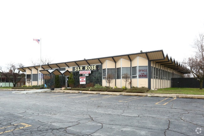
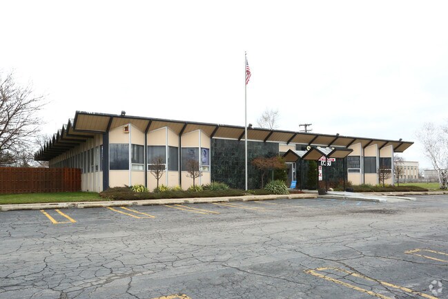
Property Record
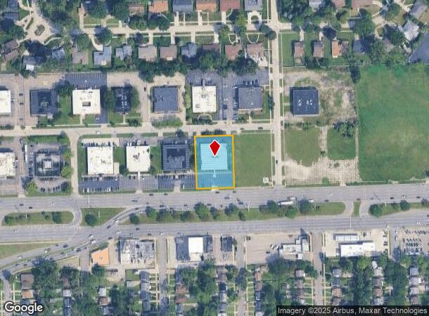
17360 W 8 Mile Rd, Southfield, MI 48075
NEARBY LISTINGS FOR SALE OR LEASE
Property Detail
17360 W 8 Mile Rd
Detroit-Warren-Dearborn, MI
Northland Park
24-36-355-004
T1N,R10E,SEC 36 10 NORTHLAND PARK LOT 10
Officebuilding
Oakland
X
Michigan
26163C0100E
10
2024
0.77 AC
2022
Southfield
162300
Detroit
9,600 SF
DEMOGRAPHICS near 17360 W 8 Mile Rd
1 Mile
3 Mile
5 Mile
2024 Total Population
13,364
142,715
360,512
2029 Population
13,284
139,769
354,384
Pop Growth 2024-2029
(0.60%)
(2.06%)
(1.70%)
Average Age
40
40
40
2024 Total Households
5,406
57,590
150,252
HH Growth 2024-2029
(0.59%)
(2.08%)
(1.70%)
Median Household Inc
$45,081
$47,464
$52,784
Avg Household Size
2.40
2.40
2.30
2024 Avg HH Vehicles
1.00
1.00
1.00
Median Home Value
$104,091
$119,313
$153,121
Median Year Built
1956
1955
1953
Nearby Places
Map Layers
Map Styles
 Street
 Aerial
- Restaurants
- Banks
- Shops
- Fitness
- Groceries
PUBLIC TRANSPORTATION
COMMUTER RAIL
DRIVE
WALK
Distance
15 min
7.0 mi
DRIVE
WALK
Distance
19 min
9.4 mi
AIRPORT
Windsor International
DRIVE
WALK
Distance
Windsor International
43 min
23.0 mi
Detroit Metro Wayne County
DRIVE
WALK
Distance
Detroit Metro Wayne County
37 min
23.7 mi
Nearby Properties
Address
Land Use
TOTAL SIZE
Lot Size
Zoning
Address
Land Use
TOTAL SIZE
Lot Size
Zoning
925,367 SF
12.82 AC
R6
Address
Land Use
TOTAL SIZE
Lot Size
Zoning
2,373,792 SF
17.35 AC
RC
Address
Land Use
TOTAL SIZE
Lot Size
Zoning
882,862 SF
8.22 AC
RC
Address
Land Use
TOTAL SIZE
Lot Size
Zoning
187,801 SF
5.49 AC
RM-2
Address
Land Use
TOTAL SIZE
Lot Size
Zoning
859,104 SF
9.59 AC
RC
Address
Land Use
TOTAL SIZE
Lot Size
Zoning
655,519 SF
9.18 AC
ERO
Address
Land Use
TOTAL SIZE
Lot Size
Zoning
280,500 SF
3.58 AC
RC
Address
Land Use
TOTAL SIZE
Lot Size
Zoning
300,830 SF
54 AC
LI
Address
Land Use
TOTAL SIZE
Lot Size
Zoning
120,093 SF
38.18 AC
TV-R
Address
Land Use
TOTAL SIZE
Lot Size
Zoning
417,880 SF
6.76 AC
RM-2
Address
Land Use
TOTAL SIZE
Lot Size
Zoning
174 SF
14.17 AC
RM
Address
Land Use
TOTAL SIZE
Lot Size
Zoning
290,448 SF
9.01 AC
O
Address
Land Use
TOTAL SIZE
Lot Size
Zoning
273,000 SF
17.31 AC
LI
Address
Land Use
TOTAL SIZE
Lot Size
Zoning
202,736 SF
20 AC
PD
Address
Land Use
TOTAL SIZE
Lot Size
Zoning
397,200 SF
14.07 AC
RMU
Address
Land Use
TOTAL SIZE
Lot Size
Zoning
10.32 AC
LI
Address
Land Use
TOTAL SIZE
Lot Size
Zoning
133,544 SF
19.65 AC
ERO
Address
Land Use
TOTAL SIZE
Lot Size
Zoning
143,700 SF
3.27 AC
PD
Address
Land Use
TOTAL SIZE
Lot Size
Zoning
97,082 SF
67.47 AC
TV-R
Address
Land Use
TOTAL SIZE
Lot Size
Zoning
110,540 SF
15.30 AC
RC
Address
Land Use
TOTAL SIZE
Lot Size
Zoning
178,854 SF
9.43 AC
RC
Address
Land Use
TOTAL SIZE
Lot Size
Zoning
163,661 SF
8.92 AC
PD
Address
Land Use
TOTAL SIZE
Lot Size
Zoning
290,448 SF
8.92 AC
O
Address
Land Use
TOTAL SIZE
Lot Size
Zoning
129 SF
15.16 AC
RM
Address
Land Use
TOTAL SIZE
Lot Size
Zoning
216 SF
13.14 AC
RM
Address
Land Use
TOTAL SIZE
Lot Size
Zoning
240,520 SF
8.14 AC
B-3
Address
Land Use
TOTAL SIZE
Lot Size
Zoning
230,048 SF
11.06 AC
RC
Address
Land Use
TOTAL SIZE
Lot Size
Zoning
165,829 SF
5.56 AC
R5
Address
Land Use
TOTAL SIZE
Lot Size
Zoning
Address
Land Use
TOTAL SIZE
Lot Size
Zoning
97.05 AC
RS
The World's #1 Commercial Real Estate Marketplace
Connect with us
© 2025 CoStar Group
The information above has been obtained from sources believed reliable. While we do not doubt its accuracy we have not verified it and make no guarantee, warranty or representation about it. It is your responsibility to independently confirm its accuracy and completeness. Any projections, opinions, assumptions, or estimates used are for example only and do not represent the current or future performance of the property. The value of this transaction to you depends on tax and other factors which should be evaluated by your tax, financial, and legal advisors. You and your advisors should conduct a careful, independent investigation of the property to determine to your satisfaction the suitability of the property for your needs.