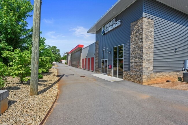
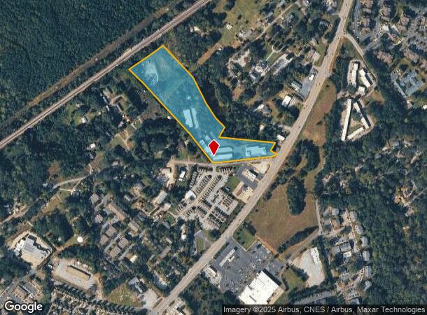
Property Record
1737 Old Central Rd, Central, SC 29630

Current Lease Availabilities
NEARBY LISTINGS FOR SALE OR LEASE
Property Detail
1737 Old Central Rd
4054-08-99-9746
Boundary Survey & Parcel Combination Sur
Sfr
S/SIDE OLD CENTRAL RD PLAT 264/4,5 PLAT 433/4B PLAT 436/4A, PLAT 603/173, PLAT 603/173
X
Pickens
45007C0085E
South Carolina
2025
10.23 AC
2024
Outlying Pickens County
011104
Greenville/Spartanburg
9,403 SF
Greenville-Anderson-Greer, SC
DEMOGRAPHICS near 1737 Old Central Rd
1 mile
3 mile
5 mile
2024 Total Population
6,133
25,125
40,768
2029 Population
6,305
25,888
42,297
Pop Growth 2024-2029
+ 2.80%
+ 3.04%
+ 3.75%
Average Age
31
34
34
2024 Total Households
2,702
10,109
15,463
HH Growth 2024-2029
+ 3.11%
+ 3.18%
+ 4.19%
Median Household Inc
$29,948
$38,950
$42,015
Avg Household Size
2.20
2.30
2.30
2024 Avg HH Vehicles
2.00
2.00
2.00
Median Home Value
$247,000
$271,581
$242,119
Median Year Built
1994
1991
1990
Nearby Places
Map Layers
Map Styles
 Street
 Aerial
Transit
 Traffic
 Biking
Places
Listings with unknown addresses are not visible on the map
- Restaurants
- Banks
- Shops
- Fitness
- Groceries
PUBLIC TRANSPORTATION
COMMUTER RAIL
Clemson Amtrak Station (Crescent - Amtrak)
Drive
Walk
Distance
Clemson Amtrak Station (Crescent - Amtrak)
5 min
2.9 mi
Freight Ports
Georgia Ports - Savannah
Drive
Walk
Distance
Georgia Ports - Savannah
321 min
228.8 mi
Nearby Properties
Address
Land Use
TOTAL SIZE
Lot Size
Zoning
Address
Land Use
TOTAL SIZE
Lot Size
Zoning
21,573 SF
4.91 AC
CP 2 COMMU
Address
Land Use
TOTAL SIZE
Lot Size
Zoning
5,208 SF
11.33 AC
RM16
Address
Land Use
TOTAL SIZE
Lot Size
Zoning
119,175 SF
2.11 AC
RM 3 MULTI
Address
Land Use
TOTAL SIZE
Lot Size
Zoning
259,277 SF
3.39 AC
PD17
Address
Land Use
TOTAL SIZE
Lot Size
Zoning
24,882 SF
12.94 AC
PD
Address
Land Use
TOTAL SIZE
Lot Size
Zoning
54,420 SF
9.52 AC
PD16
Address
Land Use
TOTAL SIZE
Lot Size
Zoning
1,544 SF
2.29 AC
RM 2 TWO F
Address
Land Use
TOTAL SIZE
Lot Size
Zoning
15,783 SF
1.43 AC
RM 4 MULTI
Address
Land Use
TOTAL SIZE
Lot Size
Zoning
2,204 SF
35.62 AC
RM 1 TWO F
Address
Land Use
TOTAL SIZE
Lot Size
Zoning
325,684 SF
19.26 AC
PD
Address
Land Use
TOTAL SIZE
Lot Size
Zoning
26,864 SF
0.98 AC
GC
Address
Land Use
TOTAL SIZE
Lot Size
Zoning
4,688 SF
10.93 AC
RM 3 MULTI
Address
Land Use
TOTAL SIZE
Lot Size
Zoning
185,383 SF
2.52 AC
GENERAL CO
Address
Land Use
TOTAL SIZE
Lot Size
Zoning
4.97 AC
PD
Address
Land Use
TOTAL SIZE
Lot Size
Zoning
267,298 SF
1.68 AC
GC
Address
Land Use
TOTAL SIZE
Lot Size
Zoning
3,160 SF
2.30 AC
RM16 RESID
Address
Land Use
TOTAL SIZE
Lot Size
Zoning
2,463 SF
42.07 AC
Address
Land Use
TOTAL SIZE
Lot Size
Zoning
7,070 SF
2.59 AC
GENERAL CO
Address
Land Use
TOTAL SIZE
Lot Size
Zoning
17 AC
RIL RESEAR
Address
Land Use
TOTAL SIZE
Lot Size
Zoning
6,574 SF
0.50 AC
RLC
Address
Land Use
TOTAL SIZE
Lot Size
Zoning
1,484 SF
1.99 AC
R 20 SINGL
Address
Land Use
TOTAL SIZE
Lot Size
Zoning
11,881 SF
2.02 AC
GENERAL CO
Address
Land Use
TOTAL SIZE
Lot Size
Zoning
5,865 SF
1.39 AC
R20
Address
Land Use
TOTAL SIZE
Lot Size
Zoning
7,692 SF
0.40 AC
RIL
Address
Land Use
TOTAL SIZE
Lot Size
Zoning
20,686 SF
15.84 AC
RM16
Address
Land Use
TOTAL SIZE
Lot Size
Zoning
2,498 SF
8.27 AC
CP2
Address
Land Use
TOTAL SIZE
Lot Size
Zoning
10.09 AC
GC
Address
Land Use
TOTAL SIZE
Lot Size
Zoning
249,600 SF
12.61 AC
RM16
Address
Land Use
TOTAL SIZE
Lot Size
Zoning
20,927 SF
2.66 AC
GC
Address
Land Use
TOTAL SIZE
Lot Size
Zoning
2,705 SF
3.88 AC
RM3
The World's #1 Commercial Real Estate Marketplace
Connect with us
© 2026 CoStar Group
The information above has been obtained from sources believed reliable. While we do not doubt its accuracy we have not verified it and make no guarantee, warranty or representation about it. It is your responsibility to independently confirm its accuracy and completeness. Any projections, opinions, assumptions, or estimates used are for example only and do not represent the current or future performance of the property. The value of this transaction to you depends on tax and other factors which should be evaluated by your tax, financial, and legal advisors. You and your advisors should conduct a careful, independent investigation of the property to determine to your satisfaction the suitability of the property for your needs.