Property Record
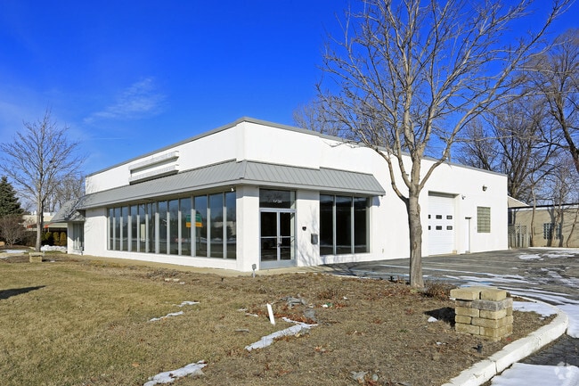
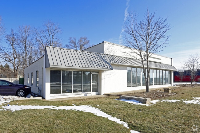
1739 S Telegraph Rd, Bloomfield Hills, MI 48302

NEARBY LISTINGS FOR SALE OR LEASE
Property Detail
1739 S Telegraph Rd
Detroit-Warren-Dearborn, MI
Supervisors Plat #2
19-06-207-018
T2N, R10E, SEC 6 SUPERVISOR'S PLAT NO. 2 LOT 238 ALSO 1/2 OF VACATED ALLEY ADJ TO SAME, ALSO LOTS 239 TO 245 INCL, ALSO 1/2
Storebuilding
Oakland
X
Michigan
26125C0506F
238-245
2024
0.42 AC
2024
Pontiac
150100
Detroit
5,525 SF
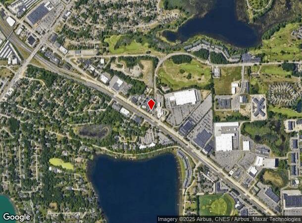
DEMOGRAPHICS near 1739 S Telegraph Rd
1 Mile
3 Mile
5 Mile
2024 Total Population
6,330
65,896
163,227
2029 Population
6,449
65,963
162,692
Pop Growth 2024-2029
+ 1.88%
+ 0.10%
(0.33%)
Average Age
44
41
41
2024 Total Households
2,902
26,923
65,917
HH Growth 2024-2029
+ 2.03%
+ 0.04%
(0.34%)
Median Household Inc
$59,166
$57,039
$67,468
Avg Household Size
2.10
2.30
2.40
2024 Avg HH Vehicles
2.00
2.00
2.00
Median Home Value
$296,540
$221,754
$271,864
Median Year Built
1974
1964
1968
Nearby Places
Map Layers
Map Styles
 Street
 Aerial
- Restaurants
- Banks
- Shops
- Fitness
- Groceries
PUBLIC TRANSPORTATION
COMMUTER RAIL
Pontiac Amtrak Station (Wolverine - Amtrak)
DRIVE
WALK
Distance
Pontiac Amtrak Station (Wolverine - Amtrak)
6 min
2.5 mi
Troy Amtrak Station (Wolverine - Amtrak)
DRIVE
WALK
Distance
Troy Amtrak Station (Wolverine - Amtrak)
18 min
9.6 mi
AIRPORT
Detroit Metro Wayne County
DRIVE
WALK
Distance
Detroit Metro Wayne County
54 min
39.3 mi
Windsor International
DRIVE
WALK
Distance
Windsor International
59 min
39.8 mi
Freight Ports
Port of Toledo
DRIVE
WALK
Distance
Port of Toledo
104 min
80.9 mi
Nearby Properties
Address
Land Use
TOTAL SIZE
Lot Size
Zoning
Address
Land Use
TOTAL SIZE
Lot Size
Zoning
526,398 SF
32.99 AC
Address
Land Use
TOTAL SIZE
Lot Size
Zoning
608,251 SF
50.49 AC
II
Address
Land Use
TOTAL SIZE
Lot Size
Zoning
481,186 SF
42.14 AC
AI
Address
Land Use
TOTAL SIZE
Lot Size
Zoning
374,400 SF
4.10 AC
Address
Land Use
TOTAL SIZE
Lot Size
Zoning
601,151 SF
Address
Land Use
TOTAL SIZE
Lot Size
Zoning
221,340 SF
26.88 AC
Address
Land Use
TOTAL SIZE
Lot Size
Zoning
156,668 SF
13.19 AC
BI
Address
Land Use
TOTAL SIZE
Lot Size
Zoning
23.28 AC
AI
Address
Land Use
TOTAL SIZE
Lot Size
Zoning
97,172 SF
13.82 AC
BI
Address
Land Use
TOTAL SIZE
Lot Size
Zoning
454,573 SF
Address
Land Use
TOTAL SIZE
Lot Size
Zoning
79,263 SF
22.27 AC
Address
Land Use
TOTAL SIZE
Lot Size
Zoning
903,018 SF
73.92 AC
II
Address
Land Use
TOTAL SIZE
Lot Size
Zoning
145,712 SF
10.51 AC
BV
Address
Land Use
TOTAL SIZE
Lot Size
Zoning
87,560 SF
7.94 AC
BI
Address
Land Use
TOTAL SIZE
Lot Size
Zoning
288,124 SF
15.76 AC
Address
Land Use
TOTAL SIZE
Lot Size
Zoning
93,706 SF
1.13 AC
Address
Land Use
TOTAL SIZE
Lot Size
Zoning
71,588 SF
3.72 AC
BI
Address
Land Use
TOTAL SIZE
Lot Size
Zoning
67,413 SF
4.32 AC
BI
Address
Land Use
TOTAL SIZE
Lot Size
Zoning
55,912 SF
1.11 AC
Address
Land Use
TOTAL SIZE
Lot Size
Zoning
143,701 SF
9.85 AC
AI
Address
Land Use
TOTAL SIZE
Lot Size
Zoning
89,442 SF
9.21 AC
BI
Address
Land Use
TOTAL SIZE
Lot Size
Zoning
562,472 SF
39.69 AC
Address
Land Use
TOTAL SIZE
Lot Size
Zoning
96,587 SF
5 AC
BI
Address
Land Use
TOTAL SIZE
Lot Size
Zoning
137,256 SF
14.97 AC
BI
Address
Land Use
TOTAL SIZE
Lot Size
Zoning
27,442 SF
3.81 AC
BI
Address
Land Use
TOTAL SIZE
Lot Size
Zoning
64,053 SF
2.69 AC
Address
Land Use
TOTAL SIZE
Lot Size
Zoning
211,861 SF
2.69 AC
BI
Address
Land Use
TOTAL SIZE
Lot Size
Zoning
55,269 SF
5.40 AC
BI
Address
Land Use
TOTAL SIZE
Lot Size
Zoning
454,573 SF
39.77 AC
Address
Land Use
TOTAL SIZE
Lot Size
Zoning
80,600 SF
51.48 AC
The World's #1 Commercial Real Estate Marketplace
Connect with us
© 2025 CoStar Group
The information above has been obtained from sources believed reliable. While we do not doubt its accuracy we have not verified it and make no guarantee, warranty or representation about it. It is your responsibility to independently confirm its accuracy and completeness. Any projections, opinions, assumptions, or estimates used are for example only and do not represent the current or future performance of the property. The value of this transaction to you depends on tax and other factors which should be evaluated by your tax, financial, and legal advisors. You and your advisors should conduct a careful, independent investigation of the property to determine to your satisfaction the suitability of the property for your needs.