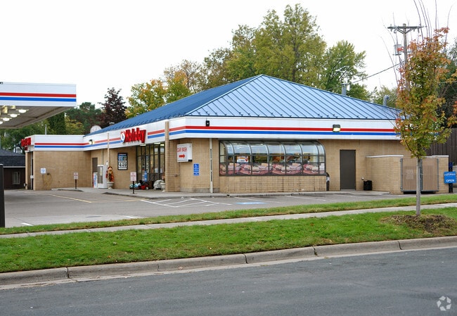
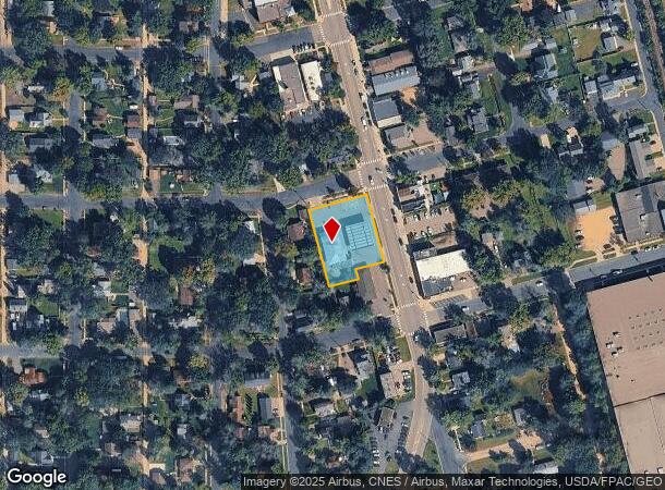
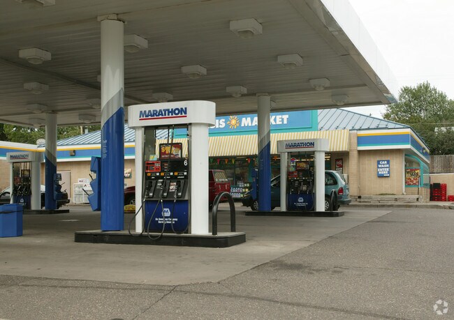
Property Record
174 3Rd St N, Bayport, MN 55003

NEARBY LISTINGS FOR SALE OR LEASE
Property Detail
174 3Rd St N
Minneapolis-St. Paul-Bloomington, MN-WI
Bayport
11-029-20-23-0039
BLOCK 60 LOT 12 SUBDIVISIONCD 2670 SUBDIVISIONNAME BAYPORT (FORMERLY SO STILLWATER) BLOCK 60 LOT 11 SUBDIVISIONCD 2670 SUBDIV
Commercialnec
Washington
X
Minnesota
27163C0269E
12
2025
0.66 AC
2024
Woodbury
070704
Minneapolis/St Paul
850 SF
DEMOGRAPHICS near 174 3Rd St N
1 Mile
3 Mile
5 Mile
2024 Total Population
2,745
20,755
55,483
2029 Population
2,989
22,413
60,084
Pop Growth 2024-2029
+ 8.89%
+ 7.99%
+ 8.29%
Average Age
40
44
43
2024 Total Households
1,138
8,797
22,477
HH Growth 2024-2029
+ 8.88%
+ 8.15%
+ 8.40%
Median Household Inc
$93,023
$101,489
$106,986
Avg Household Size
2.40
2.30
2.40
2024 Avg HH Vehicles
2.00
2.00
2.00
Median Home Value
$374,251
$375,954
$384,473
Median Year Built
1969
1977
1985
Nearby Places
Map Layers
Map Styles
 Street
 Aerial
- Restaurants
- Banks
- Shops
- Fitness
- Groceries
PUBLIC TRANSPORTATION
AIRPORT
Minneapolis-St Paul International/Wold-Chamberlain
DRIVE
WALK
Distance
Minneapolis-St Paul International/Wold-Chamberlain
40 min
29.4 mi
Freight Ports
Port Milwaukee
DRIVE
WALK
Distance
Port Milwaukee
349 min
317.0 mi
Nearby Properties
Address
Land Use
TOTAL SIZE
Lot Size
Zoning
Address
Land Use
TOTAL SIZE
Lot Size
Zoning
395,455 SF
Address
Land Use
TOTAL SIZE
Lot Size
Zoning
519,636 SF
40.40 AC
Address
Land Use
TOTAL SIZE
Lot Size
Zoning
600,000 SF
77.70 AC
Address
Land Use
TOTAL SIZE
Lot Size
Zoning
197,300 SF
0.55 AC
Address
Land Use
TOTAL SIZE
Lot Size
Zoning
198,596 SF
5 AC
Address
Land Use
TOTAL SIZE
Lot Size
Zoning
Address
Land Use
TOTAL SIZE
Lot Size
Zoning
84.75 AC
Address
Land Use
TOTAL SIZE
Lot Size
Zoning
81,240 SF
18.16 AC
Address
Land Use
TOTAL SIZE
Lot Size
Zoning
74,608 SF
0.66 AC
Address
Land Use
TOTAL SIZE
Lot Size
Zoning
Address
Land Use
TOTAL SIZE
Lot Size
Zoning
212,733 SF
23.97 AC
Address
Land Use
TOTAL SIZE
Lot Size
Zoning
132,967 SF
18.10 AC
Address
Land Use
TOTAL SIZE
Lot Size
Zoning
110,932 SF
1.59 AC
Address
Land Use
TOTAL SIZE
Lot Size
Zoning
66,665 SF
9.77 AC
Address
Land Use
TOTAL SIZE
Lot Size
Zoning
7,312 SF
3.43 AC
Address
Land Use
TOTAL SIZE
Lot Size
Zoning
46,145 SF
4.75 AC
Address
Land Use
TOTAL SIZE
Lot Size
Zoning
84,546 SF
1.10 AC
Address
Land Use
TOTAL SIZE
Lot Size
Zoning
71,848 SF
1.52 AC
Address
Land Use
TOTAL SIZE
Lot Size
Zoning
91,354 SF
5.51 AC
Address
Land Use
TOTAL SIZE
Lot Size
Zoning
70,273 SF
8.49 AC
Address
Land Use
TOTAL SIZE
Lot Size
Zoning
119,795 SF
1.48 AC
Address
Land Use
TOTAL SIZE
Lot Size
Zoning
243,612 SF
3.32 AC
Address
Land Use
TOTAL SIZE
Lot Size
Zoning
194,684 SF
14.86 AC
Address
Land Use
TOTAL SIZE
Lot Size
Zoning
268,209 SF
4.55 AC
Address
Land Use
TOTAL SIZE
Lot Size
Zoning
84,832 SF
1.61 AC
Address
Land Use
TOTAL SIZE
Lot Size
Zoning
120 SF
8.27 AC
Address
Land Use
TOTAL SIZE
Lot Size
Zoning
94,251 SF
Address
Land Use
TOTAL SIZE
Lot Size
Zoning
43,888 SF
1.37 AC
Address
Land Use
TOTAL SIZE
Lot Size
Zoning
30,352 SF
0.58 AC
Address
Land Use
TOTAL SIZE
Lot Size
Zoning
94,188 SF
The World's #1 Commercial Real Estate Marketplace
Connect with us
© 2025 CoStar Group
The information above has been obtained from sources believed reliable. While we do not doubt its accuracy we have not verified it and make no guarantee, warranty or representation about it. It is your responsibility to independently confirm its accuracy and completeness. Any projections, opinions, assumptions, or estimates used are for example only and do not represent the current or future performance of the property. The value of this transaction to you depends on tax and other factors which should be evaluated by your tax, financial, and legal advisors. You and your advisors should conduct a careful, independent investigation of the property to determine to your satisfaction the suitability of the property for your needs.