Property Record
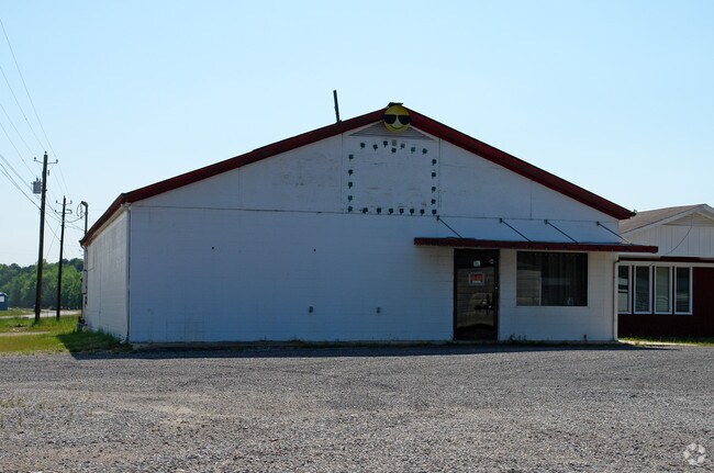
174 7Th Ave Ne, Carbon Hill, AL 35549


NEARBY LISTINGS FOR SALE OR LEASE
-
-
View all Carbon Hill listings for sale on LoopNet.com
Property Detail
174 7Th Ave Ne
08-09-29-3-000-010-0070
P/O SW/SW 29-13-9 BEG @ INT S R/W BROOKSIDE RD WITH E R/W WIDOWS LN E150 S64.13 W103.76 SW57.6 N ALG R/W 84.46 TO BEG
Commercialofficeresidentialmixeduse
Walker
AE
Alabama
01127C0119E
0.22 AC
2024
Walker County
2024
Birmingham
021100
Birmingham-Hoover, AL
2,480 SF
DEMOGRAPHICS near 174 7Th Ave Ne
1 Mile
3 Mile
5 Mile
2024 Total Population
804
2,181
3,751
2029 Population
757
2,069
3,605
Pop Growth 2024-2029
(5.85%)
(5.14%)
(3.89%)
Average Age
46
44
44
2024 Total Households
340
915
1,554
HH Growth 2024-2029
(6.18%)
(5.36%)
(3.93%)
Median Household Inc
$25,795
$37,350
$39,214
Avg Household Size
2.10
2.30
2.30
2024 Avg HH Vehicles
2.00
2.00
2.00
Median Home Value
$61,635
$68,279
$78,149
Median Year Built
1976
1978
1981
Nearby Places
Map Layers
Map Styles
 Street
 Aerial
- Restaurants
- Banks
- Shops
- Fitness
- Groceries
SALE & LEASE HISTORY
LISTING DATE
SALE/LEASE

Feb 17, 2022
For Sale
Nearby Properties
Address
Land Use
TOTAL SIZE
Lot Size
Zoning
Address
Land Use
TOTAL SIZE
Lot Size
Zoning
1,454 SF
4.30 AC
OT
Address
Land Use
TOTAL SIZE
Lot Size
Zoning
13,445 SF
2.10 AC
O
Address
Land Use
TOTAL SIZE
Lot Size
Zoning
4,800 SF
1.50 AC
O
Address
Land Use
TOTAL SIZE
Lot Size
Zoning
3,119 SF
2 AC
O
Address
Land Use
TOTAL SIZE
Lot Size
Zoning
1,392 SF
5.70 AC
A
Address
Land Use
TOTAL SIZE
Lot Size
Zoning
12,250 SF
0.47 AC
CO
Address
Land Use
TOTAL SIZE
Lot Size
Zoning
4,800 SF
0.90 AC
S
Address
Land Use
TOTAL SIZE
Lot Size
Zoning
8,950 SF
0.31 AC
CO
Address
Land Use
TOTAL SIZE
Lot Size
Zoning
6,400 SF
0.80 AC
C
Address
Land Use
TOTAL SIZE
Lot Size
Zoning
4,852 SF
0.40 AC
CO
Address
Land Use
TOTAL SIZE
Lot Size
Zoning
2,400 SF
0.80 AC
O
Address
Land Use
TOTAL SIZE
Lot Size
Zoning
3,456 SF
0.80 AC
OT
Address
Land Use
TOTAL SIZE
Lot Size
Zoning
3,972 SF
0.80 AC
O
Address
Land Use
TOTAL SIZE
Lot Size
Zoning
5,328 SF
0.16 AC
SF
Address
Land Use
TOTAL SIZE
Lot Size
Zoning
12,800 SF
0.10 AC
CO
Address
Land Use
TOTAL SIZE
Lot Size
Zoning
2,850 SF
0.60 AC
O
Address
Land Use
TOTAL SIZE
Lot Size
Zoning
2,908 SF
287 AC
OT
Address
Land Use
TOTAL SIZE
Lot Size
Zoning
1,836 SF
0.50 AC
OT
Address
Land Use
TOTAL SIZE
Lot Size
Zoning
1,600 SF
0.90 AC
OT
Address
Land Use
TOTAL SIZE
Lot Size
Zoning
2,153 SF
0.30 AC
S
Address
Land Use
TOTAL SIZE
Lot Size
Zoning
2,952 SF
0.44 AC
O
Address
Land Use
TOTAL SIZE
Lot Size
Zoning
2,844 SF
0.30 AC
C
Address
Land Use
TOTAL SIZE
Lot Size
Zoning
293 AC
CO
Address
Land Use
TOTAL SIZE
Lot Size
Zoning
4,160 SF
0.20 AC
CO
Address
Land Use
TOTAL SIZE
Lot Size
Zoning
2,216 SF
16.60 AC
Address
Land Use
TOTAL SIZE
Lot Size
Zoning
2,560 SF
0.32 AC
S
Address
Land Use
TOTAL SIZE
Lot Size
Zoning
5,222 SF
0.10 AC
SF
The World's #1 Commercial Real Estate Marketplace
Connect with us
© 2026 CoStar Group
The information above has been obtained from sources believed reliable. While we do not doubt its accuracy we have not verified it and make no guarantee, warranty or representation about it. It is your responsibility to independently confirm its accuracy and completeness. Any projections, opinions, assumptions, or estimates used are for example only and do not represent the current or future performance of the property. The value of this transaction to you depends on tax and other factors which should be evaluated by your tax, financial, and legal advisors. You and your advisors should conduct a careful, independent investigation of the property to determine to your satisfaction the suitability of the property for your needs.