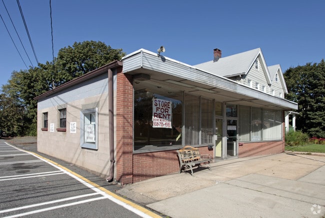
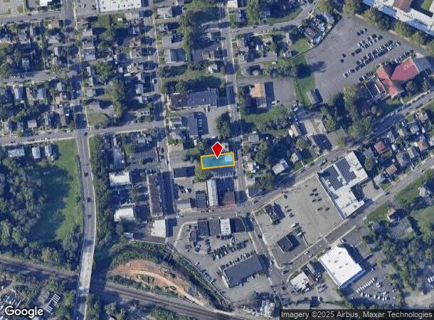
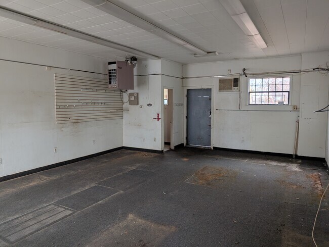
Property Record
174 Front St, South Plainfield, NJ 07080
NEARBY LISTINGS FOR SALE OR LEASE
Property Detail
174 Front St
New York-Jersey City-White Plains, NY-NJ
50X132EL
22-00265-0000-00006
Middlesex
Commercialnec
New Jersey
AE
6
34023C0033F
0.15 AC
2024
Route 287 East
2025
Northern New Jersey
000902
DEMOGRAPHICS near 174 Front St
1 Mile
3 Mile
5 Mile
2024 Total Population
11,385
127,268
325,341
2029 Population
11,285
125,935
322,637
Pop Growth 2024-2029
(0.88%)
(1.05%)
(0.83%)
Average Age
41
39
39
2024 Total Households
3,796
40,725
107,287
HH Growth 2024-2029
(1.00%)
(1.03%)
(0.88%)
Median Household Inc
$112,859
$104,015
$109,756
Avg Household Size
2.90
3.00
2.90
2024 Avg HH Vehicles
2.00
2.00
2.00
Median Home Value
$392,015
$407,448
$428,718
Median Year Built
1961
1965
1964
Nearby Places
Map Layers
Map Styles
 Street
 Aerial
- Restaurants
- Banks
- Shops
- Fitness
- Groceries
PUBLIC TRANSPORTATION
COMMUTER RAIL
Plainfield (Raritan Valley Line - NJ Transit Commuter Rail (NJ Transit))
DRIVE
WALK
Distance
Plainfield (Raritan Valley Line - NJ Transit Commuter Rail (NJ Transit))
6 min
3.4 mi
Dunellen (Raritan Valley Line - NJ Transit Commuter Rail (NJ Transit))
DRIVE
WALK
Distance
Dunellen (Raritan Valley Line - NJ Transit Commuter Rail (NJ Transit))
10 min
4.2 mi
AIRPORT
Newark Liberty International
DRIVE
WALK
Distance
Newark Liberty International
32 min
22.5 mi
Trenton Mercer
DRIVE
WALK
Distance
Trenton Mercer
55 min
39.8 mi
Freight Ports
New York Container Terminal
DRIVE
WALK
Distance
New York Container Terminal
30 min
16.5 mi
Nearby Properties
Address
Land Use
TOTAL SIZE
Lot Size
Zoning
Address
Land Use
TOTAL SIZE
Lot Size
Zoning
24.62 AC
R20
Address
Land Use
TOTAL SIZE
Lot Size
Zoning
17.01 AC
RM
Address
Land Use
TOTAL SIZE
Lot Size
Zoning
17.64 AC
R10A
Address
Land Use
TOTAL SIZE
Lot Size
Zoning
27.51 AC
RM
Address
Land Use
TOTAL SIZE
Lot Size
Zoning
38.04 AC
RM
Address
Land Use
TOTAL SIZE
Lot Size
Zoning
12.57 AC
RM
Address
Land Use
TOTAL SIZE
Lot Size
Zoning
137.89 AC
RAA
Address
Land Use
TOTAL SIZE
Lot Size
Zoning
23.94 AC
M2
Address
Land Use
TOTAL SIZE
Lot Size
Zoning
48.79 AC
SC
Address
Land Use
TOTAL SIZE
Lot Size
Zoning
10.09 AC
Address
Land Use
TOTAL SIZE
Lot Size
Zoning
17.21 AC
L15
Address
Land Use
TOTAL SIZE
Lot Size
Zoning
19.81 AC
M2
Address
Land Use
TOTAL SIZE
Lot Size
Zoning
16.21 AC
RM
Address
Land Use
TOTAL SIZE
Lot Size
Zoning
63.87 AC
LI5
Address
Land Use
TOTAL SIZE
Lot Size
Zoning
233,217 SF
36.91 AC
LI5
Address
Land Use
TOTAL SIZE
Lot Size
Zoning
1,380 SF
24.67 AC
M2
Address
Land Use
TOTAL SIZE
Lot Size
Zoning
96.22 AC
RA
Address
Land Use
TOTAL SIZE
Lot Size
Zoning
11.83 AC
RM
Address
Land Use
TOTAL SIZE
Lot Size
Zoning
1,388 SF
3.99 AC
LI5
Address
Land Use
TOTAL SIZE
Lot Size
Zoning
9.05 AC
RM
Address
Land Use
TOTAL SIZE
Lot Size
Zoning
216,476 SF
14.66 AC
LI5
Address
Land Use
TOTAL SIZE
Lot Size
Zoning
95,652 SF
38.24 AC
R20
Address
Land Use
TOTAL SIZE
Lot Size
Zoning
7.91 AC
RM
Address
Land Use
TOTAL SIZE
Lot Size
Zoning
9.57 AC
SC
Address
Land Use
TOTAL SIZE
Lot Size
Zoning
127,200 SF
11.87 AC
LI5
Address
Land Use
TOTAL SIZE
Lot Size
Zoning
9.38 AC
RM
Address
Land Use
TOTAL SIZE
Lot Size
Zoning
78,153 SF
11.30 AC
SC
Address
Land Use
TOTAL SIZE
Lot Size
Zoning
168,032 SF
14.75 AC
LI5
Address
Land Use
TOTAL SIZE
Lot Size
Zoning
9.85 AC
10A
Address
Land Use
TOTAL SIZE
Lot Size
Zoning
30.80 AC
R10
The World's #1 Commercial Real Estate Marketplace
Connect with us
© 2025 CoStar Group
The information above has been obtained from sources believed reliable. While we do not doubt its accuracy we have not verified it and make no guarantee, warranty or representation about it. It is your responsibility to independently confirm its accuracy and completeness. Any projections, opinions, assumptions, or estimates used are for example only and do not represent the current or future performance of the property. The value of this transaction to you depends on tax and other factors which should be evaluated by your tax, financial, and legal advisors. You and your advisors should conduct a careful, independent investigation of the property to determine to your satisfaction the suitability of the property for your needs.