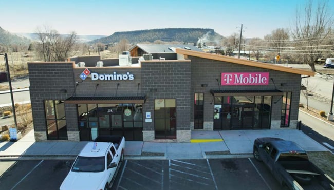
Property Record
174 Ne Combs Flat Rd, Prineville, OR 97754


Property Detail
174 Ne Combs Flat Rd
019600
SECTION 04 TOWNSHIP 15S RANGE 16E PCRL 3001 SUBDIVISION: OCHOCO MILL 1 LOT: 1 MAPTAXLOT: 1516040003001
Commercialnec
CROOK
C2
Oregon
C and X Area of minimal flood hazard, usually depicted on FIRMs as above the 500-year flood level.
1
2025
1.25 AC
2025
Crook County
950102
Other Market Areas
1 SF
Bend, OR
NEARBY LISTINGS FOR SALE OR LEASE
DEMOGRAPHICS near 174 Ne Combs Flat Rd
1 mile
3 mile
5 mile
2025 Total Population
6,193
14,967
17,025
2030 Population
6,609
15,977
18,178
Pop Growth 2025-2030
+ 6.72%
+ 6.75%
+ 6.77%
Average Age
42
42
43
2025 Total Households
2,421
5,979
6,826
HH Growth 2025-2030
+ 6.90%
+ 6.87%
+ 6.90%
Median Household Inc
$72,201
$73,538
$74,734
Avg Household Size
2.50
2.40
2.40
2025 Avg HH Vehicles
2.00
2.00
2.00
Median Home Value
$415,232
$419,868
$428,423
Median Year Built
1974
1987
1989
Nearby Places
Map Layers
Map Styles
 Street
 Aerial
Layers
 Traffic
 Biking
Places
Listings with unknown addresses are not visible on the map
- Restaurants
- Banks
- Shops
- Fitness
- Groceries
PUBLIC TRANSPORTATION
AIRPORT
Roberts Field
Drive
Walk
Distance
Roberts Field
27 min
20.1 mi
Nearby Properties
Address
Land Use
TOTAL SIZE
Lot Size
Zoning
Address
Land Use
TOTAL SIZE
Lot Size
Zoning
Address
Land Use
TOTAL SIZE
Lot Size
Zoning
1 SF
15.01 AC
R2
Address
Land Use
TOTAL SIZE
Lot Size
Zoning
68,850 SF
1.38 AC
C1
Address
Land Use
TOTAL SIZE
Lot Size
Zoning
6.16 AC
R2
Address
Land Use
TOTAL SIZE
Lot Size
Zoning
4.70 AC
C2
Address
Land Use
TOTAL SIZE
Lot Size
Zoning
1 SF
8.02 AC
C2
Address
Land Use
TOTAL SIZE
Lot Size
Zoning
202.87 AC
PR
Address
Land Use
TOTAL SIZE
Lot Size
Zoning
33,854 SF
1.52 AC
R4
Address
Land Use
TOTAL SIZE
Lot Size
Zoning
1 SF
2.24 AC
R2
Address
Land Use
TOTAL SIZE
Lot Size
Zoning
7,089 SF
46.68 AC
C5
Address
Land Use
TOTAL SIZE
Lot Size
Zoning
1 SF
1.25 AC
R2
Address
Land Use
TOTAL SIZE
Lot Size
Zoning
34,483 SF
5.80 AC
C2
Address
Land Use
TOTAL SIZE
Lot Size
Zoning
38,165 SF
1.38 AC
C2
Address
Land Use
TOTAL SIZE
Lot Size
Zoning
80.35 AC
M1
Address
Land Use
TOTAL SIZE
Lot Size
Zoning
1 SF
13.67 AC
M2
Address
Land Use
TOTAL SIZE
Lot Size
Zoning
35,030 SF
2.90 AC
C2
Address
Land Use
TOTAL SIZE
Lot Size
Zoning
Address
Land Use
TOTAL SIZE
Lot Size
Zoning
22,650 SF
5 AC
C2
Address
Land Use
TOTAL SIZE
Lot Size
Zoning
1 SF
37.07 AC
R2
Address
Land Use
TOTAL SIZE
Lot Size
Zoning
31,344 SF
2.39 AC
C2
Address
Land Use
TOTAL SIZE
Lot Size
Zoning
24,148 SF
1.55 AC
C2
Address
Land Use
TOTAL SIZE
Lot Size
Zoning
18,615 SF
1 AC
R2
Address
Land Use
TOTAL SIZE
Lot Size
Zoning
4,783 SF
445 AC
EFU2
Address
Land Use
TOTAL SIZE
Lot Size
Zoning
12,887 SF
0.70 AC
C1
Address
Land Use
TOTAL SIZE
Lot Size
Zoning
25,576 SF
1.50 AC
C2
Address
Land Use
TOTAL SIZE
Lot Size
Zoning
1 SF
22.48 AC
M2
Address
Land Use
TOTAL SIZE
Lot Size
Zoning
1.22 AC
R2
Address
Land Use
TOTAL SIZE
Lot Size
Zoning
12,918 SF
3.05 AC
C2
Address
Land Use
TOTAL SIZE
Lot Size
Zoning
34,789 SF
2.87 AC
C2
Address
Land Use
TOTAL SIZE
Lot Size
Zoning
10,800 SF
5.51 AC
IP
The World's #1 Commercial Real Estate Marketplace
Connect with us
© 2026 CoStar Group
The information above has been obtained from sources believed reliable. While we do not doubt its accuracy we have not verified it and make no guarantee, warranty or representation about it. It is your responsibility to independently confirm its accuracy and completeness. Any projections, opinions, assumptions, or estimates used are for example only and do not represent the current or future performance of the property. The value of this transaction to you depends on tax and other factors which should be evaluated by your tax, financial, and legal advisors. You and your advisors should conduct a careful, independent investigation of the property to determine to your satisfaction the suitability of the property for your needs.