Property Record
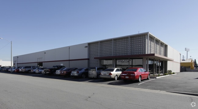
1740 N Lemon St, Anaheim, CA 92801


NEARBY LISTINGS FOR SALE OR LEASE
Property Detail
1740 N Lemon St
Anaheim-Santa Ana-Irvine, CA
Parcel Map No 16527
073-551-28
P BK 2 PG 1 PAR 17 P M 002-01 PAR 17 POR OF PAR
Industrialgeneral
Orange
X
California
06059C0131J
1
2024
1.33 AC
2025
Anaheim
011602
Orange County (California)
20,000 SF
DEMOGRAPHICS near 1740 N Lemon St
1 Mile
3 Mile
5 Mile
2024 Total Population
25,095
230,642
590,230
2029 Population
24,690
227,560
583,297
Pop Growth 2024-2029
(1.61%)
(1.34%)
(1.17%)
Average Age
36
37
38
2024 Total Households
8,112
68,526
182,778
HH Growth 2024-2029
(1.87%)
(1.51%)
(1.31%)
Median Household Inc
$71,705
$82,298
$86,111
Avg Household Size
2.90
3.20
3.10
2024 Avg HH Vehicles
2.00
2.00
2.00
Median Home Value
$586,731
$735,167
$729,863
Median Year Built
1967
1966
1970
Nearby Places
Map Layers
Map Styles
 Street
 Aerial
- Restaurants
- Banks
- Shops
- Fitness
- Groceries
PUBLIC TRANSPORTATION
TRANSIT/SUBWAY
Fullerton (91 Line - Southern California Regional Rail Authority (Metrolink), Orange County Line - Southern California Regional Rail Authority (Metrolink))
DRIVE
WALK
Distance
Fullerton (91 Line - Southern California Regional Rail Authority (Metrolink), Orange County Line - Southern California Regional Rail Authority (Metrolink))
2 min
19 min
0.7 mi
COMMUTER RAIL
Fullerton (91 Line - Southern California Regional Rail Authority (Metrolink), Orange County Line - Southern California Regional Rail Authority (Metrolink))
DRIVE
WALK
Distance
Fullerton (91 Line - Southern California Regional Rail Authority (Metrolink), Orange County Line - Southern California Regional Rail Authority (Metrolink))
2 min
18 min
0.7 mi
Buena Park (91 Line - Southern California Regional Rail Authority (Metrolink), Orange County Line - Southern California Regional Rail Authority (Metrolink))
DRIVE
WALK
Distance
Buena Park (91 Line - Southern California Regional Rail Authority (Metrolink), Orange County Line - Southern California Regional Rail Authority (Metrolink))
10 min
5.7 mi
AIRPORT
John Wayne/Orange County
DRIVE
WALK
Distance
John Wayne/Orange County
23 min
16.3 mi
Long Beach (Daugherty Field)
DRIVE
WALK
Distance
Long Beach (Daugherty Field)
29 min
19.9 mi
Ontario International
DRIVE
WALK
Distance
Ontario International
41 min
30.0 mi
Freight Ports
Port of Long Beach
DRIVE
WALK
Distance
Port of Long Beach
35 min
25.5 mi
Nearby Properties
Address
Land Use
TOTAL SIZE
Lot Size
Zoning
Address
Land Use
TOTAL SIZE
Lot Size
Zoning
Address
Land Use
TOTAL SIZE
Lot Size
Zoning
Address
Land Use
TOTAL SIZE
Lot Size
Zoning
Address
Land Use
TOTAL SIZE
Lot Size
Zoning
12.50 AC
Address
Land Use
TOTAL SIZE
Lot Size
Zoning
4.29 AC
Address
Land Use
TOTAL SIZE
Lot Size
Zoning
29.16 AC
Address
Land Use
TOTAL SIZE
Lot Size
Zoning
Address
Land Use
TOTAL SIZE
Lot Size
Zoning
Address
Land Use
TOTAL SIZE
Lot Size
Zoning
47,520 SF
1.92 AC
C
Address
Land Use
TOTAL SIZE
Lot Size
Zoning
Address
Land Use
TOTAL SIZE
Lot Size
Zoning
Address
Land Use
TOTAL SIZE
Lot Size
Zoning
Address
Land Use
TOTAL SIZE
Lot Size
Zoning
26.38 AC
Address
Land Use
TOTAL SIZE
Lot Size
Zoning
Address
Land Use
TOTAL SIZE
Lot Size
Zoning
Address
Land Use
TOTAL SIZE
Lot Size
Zoning
4.79 AC
Address
Land Use
TOTAL SIZE
Lot Size
Zoning
Address
Land Use
TOTAL SIZE
Lot Size
Zoning
215,384 SF
8.82 AC
Address
Land Use
TOTAL SIZE
Lot Size
Zoning
Address
Land Use
TOTAL SIZE
Lot Size
Zoning
Address
Land Use
TOTAL SIZE
Lot Size
Zoning
12,040 SF
1.82 AC
Address
Land Use
TOTAL SIZE
Lot Size
Zoning
198,208 SF
11.62 AC
Address
Land Use
TOTAL SIZE
Lot Size
Zoning
25.81 AC
Address
Land Use
TOTAL SIZE
Lot Size
Zoning
5.10 AC
Address
Land Use
TOTAL SIZE
Lot Size
Zoning
Address
Land Use
TOTAL SIZE
Lot Size
Zoning
Address
Land Use
TOTAL SIZE
Lot Size
Zoning
Address
Land Use
TOTAL SIZE
Lot Size
Zoning
24.80 AC
Address
Land Use
TOTAL SIZE
Lot Size
Zoning
208,000 SF
17.03 AC
Address
Land Use
TOTAL SIZE
Lot Size
Zoning
9.63 AC
The World's #1 Commercial Real Estate Marketplace
Connect with us
© 2026 CoStar Group
The information above has been obtained from sources believed reliable. While we do not doubt its accuracy we have not verified it and make no guarantee, warranty or representation about it. It is your responsibility to independently confirm its accuracy and completeness. Any projections, opinions, assumptions, or estimates used are for example only and do not represent the current or future performance of the property. The value of this transaction to you depends on tax and other factors which should be evaluated by your tax, financial, and legal advisors. You and your advisors should conduct a careful, independent investigation of the property to determine to your satisfaction the suitability of the property for your needs.