Property Record
1741 Virginia Ave, Harrisonburg, VA 22802


NEARBY LISTINGS FOR SALE OR LEASE
Property Detail
1741 Virginia Ave
053-I-3
Harmony Square Subdivision
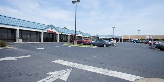
Stripcommercialcenter
COMMERCIAL DISTRICT 1 NS BIRCH DR
X
Harrisonburg
51165C0401D
Virginia
2024
1.26 AC
2025
Staunton & Harrisonburg
000401
Other Market Areas
14,080 SF
Harrisonburg, VA
DEMOGRAPHICS near 1741 Virginia Ave
1 Mile
3 Mile
5 Mile
2024 Total Population
3,930
29,892
62,664
2029 Population
3,833
29,466
62,275
Pop Growth 2024-2029
(2.47%)
(1.43%)
(0.62%)
Average Age
44
35
34
2024 Total Households
1,534
10,568
21,472
HH Growth 2024-2029
(3.39%)
(1.67%)
(0.69%)
Median Household Inc
$59,071
$56,908
$55,270
Avg Household Size
2.10
2.50
2.50
2024 Avg HH Vehicles
2.00
2.00
2.00
Median Home Value
$300,987
$257,357
$265,332
Median Year Built
1987
1982
1988
Nearby Places
Map Layers
Map Styles
 Street
 Aerial
- Restaurants
- Banks
- Shops
- Fitness
- Groceries
SALE & LEASE HISTORY
LISTING DATE
SALE/LEASE

Sep 25, 2016
For Lease
Nearby Properties
Address
Land Use
TOTAL SIZE
Lot Size
Zoning
Address
Land Use
TOTAL SIZE
Lot Size
Zoning
9.63 AC
MULTI DWEL
Address
Land Use
TOTAL SIZE
Lot Size
Zoning
100,172 SF
0.79 AC
MULTI DWEL
Address
Land Use
TOTAL SIZE
Lot Size
Zoning
40,887 SF
24.09 AC
MULTI DWEL
Address
Land Use
TOTAL SIZE
Lot Size
Zoning
11.07 AC
RESIDENTIA
Address
Land Use
TOTAL SIZE
Lot Size
Zoning
236,916 SF
3.72 AC
MULTI DWEL
Address
Land Use
TOTAL SIZE
Lot Size
Zoning
172,594 SF
0.65 AC
MULTI DWEL
Address
Land Use
TOTAL SIZE
Lot Size
Zoning
95,500 SF
12.96 AC
GENERAL IN
Address
Land Use
TOTAL SIZE
Lot Size
Zoning
27,572 SF
MULTI DWEL
Address
Land Use
TOTAL SIZE
Lot Size
Zoning
78,560 SF
3.41 AC
MULTI DWEL
Address
Land Use
TOTAL SIZE
Lot Size
Zoning
420 SF
88 AC
MULTI DWEL
Address
Land Use
TOTAL SIZE
Lot Size
Zoning
119,941 SF
10.82 AC
SINGLE FAM
Address
Land Use
TOTAL SIZE
Lot Size
Zoning
146,940 SF
32.91 AC
SINGLE FAM
Address
Land Use
TOTAL SIZE
Lot Size
Zoning
138.58 AC
I1
Address
Land Use
TOTAL SIZE
Lot Size
Zoning
107,978 SF
20.45 AC
MULTI DWEL
Address
Land Use
TOTAL SIZE
Lot Size
Zoning
236,070 SF
2.40 AC
GENERAL IN
Address
Land Use
TOTAL SIZE
Lot Size
Zoning
12,276 SF
120 AC
MULTI DWEL
Address
Land Use
TOTAL SIZE
Lot Size
Zoning
13,939 SF
98 AC
CENTRAL BU
Address
Land Use
TOTAL SIZE
Lot Size
Zoning
28,776 SF
2.05 AC
CENTRAL BU
Address
Land Use
TOTAL SIZE
Lot Size
Zoning
206,055 SF
4.08 AC
GENERAL IN
Address
Land Use
TOTAL SIZE
Lot Size
Zoning
86,703 SF
1.42 AC
CENTRAL BU
Address
Land Use
TOTAL SIZE
Lot Size
Zoning
19,212 SF
32.58 AC
R3
Address
Land Use
TOTAL SIZE
Lot Size
Zoning
81,000 SF
20 AC
A2
Address
Land Use
TOTAL SIZE
Lot Size
Zoning
4,112 SF
16.16 AC
MULTI DWEL
Address
Land Use
TOTAL SIZE
Lot Size
Zoning
120 AC
MULTI DWEL
Address
Land Use
TOTAL SIZE
Lot Size
Zoning
7,590 SF
81.38 AC
I1
Address
Land Use
TOTAL SIZE
Lot Size
Zoning
49,489 SF
2.54 AC
CENTRAL BU
Address
Land Use
TOTAL SIZE
Lot Size
Zoning
23,218 SF
4.21 AC
CENTRAL BU
Address
Land Use
TOTAL SIZE
Lot Size
Zoning
16,674 SF
108 AC
MULTI DWEL
Address
Land Use
TOTAL SIZE
Lot Size
Zoning
44,614 SF
5.17 AC
B1
Address
Land Use
TOTAL SIZE
Lot Size
Zoning
35,703 SF
9.89 AC
GENERAL BU
The World's #1 Commercial Real Estate Marketplace
Connect with us
© 2025 CoStar Group
The information above has been obtained from sources believed reliable. While we do not doubt its accuracy we have not verified it and make no guarantee, warranty or representation about it. It is your responsibility to independently confirm its accuracy and completeness. Any projections, opinions, assumptions, or estimates used are for example only and do not represent the current or future performance of the property. The value of this transaction to you depends on tax and other factors which should be evaluated by your tax, financial, and legal advisors. You and your advisors should conduct a careful, independent investigation of the property to determine to your satisfaction the suitability of the property for your needs.