Property Record
17410 Hart St, Spring Lake, MI 49456

NEARBY LISTINGS FOR SALE OR LEASE
Property Detail
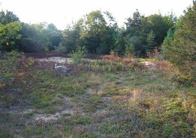
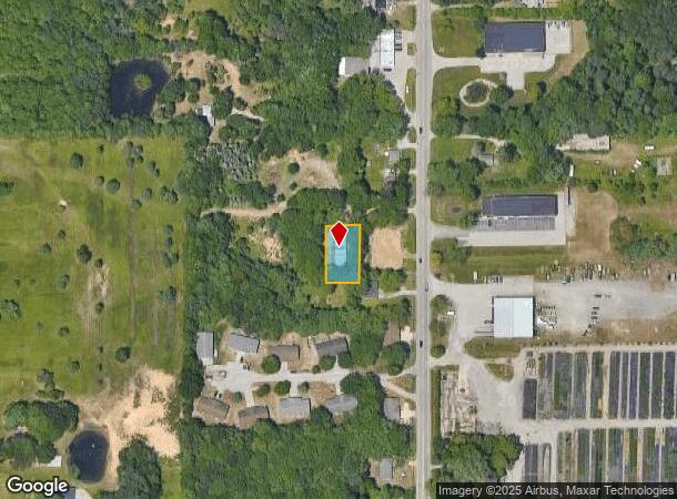
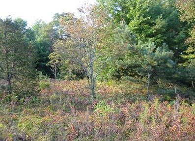
17410 Hart St
Grand Rapids-Wyoming, MI
Hart Sub
70-03-04-161-004
LOT 12 HART SUB
Publicstorage
Ottawa
X
Michigan
26139C0076F
12
2024
0.30 AC
2025
Grand Haven/Ferrysburg
020600
West Michigan
2,895 SF
DEMOGRAPHICS near 17410 Hart St
1 Mile
3 Mile
5 Mile
2024 Total Population
866
18,556
54,831
2029 Population
925
19,417
57,069
Pop Growth 2024-2029
+ 6.81%
+ 4.64%
+ 4.08%
Average Age
49
44
43
2024 Total Households
344
7,908
23,144
HH Growth 2024-2029
+ 6.98%
+ 4.78%
+ 4.27%
Median Household Inc
$83,088
$73,501
$71,923
Avg Household Size
2.30
2.30
2.30
2024 Avg HH Vehicles
2.00
2.00
2.00
Median Home Value
$351,851
$290,342
$257,342
Median Year Built
1999
1991
1977
Nearby Places
Map Layers
Map Styles
 Street
 Aerial
- Restaurants
- Banks
- Shops
- Fitness
- Groceries
SALE & LEASE HISTORY
LISTING DATE
SALE/LEASE

Sep 24, 2016
For Sale
Nearby Properties
Address
Land Use
TOTAL SIZE
Lot Size
Zoning
Address
Land Use
TOTAL SIZE
Lot Size
Zoning
348,731 SF
40.52 AC
R-4
Address
Land Use
TOTAL SIZE
Lot Size
Zoning
381,476 SF
17.96 AC
I INDU
Address
Land Use
TOTAL SIZE
Lot Size
Zoning
188,314 SF
9.72 AC
Address
Land Use
TOTAL SIZE
Lot Size
Zoning
169.22 AC
PR
Address
Land Use
TOTAL SIZE
Lot Size
Zoning
273,059 SF
30.59 AC
PUD
Address
Land Use
TOTAL SIZE
Lot Size
Zoning
337.87 AC
REC
Address
Land Use
TOTAL SIZE
Lot Size
Zoning
192,833 SF
14.44 AC
I INDU
Address
Land Use
TOTAL SIZE
Lot Size
Zoning
40,251 SF
159.38 AC
PR
Address
Land Use
TOTAL SIZE
Lot Size
Zoning
37,874 SF
20.27 AC
PORT IN
Address
Land Use
TOTAL SIZE
Lot Size
Zoning
65,152 SF
9.77 AC
PUD
Address
Land Use
TOTAL SIZE
Lot Size
Zoning
242,746 SF
36.05 AC
I INDU
Address
Land Use
TOTAL SIZE
Lot Size
Zoning
147,000 SF
GI
Address
Land Use
TOTAL SIZE
Lot Size
Zoning
237,612 SF
13.40 AC
PUD
Address
Land Use
TOTAL SIZE
Lot Size
Zoning
250,000 SF
19.08 AC
GI
Address
Land Use
TOTAL SIZE
Lot Size
Zoning
125,088 SF
7.24 AC
CBD
Address
Land Use
TOTAL SIZE
Lot Size
Zoning
275,714 SF
17.26 AC
PUD
Address
Land Use
TOTAL SIZE
Lot Size
Zoning
148,413 SF
38.08 AC
Address
Land Use
TOTAL SIZE
Lot Size
Zoning
105,179 SF
20.81 AC
I INDU
Address
Land Use
TOTAL SIZE
Lot Size
Zoning
250,000 SF
15.60 AC
GI
Address
Land Use
TOTAL SIZE
Lot Size
Zoning
99,081 SF
11.66 AC
R-4
Address
Land Use
TOTAL SIZE
Lot Size
Zoning
169,420 SF
15.20 AC
PUD
Address
Land Use
TOTAL SIZE
Lot Size
Zoning
149,707 SF
35.72 AC
GI
Address
Land Use
TOTAL SIZE
Lot Size
Zoning
91,682 SF
21.93 AC
PUD
Address
Land Use
TOTAL SIZE
Lot Size
Zoning
117,950 SF
10 AC
GI
Address
Land Use
TOTAL SIZE
Lot Size
Zoning
127,211 SF
11.74 AC
I INDU
Address
Land Use
TOTAL SIZE
Lot Size
Zoning
204.11 AC
REC
Address
Land Use
TOTAL SIZE
Lot Size
Zoning
106,000 SF
GI
Address
Land Use
TOTAL SIZE
Lot Size
Zoning
141,007 SF
12.86 AC
GI
Address
Land Use
TOTAL SIZE
Lot Size
Zoning
118,532 SF
8.16 AC
REC
Address
Land Use
TOTAL SIZE
Lot Size
Zoning
113,167 SF
6.72 AC
I INDU
The World's #1 Commercial Real Estate Marketplace
Connect with us
© 2025 CoStar Group
The information above has been obtained from sources believed reliable. While we do not doubt its accuracy we have not verified it and make no guarantee, warranty or representation about it. It is your responsibility to independently confirm its accuracy and completeness. Any projections, opinions, assumptions, or estimates used are for example only and do not represent the current or future performance of the property. The value of this transaction to you depends on tax and other factors which should be evaluated by your tax, financial, and legal advisors. You and your advisors should conduct a careful, independent investigation of the property to determine to your satisfaction the suitability of the property for your needs.