Property Record
17411 Vashon Hwy Sw, Vashon, WA 98070
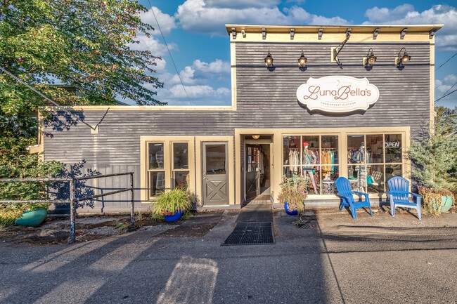
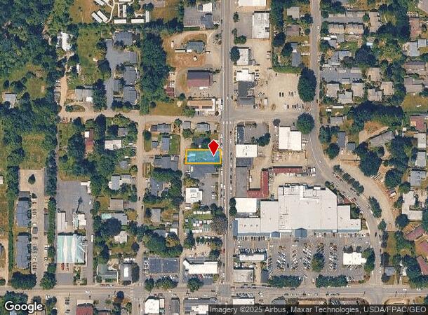
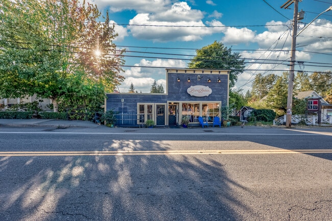

This Property Is For Sale
NEARBY LISTINGS FOR SALE OR LEASE
-
-
View all Vashon listings for sale on LoopNet.com
Property Detail
17411 Vashon Hwy Sw
302303-9061
N 50 FT OF S 540 FT OF W 130 FT OF E 160 FT OF SE 1/4 OF SE 1/4
Storebuilding
King
X
Washington
53033C0950G
302303
2025
0.15 AC
2024
Vashon/Maury Island
027701
Seattle/Puget Sound
1,520 SF
Seattle-Tacoma-Bellevue, WA
DEMOGRAPHICS near 17411 Vashon Hwy Sw
1 Mile
3 Mile
5 Mile
2024 Total Population
1,754
5,482
17,427
2029 Population
1,814
5,700
18,034
Pop Growth 2024-2029
+ 3.42%
+ 3.98%
+ 3.48%
Average Age
48
49
48
2024 Total Households
739
2,311
7,184
HH Growth 2024-2029
+ 3.38%
+ 3.89%
+ 3.52%
Median Household Inc
$96,022
$104,253
$123,607
Avg Household Size
2.30
2.30
2.40
2024 Avg HH Vehicles
2.00
2.00
2.00
Median Home Value
$770,909
$792,137
$814,558
Median Year Built
1975
1976
1974
Nearby Places
- Restaurants
- Banks
- Shops
- Fitness
- Groceries
PUBLIC TRANSPORTATION
AIRPORT
Seattle-Tacoma International
DRIVE
WALK
Distance
Seattle-Tacoma International
79 min
40.4 mi
Freight Ports
Port of Seattle
DRIVE
WALK
Distance
Port of Seattle
89 min
50.6 mi
Nearby Properties
Address
Land Use
TOTAL SIZE
Lot Size
Zoning
Address
Land Use
TOTAL SIZE
Lot Size
Zoning
78,683 SF
9.87 AC
RA10SO
Address
Land Use
TOTAL SIZE
Lot Size
Zoning
2,080 SF
3.01 AC
CBPSO
Address
Land Use
TOTAL SIZE
Lot Size
Zoning
240 SF
1.50 AC
R4
Address
Land Use
TOTAL SIZE
Lot Size
Zoning
14,000 SF
4.34 AC
IPSO
Address
Land Use
TOTAL SIZE
Lot Size
Zoning
28,900 SF
7.75 AC
CBPSO
Address
Land Use
TOTAL SIZE
Lot Size
Zoning
48,832 SF
4.62 AC
R24
Address
Land Use
TOTAL SIZE
Lot Size
Zoning
240 SF
19.39 AC
RA5
Address
Land Use
TOTAL SIZE
Lot Size
Zoning
13,923 SF
39.42 AC
RA10SO
Address
Land Use
TOTAL SIZE
Lot Size
Zoning
3,165 SF
0.83 AC
R8P
Address
Land Use
TOTAL SIZE
Lot Size
Zoning
832 SF
20.68 AC
RA10SO
Address
Land Use
TOTAL SIZE
Lot Size
Zoning
22,815 SF
1.09 AC
R4P
Address
Land Use
TOTAL SIZE
Lot Size
Zoning
1,024 SF
4.45 AC
CBPSO
Address
Land Use
TOTAL SIZE
Lot Size
Zoning
54,948 SF
1.51 AC
CBPSO
Address
Land Use
TOTAL SIZE
Lot Size
Zoning
15,480 SF
2.96 AC
CBPSO
Address
Land Use
TOTAL SIZE
Lot Size
Zoning
4,800 SF
4.88 AC
CBPSO
Address
Land Use
TOTAL SIZE
Lot Size
Zoning
27,170 SF
3.44 AC
R8P
Address
Land Use
TOTAL SIZE
Lot Size
Zoning
12,672 SF
0.92 AC
R12
Address
Land Use
TOTAL SIZE
Lot Size
Zoning
14,460 SF
1.47 AC
CBPSO
Address
Land Use
TOTAL SIZE
Lot Size
Zoning
12,180 SF
1.80 AC
R12
Address
Land Use
TOTAL SIZE
Lot Size
Zoning
10,157 SF
52.54 AC
RA5
Address
Land Use
TOTAL SIZE
Lot Size
Zoning
16,275 SF
1.74 AC
R4P
Address
Land Use
TOTAL SIZE
Lot Size
Zoning
16,752 SF
1.26 AC
R12
Address
Land Use
TOTAL SIZE
Lot Size
Zoning
2,560 SF
1.89 AC
CBPSO
Address
Land Use
TOTAL SIZE
Lot Size
Zoning
9,360 SF
0.25 AC
CBPSO
Address
Land Use
TOTAL SIZE
Lot Size
Zoning
3,712 SF
9.59 AC
IPSO
Address
Land Use
TOTAL SIZE
Lot Size
Zoning
7,500 SF
0.16 AC
CBPSO
Address
Land Use
TOTAL SIZE
Lot Size
Zoning
7,272 SF
0.49 AC
R8
Address
Land Use
TOTAL SIZE
Lot Size
Zoning
6,196 SF
5.47 AC
R4P
Address
Land Use
TOTAL SIZE
Lot Size
Zoning
1,398 SF
43.25 AC
RA5
Address
Land Use
TOTAL SIZE
Lot Size
Zoning
5,460 SF
4.10 AC
CBPSO
The World's #1 Commercial Real Estate Marketplace
Connect with us
© 2025 CoStar Group
The information above has been obtained from sources believed reliable. While we do not doubt its accuracy we have not verified it and make no guarantee, warranty or representation about it. It is your responsibility to independently confirm its accuracy and completeness. Any projections, opinions, assumptions, or estimates used are for example only and do not represent the current or future performance of the property. The value of this transaction to you depends on tax and other factors which should be evaluated by your tax, financial, and legal advisors. You and your advisors should conduct a careful, independent investigation of the property to determine to your satisfaction the suitability of the property for your needs.