Property Record
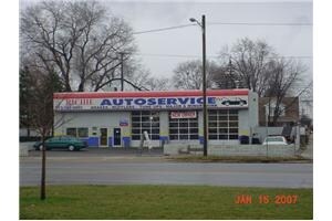
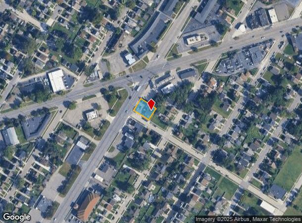
17420 Dix Rd, Melvindale, MI 48122
NEARBY LISTINGS FOR SALE OR LEASE
Property Detail
17420 Dix Rd
Detroit-Warren-Dearborn, MI
Kaiers Fort Boulevard
47-001-02-0050-301
*B50-53 LOTS 50 TO 53 INCL KAIERS FORT BOULEVARD SUB PC 671 L42 P92 WCR--K=80.34
Autorepair
Wayne
X
Michigan
26163C0270F
50-53
2025
0.19 AC
2025
Downriver North
578600
Detroit
2,225 SF
DEMOGRAPHICS near 17420 Dix Rd
1 Mile
3 Mile
5 Mile
2024 Total Population
7,797
97,478
287,660
2029 Population
7,458
94,242
277,850
Pop Growth 2024-2029
(4.35%)
(3.32%)
(3.41%)
Average Age
36
37
37
2024 Total Households
2,792
35,257
103,210
HH Growth 2024-2029
(4.33%)
(3.27%)
(3.40%)
Median Household Inc
$37,682
$44,568
$49,870
Avg Household Size
2.70
2.70
2.70
2024 Avg HH Vehicles
2.00
2.00
2.00
Median Home Value
$91,230
$109,579
$132,224
Median Year Built
1952
1952
1952
Nearby Places
Map Layers
Map Styles
 Street
 Aerial
- Restaurants
- Banks
- Shops
- Fitness
- Groceries
PUBLIC TRANSPORTATION
COMMUTER RAIL
DRIVE
WALK
Distance
12 min
4.8 mi
DRIVE
WALK
Distance
16 min
9.6 mi
AIRPORT
Detroit Metro Wayne County
DRIVE
WALK
Distance
Detroit Metro Wayne County
25 min
14.2 mi
Windsor International
DRIVE
WALK
Distance
Windsor International
34 min
17.5 mi
Freight Ports
DRIVE
WALK
Distance
67 min
53.9 mi
Nearby Properties
Address
Land Use
TOTAL SIZE
Lot Size
Zoning
Address
Land Use
TOTAL SIZE
Lot Size
Zoning
590,116 SF
388.80 AC
ID
Address
Land Use
TOTAL SIZE
Lot Size
Zoning
229,368 SF
1 AC
C 6A
Address
Land Use
TOTAL SIZE
Lot Size
Zoning
153,040 SF
2.13 AC
BC
Address
Land Use
TOTAL SIZE
Lot Size
Zoning
304,206 SF
29.53 AC
RC
Address
Land Use
TOTAL SIZE
Lot Size
Zoning
2,822,007 SF
75.54 AC
ID
Address
Land Use
TOTAL SIZE
Lot Size
Zoning
357,640 SF
13.89 AC
C 6C
Address
Land Use
TOTAL SIZE
Lot Size
Zoning
135,775 SF
18.39 AC
BC
Address
Land Use
TOTAL SIZE
Lot Size
Zoning
7,320 SF
226.49 AC
Address
Land Use
TOTAL SIZE
Lot Size
Zoning
1,076,924 SF
125.54 AC
ID
Address
Land Use
TOTAL SIZE
Lot Size
Zoning
108,960 SF
5.23 AC
OS
Address
Land Use
TOTAL SIZE
Lot Size
Zoning
678,368 SF
48.99 AC
RD RESEARC
Address
Land Use
TOTAL SIZE
Lot Size
Zoning
102,646 SF
77.55 AC
ID
Address
Land Use
TOTAL SIZE
Lot Size
Zoning
198,237 SF
11.07 AC
RE
Address
Land Use
TOTAL SIZE
Lot Size
Zoning
107,772 SF
8 AC
BC
Address
Land Use
TOTAL SIZE
Lot Size
Zoning
32,608 SF
46.51 AC
BC
Address
Land Use
TOTAL SIZE
Lot Size
Zoning
80,861 SF
1.17 AC
BC
Address
Land Use
TOTAL SIZE
Lot Size
Zoning
77,974 SF
1 AC
C 6A
Address
Land Use
TOTAL SIZE
Lot Size
Zoning
111,008 SF
26.62 AC
IB
Address
Land Use
TOTAL SIZE
Lot Size
Zoning
205,632 SF
1 AC
C 6A
Address
Land Use
TOTAL SIZE
Lot Size
Zoning
169,200 SF
19.92 AC
RD RESEARC
Address
Land Use
TOTAL SIZE
Lot Size
Zoning
637,176 SF
39.11 AC
C 6C
Address
Land Use
TOTAL SIZE
Lot Size
Zoning
303,705 SF
17.28 AC
ID
Address
Land Use
TOTAL SIZE
Lot Size
Zoning
196,801 SF
38.32 AC
M5
Address
Land Use
TOTAL SIZE
Lot Size
Zoning
153,668 SF
9.16 AC
RD
Address
Land Use
TOTAL SIZE
Lot Size
Zoning
111,402 SF
3.17 AC
Address
Land Use
TOTAL SIZE
Lot Size
Zoning
115,159 SF
10.49 AC
BB
Address
Land Use
TOTAL SIZE
Lot Size
Zoning
182,840 SF
11.70 AC
C 6C
Address
Land Use
TOTAL SIZE
Lot Size
Zoning
83,552 SF
20.32 AC
IC
Address
Land Use
TOTAL SIZE
Lot Size
Zoning
95,549 SF
6.46 AC
RE
Address
Land Use
TOTAL SIZE
Lot Size
Zoning
735,435 SF
37.86 AC
ID
The World's #1 Commercial Real Estate Marketplace
Connect with us
© 2026 CoStar Group
The information above has been obtained from sources believed reliable. While we do not doubt its accuracy we have not verified it and make no guarantee, warranty or representation about it. It is your responsibility to independently confirm its accuracy and completeness. Any projections, opinions, assumptions, or estimates used are for example only and do not represent the current or future performance of the property. The value of this transaction to you depends on tax and other factors which should be evaluated by your tax, financial, and legal advisors. You and your advisors should conduct a careful, independent investigation of the property to determine to your satisfaction the suitability of the property for your needs.