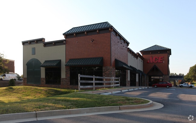
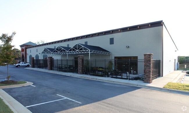
Property Record
1744 Highway 81 E, Mcdonough, GA 30252

Property Detail
1744 Highway 81 E
0124-01-013-000
LD: 7LL: 171
Regionalshoppingcenterormallwithanchorstore
HENRY
C2
Georgia
B and X Area of moderate flood hazard, usually the area between the limits of the 100-year and 500-year floods.
171
2025
2.74 AC
2025
McDonough/Butts
070209
Atlanta
25,286 SF
Atlanta-Sandy Springs-Roswell, GA
NEARBY LISTINGS FOR SALE OR LEASE
-
-
View all Mcdonough listings for sale on LoopNet.com
DEMOGRAPHICS near 1744 Highway 81 E
1 mile
3 mile
5 mile
2025 Total Population
1,570
25,609
68,750
2030 Population
1,661
27,405
73,620
Pop Growth 2025-2030
+ 5.80%
+ 7.01%
+ 7.08%
Average Age
40
38
38
2025 Total Households
530
8,796
23,833
HH Growth 2025-2030
+ 6.04%
+ 7.15%
+ 7.25%
Median Household Inc
$114,130
$86,173
$80,517
Avg Household Size
2.90
2.90
2.80
2025 Avg HH Vehicles
3.00
2.00
2.00
Median Home Value
$389,731
$377,977
$356,234
Median Year Built
1993
2003
2003
Nearby Places
Map Layers
Map Styles
 Street
 Aerial
Layers
 Traffic
 Biking
Places
Listings with unknown addresses are not visible on the map
- Restaurants
- Banks
- Shops
- Fitness
- Groceries
PUBLIC TRANSPORTATION
AIRPORT
Hartsfield - Jackson Atlanta International
Drive
Walk
Distance
Hartsfield - Jackson Atlanta International
40 min
29.4 mi
Nearby Properties
Address
Land Use
TOTAL SIZE
Lot Size
Zoning
Address
Land Use
TOTAL SIZE
Lot Size
Zoning
1,573,998 SF
84.31 AC
M2
Address
Land Use
TOTAL SIZE
Lot Size
Zoning
1,226,687 SF
100.81 AC
M2
Address
Land Use
TOTAL SIZE
Lot Size
Zoning
27,336 SF
27.95 AC
Address
Land Use
TOTAL SIZE
Lot Size
Zoning
21,880 SF
22.04 AC
RMH
Address
Land Use
TOTAL SIZE
Lot Size
Zoning
40,500 SF
27.66 AC
RA
Address
Land Use
TOTAL SIZE
Lot Size
Zoning
25,622 SF
17.43 AC
RMH
Address
Land Use
TOTAL SIZE
Lot Size
Zoning
1,456,864 SF
82.62 AC
Address
Land Use
TOTAL SIZE
Lot Size
Zoning
3,877,368 SF
44.93 AC
M2
Address
Land Use
TOTAL SIZE
Lot Size
Zoning
40,246 SF
13.73 AC
Address
Land Use
TOTAL SIZE
Lot Size
Zoning
532,585 SF
67.79 AC
M2
Address
Land Use
TOTAL SIZE
Lot Size
Zoning
63,279 SF
52.18 AC
C1
Address
Land Use
TOTAL SIZE
Lot Size
Zoning
997,015 SF
153.75 AC
M1
Address
Land Use
TOTAL SIZE
Lot Size
Zoning
429,447 SF
40.07 AC
M2
Address
Land Use
TOTAL SIZE
Lot Size
Zoning
652,452 SF
55.99 AC
M2
Address
Land Use
TOTAL SIZE
Lot Size
Zoning
124,652 SF
25 AC
Address
Land Use
TOTAL SIZE
Lot Size
Zoning
65,865 SF
21.08 AC
M1
Address
Land Use
TOTAL SIZE
Lot Size
Zoning
73,785 SF
12.40 AC
C2
Address
Land Use
TOTAL SIZE
Lot Size
Zoning
101,196 SF
17.01 AC
RA
Address
Land Use
TOTAL SIZE
Lot Size
Zoning
52,071 SF
0.62 AC
C1
Address
Land Use
TOTAL SIZE
Lot Size
Zoning
3,204 SF
7.26 AC
RM
Address
Land Use
TOTAL SIZE
Lot Size
Zoning
64,646 SF
5.13 AC
M1
Address
Land Use
TOTAL SIZE
Lot Size
Zoning
68,354 SF
8.03 AC
C1
Address
Land Use
TOTAL SIZE
Lot Size
Zoning
63,713 SF
16.65 AC
Address
Land Use
TOTAL SIZE
Lot Size
Zoning
168,254 SF
10.65 AC
C
Address
Land Use
TOTAL SIZE
Lot Size
Zoning
1,142 SF
52.99 AC
M2
Address
Land Use
TOTAL SIZE
Lot Size
Zoning
20,217 SF
41.18 AC
Address
Land Use
TOTAL SIZE
Lot Size
Zoning
41,852 SF
1.76 AC
C2
Address
Land Use
TOTAL SIZE
Lot Size
Zoning
79,748 SF
4.47 AC
C2
Address
Land Use
TOTAL SIZE
Lot Size
Zoning
3,600 SF
15.60 AC
C1
Address
Land Use
TOTAL SIZE
Lot Size
Zoning
14,980 SF
1.90 AC
C2
The World's #1 Commercial Real Estate Marketplace
Connect with us
© 2026 CoStar Group
The information above has been obtained from sources believed reliable. While we do not doubt its accuracy we have not verified it and make no guarantee, warranty or representation about it. It is your responsibility to independently confirm its accuracy and completeness. Any projections, opinions, assumptions, or estimates used are for example only and do not represent the current or future performance of the property. The value of this transaction to you depends on tax and other factors which should be evaluated by your tax, financial, and legal advisors. You and your advisors should conduct a careful, independent investigation of the property to determine to your satisfaction the suitability of the property for your needs.