Property Record
1744 Indianapolis Rd, Greencastle, IN 46135


NEARBY LISTINGS FOR SALE OR LEASE
-
-
View all Greencastle listings for sale on LoopNet.com
Property Detail
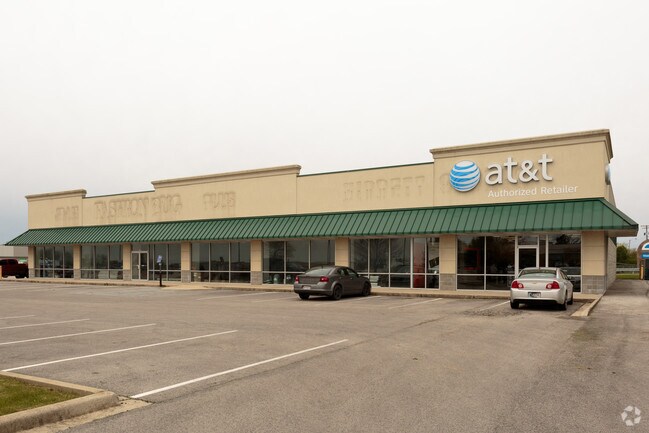
1744 Indianapolis Rd
Greencastle, IN
Wal Mart Subdivision
67-09-23-200-021.902-008
WALMART SUB LOT 3 (1.32A)
Stripcommercialcenter
Putnam
X
Indiana
18133C0164C
3
2024
1.32 AC
2024
Putnam County
956200
Indianapolis
12,615 SF
DEMOGRAPHICS near 1744 Indianapolis Rd
1 Mile
3 Mile
5 Mile
2024 Total Population
1,626
12,282
15,574
2029 Population
1,647
12,608
15,942
Pop Growth 2024-2029
+ 1.29%
+ 2.65%
+ 2.36%
Average Age
44
38
39
2024 Total Households
782
4,470
5,730
HH Growth 2024-2029
+ 0.64%
+ 2.84%
+ 2.55%
Median Household Inc
$46,232
$57,328
$62,293
Avg Household Size
2.00
2.20
2.30
2024 Avg HH Vehicles
1.00
2.00
2.00
Median Home Value
$157,905
$161,457
$170,432
Median Year Built
1993
1972
1972
Nearby Places
Map Layers
Map Styles
 Street
 Aerial
- Restaurants
- Banks
- Shops
- Fitness
- Groceries
PUBLIC TRANSPORTATION
AIRPORT
Indianapolis International
DRIVE
WALK
Distance
Indianapolis International
54 min
40.5 mi
Nearby Properties
Address
Land Use
TOTAL SIZE
Lot Size
Zoning
Address
Land Use
TOTAL SIZE
Lot Size
Zoning
4,732 SF
121.98 AC
ZO01
Address
Land Use
TOTAL SIZE
Lot Size
Zoning
195,519 SF
30.40 AC
ZO01
Address
Land Use
TOTAL SIZE
Lot Size
Zoning
397,802 SF
42.42 AC
ZO01
Address
Land Use
TOTAL SIZE
Lot Size
Zoning
162,953 SF
21.97 AC
ZO01
Address
Land Use
TOTAL SIZE
Lot Size
Zoning
227,538 SF
87.31 AC
ZO01
Address
Land Use
TOTAL SIZE
Lot Size
Zoning
348,756 SF
35.27 AC
ZO01
Address
Land Use
TOTAL SIZE
Lot Size
Zoning
214,556 SF
15.84 AC
ZO01
Address
Land Use
TOTAL SIZE
Lot Size
Zoning
15,848 SF
7.89 AC
ZO01
Address
Land Use
TOTAL SIZE
Lot Size
Zoning
218,064 SF
3.52 AC
ZO01
Address
Land Use
TOTAL SIZE
Lot Size
Zoning
180,721 SF
3.47 AC
ZO01
Address
Land Use
TOTAL SIZE
Lot Size
Zoning
182,135 SF
20 AC
ZO01
Address
Land Use
TOTAL SIZE
Lot Size
Zoning
17,002 SF
7.66 AC
ZO01
Address
Land Use
TOTAL SIZE
Lot Size
Zoning
94,184 SF
3.50 AC
ZO01
Address
Land Use
TOTAL SIZE
Lot Size
Zoning
108,000 SF
9.18 AC
ZO03
Address
Land Use
TOTAL SIZE
Lot Size
Zoning
77,979 SF
4.20 AC
ZO01
Address
Land Use
TOTAL SIZE
Lot Size
Zoning
137,967 SF
18.71 AC
ZO01
Address
Land Use
TOTAL SIZE
Lot Size
Zoning
36,852 SF
8.55 AC
ZO01
Address
Land Use
TOTAL SIZE
Lot Size
Zoning
5,808 SF
7.75 AC
ZO01
Address
Land Use
TOTAL SIZE
Lot Size
Zoning
50,983 SF
0.98 AC
ZO01
Address
Land Use
TOTAL SIZE
Lot Size
Zoning
38,268 SF
2.85 AC
ZO01
Address
Land Use
TOTAL SIZE
Lot Size
Zoning
99,876 SF
18.82 AC
ZO01
Address
Land Use
TOTAL SIZE
Lot Size
Zoning
11,074 SF
8.32 AC
ZO01
Address
Land Use
TOTAL SIZE
Lot Size
Zoning
48,087 SF
4.59 AC
ZO01
Address
Land Use
TOTAL SIZE
Lot Size
Zoning
32,310 SF
4.50 AC
ZO01
Address
Land Use
TOTAL SIZE
Lot Size
Zoning
46,252 SF
11.53 AC
ZO01
Address
Land Use
TOTAL SIZE
Lot Size
Zoning
24,469 SF
1.93 AC
ZO01
Address
Land Use
TOTAL SIZE
Lot Size
Zoning
82,022 SF
14.90 AC
ZO01
Address
Land Use
TOTAL SIZE
Lot Size
Zoning
54,380 SF
7.09 AC
ZO01
Address
Land Use
TOTAL SIZE
Lot Size
Zoning
48,800 SF
9.76 AC
ZO01
Address
Land Use
TOTAL SIZE
Lot Size
Zoning
33,000 SF
3.31 AC
ZO01
The World's #1 Commercial Real Estate Marketplace
Connect with us
© 2026 CoStar Group
The information above has been obtained from sources believed reliable. While we do not doubt its accuracy we have not verified it and make no guarantee, warranty or representation about it. It is your responsibility to independently confirm its accuracy and completeness. Any projections, opinions, assumptions, or estimates used are for example only and do not represent the current or future performance of the property. The value of this transaction to you depends on tax and other factors which should be evaluated by your tax, financial, and legal advisors. You and your advisors should conduct a careful, independent investigation of the property to determine to your satisfaction the suitability of the property for your needs.